TopoQuest Logo
Do you find TopoQuest useful?
Help keep TopoQuest running and adding new maps/features by donating!
Bitcoin:  19c7KJd3qBynnjoSw5npx9KScwjBe4ifkT
Litecoin:  LXs6TkuXGGXo1vDsWCkWVdjQX94eUKd6ui
Home View Maps Find Maps Find Places Resources & Links


Billings, Missouri Topographic Map

USGS Map Title: Billings, MO
USGS Map MRC: 37093A5
DRG (GeoTIFF) Download: o37093a5.tif


Neighboring USGS Topographic Map Quads:


  Halltown, MO  
37093B6
 

  Halltown NE, MO  
37093B5
 

  Brookline, MO  
37093B4
 

  Chesapeake, MO  
37093A6
 

  Billings, MO  
37093A5
 

  Republic, MO  
37093A4
 

  Aurora, MO  
36093H6
 

  Crane, MO  
36093H5
 

  Hurley, MO  
36093H4


Map MRC Location:

N38°
W94°
N38°
W93°
H8 H7 H6 H5 H4 H3 H2 H1
G8 G7 G6 G5 G4 G3 G2 G1
F8 F7 F6 F5 F4 F3 F2 F1
E8 E7 E6 E5 E4 E3 E2 E1
D8 D7 D6 D5 D4 D3 D2 D1
C8 C7 C6 C5 C4 C3 C2 C1
B8 B7 B6 B5 B4 B3 B2 B1
A8 A7 A6 A5 A4 A3 A2 A1
N37°
W94°
N37°
W93°

Billings, MO USGS 1:24K Topographic Map Preview:
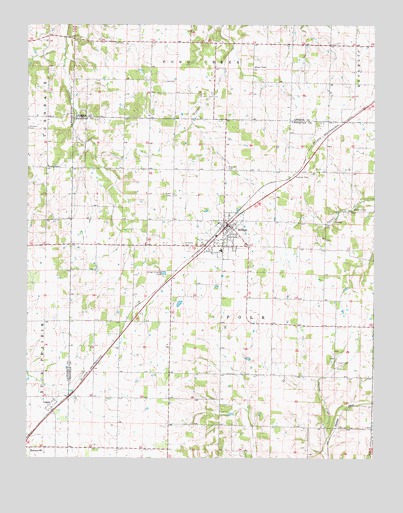
Billings, MO USGS Topographic Map
Click on map above to begin viewing in our Map Viewer.

This topographic map contains these locations and features:
Feature Name Type Latitude Longitude GNIS ID View Map
Anderson School (historical)SchoolN37.0095°W93.5283°733142View Map
BillingsPopulated PlaceN37.0676°W93.5521°714237View Map
Billings Fire Protection DistrictBuildingN37.0656°W93.5535°2621054View Map
Billings Police DepartmentBuildingN37.0671°W93.5527°2752424View Map
Billings Post OfficePost OfficeN37.0658°W93.5544°2782621View Map
Billings SchoolSchoolN37.0601°W93.5555°733143View Map
Blades ChapelChurchN37.1128°W93.5427°714342View Map
Blakes School (historical)SchoolN37.1126°W93.5252°732716View Map
Brashers CemeteryCemeteryN37.0950°W93.6249°714648View Map
Camp LenapeLocaleN37.0720°W93.5074°715276View Map
Center School (historical)SchoolN37.0389°W93.5558°733139View Map
City of BillingsCivilN37.0626°W93.5539°2394168View Map
Curtis ChapelChurchN37.0842°W93.6177°716606View Map
French Valley SchoolSchoolN37.0601°W93.5869°733138View Map
Hagewood LakeReservoirN37.1159°W93.5357°765461View Map
Hagewood Lake DamDamN37.1151°W93.5352°765460View Map
Herndon Orchard Airport (historical)AirportN37.0167°W93.6002°758803View Map
Lane School (historical)SchoolN37.0567°W93.5002°733137View Map
Laney CemeteryCemeteryN37.1087°W93.5752°720803View Map
LoganPopulated PlaceN37.0145°W93.6160°721412View Map
Oak Hill School (historical)SchoolN37.0831°W93.5810°733135View Map
Rose Hill CemeteryCemeteryN37.0837°W93.5527°725562View Map
Saint Joe School (historical)SchoolN37.1095°W93.5813°732715View Map
Saint Joseph CemeteryCemeteryN37.0759°W93.5724°725794View Map
Saint Peters Evangelical CemeteryCemeteryN37.0622°W93.5689°725888View Map
Smart CemeteryCemeteryN37.0278°W93.5135°726567View Map
Smart School (historical)SchoolN37.0317°W93.5010°733140View Map
Sodom School (historical)SchoolN37.0173°W93.5916°733141View Map
Tiede School (historical)SchoolN37.0828°W93.5174°733136View Map
Township of East PolkCivilN37.0418°W93.5282°2397796View Map
Township of Polk (historical)CivilN37.0537°W93.5530°766484View Map
Township of West PolkCivilN37.0569°W93.5803°2397897View Map

Note: Coordinates in the location and feature list above are referenced to NAD83 datum.


Copyright (C) 2008-2025 Ryan Niemi / Sunset Dynamics ... All Rights Reserved