TopoQuest Logo
Do you find TopoQuest useful?
Help keep TopoQuest running and adding new maps/features by donating!
Bitcoin:  19c7KJd3qBynnjoSw5npx9KScwjBe4ifkT
Litecoin:  LXs6TkuXGGXo1vDsWCkWVdjQX94eUKd6ui
Home View Maps Find Maps Find Places Resources & Links


Salina, Utah Topographic Map

USGS Map Title: Salina, UT
USGS Map MRC: 38111H7
DRG (GeoTIFF) Download: o38111h7.tif


Neighboring USGS Topographic Map Quads:


  Redmond Canyon, UT  
39111A8
 

  Redmond, UT  
39111A7
 

  Mayfield, UT  
39111A6
 

  Aurora, UT  
38111H8
 

  Salina, UT  
38111H7
 

  Steves Mountain, UT  
38111H6
 

  Sigurd, UT  
38111G8
 

  Rex Reservoir, UT  
38111G7
 

  Gooseberry Creek, UT  
38111G6


Map MRC Location:

N39°
W112°
N39°
W111°
H8 H7 H6 H5 H4 H3 H2 H1
G8 G7 G6 G5 G4 G3 G2 G1
F8 F7 F6 F5 F4 F3 F2 F1
E8 E7 E6 E5 E4 E3 E2 E1
D8 D7 D6 D5 D4 D3 D2 D1
C8 C7 C6 C5 C4 C3 C2 C1
B8 B7 B6 B5 B4 B3 B2 B1
A8 A7 A6 A5 A4 A3 A2 A1
N38°
W112°
N38°
W111°

Salina, UT USGS 1:24K Topographic Map Preview:
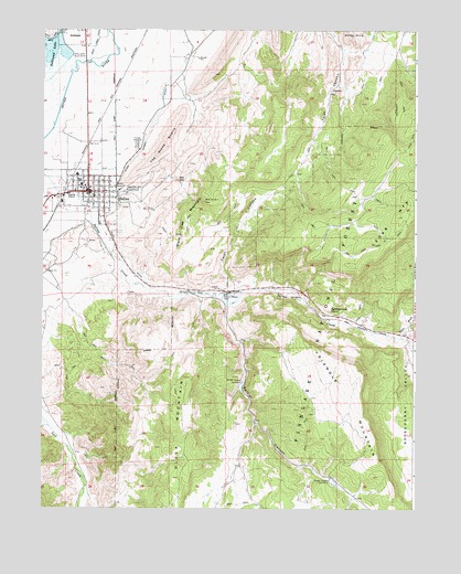
Salina, UT USGS Topographic Map
Click on map above to begin viewing in our Map Viewer.

This topographic map contains these locations and features:
Feature Name Type Latitude Longitude GNIS ID View Map
Black Cap MountainSummitN38.9552°W111.8208°1438838View Map
Black MountainSummitN38.8958°W111.8263°1438863View Map
Butch Cassidy CampgroundLocaleN38.9464°W111.8685°1448214View Map
City of SalinaCivilN38.9365°W111.8666°2411767View Map
Dons Texaco CampgroundLocaleN38.9572°W111.8638°1448348View Map
East Side CemeteryCemeteryN38.9583°W111.8449°1440846View Map
Faith Baptist ChurchChurchN38.9530°W111.8616°1455597View Map
Gooseberry CreekStreamN38.9189°W111.7519°1441376View Map
Gooseberry ValleyValleyN38.9147°W111.7524°1441380View Map
North Sevier High SchoolSchoolN38.9639°W111.8655°1448757View Map
North Sevier Middle SchoolSchoolN38.9602°W111.8630°1448758View Map
Okerlund CampgroundLocaleN38.9611°W111.8638°1448769View Map
Pioneer CemeteryCemeteryN38.9700°W111.8435°1444440View Map
Prous SpringSpringN38.8939°W111.8155°1448876View Map
Rattlesnake PointSummitN38.9272°W111.7791°1444744View Map
Redmond DamDamN38.9983°W111.8691°1447745View Map
Redmond LakeReservoirN38.9923°W111.8727°1447744View Map
SalinaPopulated PlaceN38.9577°W111.8599°1445269View Map
Salina Canyon DamDamN38.9302°W111.8144°1445270View Map
Salina City CemeteryCemeteryN38.9666°W111.8494°1449895View Map
Salina City Police DepartmentBuildingN38.9579°W111.8658°2730403View Map
Salina Creek RV and CampParkN38.9444°W111.8724°1448956View Map
Salina Elementary SchoolSchoolN38.9622°W111.8644°1448957View Map
Salina Post OfficePost OfficeN38.9581°W111.8586°1455495View Map
Salina Volunteer Fire DepartmentBuildingN38.9587°W111.8614°2627291View Map
Salt GapGapN38.9611°W111.8308°1445282View Map
Sevier County Ambulance - SalinaBuildingN38.9642°W111.8632°2768487View Map
Soldier CanyonValleyN38.9277°W111.8130°1445766View Map
Soldier Canyon Dam Number 1DamN38.9080°W111.8077°1454525View Map
Soldier Canyon Dam Number 2DamN38.8827°W111.7783°1454526View Map
Steves WashValleyN38.9200°W111.7571°1446143View Map
Stone Quarry DitchCanalN38.9761°W111.8377°1446164View Map
The Church of Jesus Christ of Latter Day SaintsChurchN38.9566°W111.8580°1449602View Map
The Church of Jesus Christ of Latter Day SaintsChurchN38.9633°W111.8613°1450966View Map
The Stone QuarrySummitN38.9694°W111.8344°1446507View Map
Triangle MountainSummitN38.9114°W111.7696°1446715View Map
Trunk CanyonValleyN38.9577°W111.8508°1451369View Map
Trunk DitchCanalN38.9441°W111.8505°1446748View Map
Twist CanyonValleyN38.9316°W111.8146°1446811View Map
Twist CanyonValleyN38.9936°W111.7744°1446812View Map

Note: Coordinates in the location and feature list above are referenced to NAD83 datum.


Copyright (C) 2008-2025 Ryan Niemi / Sunset Dynamics ... All Rights Reserved