TopoQuest Logo
Do you find TopoQuest useful?
Help keep TopoQuest running and adding new maps/features by donating!
Bitcoin:  19c7KJd3qBynnjoSw5npx9KScwjBe4ifkT
Litecoin:  LXs6TkuXGGXo1vDsWCkWVdjQX94eUKd6ui
Home View Maps Find Maps Find Places Resources & Links


Rex Reservoir, Utah Topographic Map

USGS Map Title: Rex Reservoir, UT
USGS Map MRC: 38111G7
DRG (GeoTIFF) Download: o38111g7.tif


Neighboring USGS Topographic Map Quads:


  Aurora, UT  
38111H8
 

  Salina, UT  
38111H7
 

  Steves Mountain, UT  
38111H6
 

  Sigurd, UT  
38111G8
 

  Rex Reservoir, UT  
38111G7
 

  Gooseberry Creek, UT  
38111G6
 

  Water Creek Canyon, UT  
38111F8
 

  Boobe Hole Reservoir, UT  
38111F7
 

  Mount Terrill, UT  
38111F6


Map MRC Location:

N39°
W112°
N39°
W111°
H8 H7 H6 H5 H4 H3 H2 H1
G8 G7 G6 G5 G4 G3 G2 G1
F8 F7 F6 F5 F4 F3 F2 F1
E8 E7 E6 E5 E4 E3 E2 E1
D8 D7 D6 D5 D4 D3 D2 D1
C8 C7 C6 C5 C4 C3 C2 C1
B8 B7 B6 B5 B4 B3 B2 B1
A8 A7 A6 A5 A4 A3 A2 A1
N38°
W112°
N38°
W111°

Rex Reservoir, UT USGS 1:24K Topographic Map Preview:
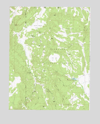
Rex Reservoir, UT USGS Topographic Map
Click on map above to begin viewing in our Map Viewer.

This topographic map contains these locations and features:
Feature Name Type Latitude Longitude GNIS ID View Map
Blue Jay FlatFlatN38.8439°W111.8280°1438933View Map
Coonah BenchBenchN38.7650°W111.7744°1439931View Map
Coonah SwaleValleyN38.7847°W111.8027°1439932View Map
Dipping Vat DrawValleyN38.7830°W111.8333°1440471View Map
Durfrey HomesteadLocaleN38.7586°W111.8696°1448358View Map
Fallon SpringSpringN38.8367°W111.8106°1440995View Map
Flat TopFlatN38.8130°W111.8055°1441133View Map
Flowell SpringSpringN38.8605°W111.8317°1449942View Map
Hearthstone FlatFlatN38.8383°W111.8380°1441659View Map
Hearthstone SpringSpringN38.8400°W111.8372°1441660View Map
Hock SwaleValleyN38.7736°W111.8346°1441790View Map
Josiah SpringsSpringN38.8649°W111.8037°1442230View Map
Kasov SpringSpringN38.7542°W111.8194°1442281View Map
Kinnikinnick SpringSpringN38.7949°W111.8415°1442340View Map
Kumo ValleyValleyN38.7964°W111.8246°1442368View Map
Little Lost CreekStreamN38.7897°W111.8344°1442736View Map
Mud SpringSpringN38.8744°W111.7982°1443692View Map
Pinenuts FlatFlatN38.8330°W111.8266°1444420View Map
Prowse SpringSpringN38.8749°W111.8194°1444672View Map
PurgatoryCliffN38.7958°W111.8019°1444678View Map
Rex DamDamN38.7900°W111.7758°1447739View Map
Rex ReservoirReservoirN38.7879°W111.7741°1447738View Map
Scorups MeadowsFlatN38.8522°W111.8310°1445382View Map
Shoap SpringSpringN38.8284°W111.8268°1445547View Map
Smithii FlatFlatN38.7802°W111.8221°1445713View Map
Squaw LedgeBenchN38.8527°W111.8638°1446079View Map
Swamp SpringSpringN38.7603°W111.8032°1446273View Map
Sweet Water CreekStreamN38.7872°W111.8127°1446289View Map
Teah FlatFlatN38.8216°W111.8213°1446359View Map
The RocksPillarN38.8464°W111.7894°1446499View Map
Twin PondsLakeN38.8188°W111.7817°1446802View Map
Wine CreekStreamN38.7855°W111.7741°1447478View Map
Zero FlatFlatN38.8322°W111.8380°1447584View Map

Note: Coordinates in the location and feature list above are referenced to NAD83 datum.


Copyright (C) 2008-2025 Ryan Niemi / Sunset Dynamics ... All Rights Reserved