TopoQuest Logo
Do you find TopoQuest useful?
Help keep TopoQuest running and adding new maps/features by donating!
Bitcoin:  19c7KJd3qBynnjoSw5npx9KScwjBe4ifkT
Litecoin:  LXs6TkuXGGXo1vDsWCkWVdjQX94eUKd6ui
Home View Maps Find Maps Find Places Resources & Links


Saline City, Indiana Topographic Map

USGS Map Title: Saline City, IN
USGS Map MRC: 39087C2
DRG (GeoTIFF) Download: o39087c2.tif


Neighboring USGS Topographic Map Quads:


  Seelyville, IN  
39087D3
 

  Staunton, IN  
39087D2
 

  Center Point, IN  
39087D1
 

  Lewis, IN  
39087C3
 

  Saline City, IN  
39087C2
 

  Clay City, IN  
39087C1
 

  Hymera, IN  
39087B3
 

  Jasonville, IN  
39087B2
 

  Coal City, IN  
39087B1


Map MRC Location:

N40°
W88°
N40°
W87°
H8 H7 H6 H5 H4 H3 H2 H1
G8 G7 G6 G5 G4 G3 G2 G1
F8 F7 F6 F5 F4 F3 F2 F1
E8 E7 E6 E5 E4 E3 E2 E1
D8 D7 D6 D5 D4 D3 D2 D1
C8 C7 C6 C5 C4 C3 C2 C1
B8 B7 B6 B5 B4 B3 B2 B1
A8 A7 A6 A5 A4 A3 A2 A1
N39°
W88°
N39°
W87°

Saline City, IN USGS 1:24K Topographic Map Preview:
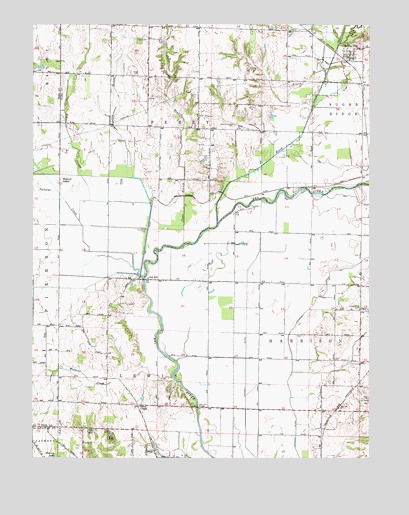
Saline City, IN USGS Topographic Map
Click on map above to begin viewing in our Map Viewer.

This topographic map contains these locations and features:
Feature Name Type Latitude Longitude GNIS ID View Map
Big CreekStreamN39.2859°W87.1550°449055View Map
Big SloughStreamN39.3184°W87.2331°431064View Map
Birch CreekStreamN39.3175°W87.1817°431099View Map
Briley ChapelChurchN39.2650°W87.2106°431528View Map
Brush CreekStreamN39.3731°W87.1408°431680View Map
Clear BranchStreamN39.3198°W87.2067°432604View Map
Conneley DitchCanalN39.2950°W87.1450°432883View Map
Crooked CreekStreamN39.3606°W87.1408°433164View Map
Hickory IslandPopulated PlaceN39.3295°W87.2395°436107View Map
Lafferty DitchCanalN39.2767°W87.1706°437508View Map
Little SloughStreamN39.3025°W87.2100°438149View Map
Maple Grove CemeteryCemeteryN39.2931°W87.1272°438550View Map
Neal Mill BridgeBridgeN39.2648°W87.1889°439957View Map
Old HillPopulated PlaceN39.3020°W87.2075°440570View Map
Owl CreekStreamN39.3331°W87.2475°440809View Map
Saline CityPopulated PlaceN39.3653°W87.1322°442932View Map
Splunge CreekStreamN39.3031°W87.2103°443957View Map
Stagg CemeteryCemeteryN39.3603°W87.2120°444047View Map
Turner Farms AirportAirportN39.3725°W87.1726°2717325View Map
Watkins CreekStreamN39.2734°W87.1981°445548View Map
Zion ChurchChurchN39.3450°W87.1742°446456View Map
Zion Gummere CemeteryCemeteryN39.3459°W87.1753°446474View Map

Note: Coordinates in the location and feature list above are referenced to NAD83 datum.


Copyright (C) 2008-2024 Ryan Niemi / Sunset Dynamics ... All Rights Reserved