TopoQuest Logo
Do you find TopoQuest useful?
Help keep TopoQuest running and adding new maps/features by donating!
Bitcoin:  19c7KJd3qBynnjoSw5npx9KScwjBe4ifkT
Litecoin:  LXs6TkuXGGXo1vDsWCkWVdjQX94eUKd6ui
Home View Maps Find Maps Find Places Resources & Links


Center Point, Indiana Topographic Map

USGS Map Title: Center Point, IN
USGS Map MRC: 39087D1
DRG (GeoTIFF) Download: o39087d1.tif


Neighboring USGS Topographic Map Quads:


  Brazil West, IN  
39087E2
 

  Brazil East, IN  
39087E1
 

  Reelsville, IN  
39086E8
 

  Staunton, IN  
39087D2
 

  Center Point, IN  
39087D1
 

  Poland, IN  
39086D8
 

  Saline City, IN  
39087C2
 

  Clay City, IN  
39087C1
 

  Patricksburg, IN  
39086C8


Map MRC Location:

N40°
W88°
N40°
W87°
H8 H7 H6 H5 H4 H3 H2 H1
G8 G7 G6 G5 G4 G3 G2 G1
F8 F7 F6 F5 F4 F3 F2 F1
E8 E7 E6 E5 E4 E3 E2 E1
D8 D7 D6 D5 D4 D3 D2 D1
C8 C7 C6 C5 C4 C3 C2 C1
B8 B7 B6 B5 B4 B3 B2 B1
A8 A7 A6 A5 A4 A3 A2 A1
N39°
W88°
N39°
W87°

Center Point, IN USGS 1:24K Topographic Map Preview:
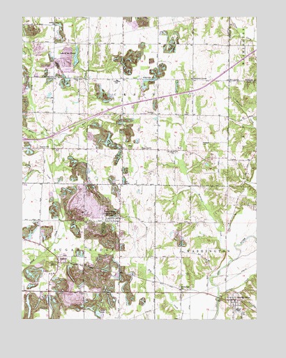
Center Point, IN USGS Topographic Map
Click on map above to begin viewing in our Map Viewer.

This topographic map contains these locations and features:
Feature Name Type Latitude Longitude GNIS ID View Map
Air Evacuation Lifeteam 39BuildingN39.4751°W87.0996°2719415View Map
Asbury ChurchChurchN39.4970°W87.1075°430298View Map
AshboroPopulated PlaceN39.3989°W87.1058°449615View Map
Ashboro North PitMineN39.3997°W87.1036°2634361View Map
AshervillePopulated PlaceN39.4748°W87.0622°447632View Map
Bowling GreenPopulated PlaceN39.3831°W87.0117°431404View Map
Bowling Green Volunteer Fire DepartmentBuildingN39.3828°W87.0116°2626057View Map
Brazil Clay County AirportAirportN39.4750°W87.0998°449113View Map
Center PointPopulated PlaceN39.4170°W87.0772°432336View Map
Center Point and Community Volunteer Fire DepartmentBuildingN39.4175°W87.0754°2626058View Map
Church CreekStreamN39.4903°W87.0014°432509View Map
Clay CountyCivilN39.3927°W87.1158°450341View Map
Dietz LakeLakeN39.3777°W87.0839°433547View Map
East Fork Birch CreekStreamN39.4470°W87.1086°433884View Map
Gremes CemeteryCemeteryN39.3859°W87.0914°435484View Map
Hirt CornerPopulated PlaceN39.4737°W87.0147°436244View Map
HoosiervillePopulated PlaceN39.4750°W87.1083°436417View Map
Jackson Township Elementary SchoolSchoolN39.4737°W87.0750°446522View Map
Jackson Township Volunteer Fire Department Brazil StationBuildingN39.4741°W87.0728°2626023View Map
Jordan CreekStreamN39.3862°W87.0181°437119View Map
Kealber CemeteryCemeteryN39.4456°W87.0667°437181View Map
Killion CemeteryCemeteryN39.3931°W87.0356°437299View Map
Lake of the WoodsReservoirN39.4839°W87.0964°448662View Map
Lap CornerPopulated PlaceN39.4309°W87.0717°437627View Map
Little Birch CreekStreamN39.4509°W87.1120°437989View Map
McIntyre CreekStreamN39.3995°W87.0122°438885View Map
Miller CemeteryCemeteryN39.4925°W87.0731°439189View Map
Miller CreekStreamN39.4309°W87.0628°439197View Map
Moss CemeteryCemeteryN39.3975°W87.1100°439498View Map
Mount Carmel ChurchChurchN39.3870°W87.0397°439550View Map
Neidlinger CemeteryCemeteryN39.4599°W87.0542°439987View Map
Prairie CityPopulated PlaceN39.4456°W87.1133°441539View Map
Prairie CreekStreamN39.4281°W87.1067°441544View Map
Roadman CornerPopulated PlaceN39.4742°W87.0339°442127View Map
Saint Johns ChurchChurchN39.4445°W87.0436°442593View Map
Son RunStreamN39.4195°W87.0006°443770View Map
StearleyvillePopulated PlaceN39.4450°W87.0614°444104View Map
Town of Center PointCivilN39.4154°W87.0752°2396635View Map
Township of JacksonCivilN39.4742°W87.0703°453436View Map
Township of Sugar RidgeCivilN39.3794°W87.0998°453887View Map
Union ChurchChurchN39.4742°W87.0950°445106View Map
Vinegar HillSummitN39.4475°W87.0292°445306View Map
Walker CemeteryCemeteryN39.4974°W87.0918°445372View Map
Zenor CemeteryCemeteryN39.4453°W87.1072°446435View Map

Note: Coordinates in the location and feature list above are referenced to NAD83 datum.


Copyright (C) 2008-2025 Ryan Niemi / Sunset Dynamics ... All Rights Reserved