TopoQuest Logo
Do you find TopoQuest useful?
Help keep TopoQuest running and adding new maps/features by donating!
Bitcoin:  19c7KJd3qBynnjoSw5npx9KScwjBe4ifkT
Litecoin:  LXs6TkuXGGXo1vDsWCkWVdjQX94eUKd6ui
Home View Maps Find Maps Find Places Resources & Links


Bingham Canyon, Utah Topographic Map

USGS Map Title: Bingham Canyon, UT
USGS Map MRC: 40112E2
DRG (GeoTIFF) Download: o40112e2.tif


Neighboring USGS Topographic Map Quads:


  Magna, UT  
40112F1
 

  Tooele, UT  
40112E3
 

  Bingham Canyon, UT  
40112E2
 

  Copperton, UT  
40112E1
 

  Stockton, UT  
40112D3
 

  Lowe Peak, UT  
40112D2
 

  Tickville Spring, UT  
40112D1


Map MRC Location:

N41°
W113°
N41°
W112°
H8 H7 H6 H5 H4 H3 H2 H1
G8 G7 G6 G5 G4 G3 G2 G1
F8 F7 F6 F5 F4 F3 F2 F1
E8 E7 E6 E5 E4 E3 E2 E1
D8 D7 D6 D5 D4 D3 D2 D1
C8 C7 C6 C5 C4 C3 C2 C1
B8 B7 B6 B5 B4 B3 B2 B1
A8 A7 A6 A5 A4 A3 A2 A1
N40°
W113°
N40°
W112°

Bingham Canyon, UT USGS 1:24K Topographic Map Preview:
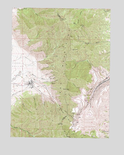
Bingham Canyon, UT USGS Topographic Map
Click on map above to begin viewing in our Map Viewer.

This topographic map contains these locations and features:
Feature Name Type Latitude Longitude GNIS ID View Map
Anaconda ReservoirReservoirN40.5533°W112.2458°1434826View Map
Anaconda Tailing DamDamN40.5533°W112.2458°1434827View Map
Apex ShaftMineN40.5236°W112.1713°1425159View Map
Apex TunnelMineN40.5224°W112.1630°1425160View Map
Archers CanyonValleyN40.5397°W112.2238°1425166View Map
Armstrong TunnelMineN40.5191°W112.1649°1425172View Map
Baltimore GulchValleyN40.5299°W112.1908°1425270View Map
Barneys PeakSummitN40.5849°W112.1744°1425296View Map
Bear HollowValleyN40.5563°W112.2038°1425350View Map
Bingham CanyonLocaleN40.5416°W112.1480°1425580View Map
Bingham Copper MineMineN40.5222°W112.1494°1435143View Map
Bingham West Dip TunnelMineN40.5524°W112.1997°1425585View Map
Chandler CemeteryCemeteryN40.5561°W112.1361°1455681View Map
Clipper PeakSummitN40.5133°W112.1874°1426728View Map
Clipper RidgeRidgeN40.5163°W112.2172°1426729View Map
Crystal SpringSpringN40.6099°W112.1697°1427139View Map
Curry PeakSummitN40.5733°W112.1405°1437257View Map
Dry CanyonValleyN40.5530°W112.2483°1427515View Map
Dry Fork Bingham CanyonValleyN40.5577°W112.1322°1427546View Map
Flood CanyonValleyN40.5863°W112.2411°1428018View Map
Freeman GulchValleyN40.5463°W112.1608°1428091View Map
Freeman PeakSummitN40.5574°W112.1688°1435555View Map
Highland TunnelMineN40.5152°W112.1677°1428710View Map
InternationalLocaleN40.5513°W112.2286°1429033View Map
KALL-FM (Salt Lake City)TowerN40.6061°W112.1644°1455796View Map
KBYU-FM (Provo)TowerN40.6077°W112.1599°1455797View Map
KBYU-TV (Provo)TowerN40.6077°W112.1599°1455823View Map
KCPX-FM (Salt Lake City)TowerN40.6083°W112.1602°1455798View Map
KCPX-FM (Salt Lake City)TowerN40.6138°W112.1874°1455800View Map
KTVX-TV (Salt Lake City)TowerN40.6138°W112.1855°1455825View Map
KUED-TV (Salt Lake City)TowerN40.6080°W112.1608°1455824View Map
KUER-FM (Salt Lake City)TowerN40.6083°W112.1602°1455799View Map
KUTV-TV (Salt Lake City)TowerN40.6063°W112.1638°1455822View Map
KUTV-TV (Salt Lake City)TowerN40.6138°W112.1869°1455826View Map
Leavetts CanyonValleyN40.5661°W112.2180°1429512View Map
Markham GulchValleyN40.5372°W112.1697°1430109View Map
Markham PeakSummitN40.5463°W112.1794°1430110View Map
Nelson PeakSummitN40.6136°W112.1883°1430682View Map
North Fork Swensons CanyonValleyN40.5577°W112.2141°1430810View Map
Oquirrh MountainsRangeN40.5774°W112.1824°1431019View Map
Pass CanyonValleyN40.5666°W112.2338°1431128View Map
Pine CanyonValleyN40.5605°W112.2366°1431242View Map
Pine CreekStreamN40.5641°W112.2413°1431250View Map
Pole CanyonValleyN40.5541°W112.2172°1431375View Map
Sap GulchValleyN40.5144°W112.1736°1432241View Map
South Fork Swensons CanyonValleyN40.5563°W112.2038°1432713View Map
Spring CanyonValleyN40.5413°W112.2455°1432823View Map
Swensons CanyonValleyN40.5636°W112.2297°1433138View Map
Township of CoppertonCivilN40.5955°W112.1364°2708941View Map
West MountainSummitN40.5002°W112.1766°1447166View Map

Note: Coordinates in the location and feature list above are referenced to NAD83 datum.


Copyright (C) 2008-2025 Ryan Niemi / Sunset Dynamics ... All Rights Reserved