TopoQuest Logo
Do you find TopoQuest useful?
Help keep TopoQuest running and adding new maps/features by donating!
Bitcoin:  19c7KJd3qBynnjoSw5npx9KScwjBe4ifkT
Litecoin:  LXs6TkuXGGXo1vDsWCkWVdjQX94eUKd6ui
Home View Maps Find Maps Find Places Resources & Links


Tickville Spring, Utah Topographic Map

USGS Map Title: Tickville Spring, UT
USGS Map MRC: 40112D1
DRG (GeoTIFF) Download: o40112d1.tif


Neighboring USGS Topographic Map Quads:


  Bingham Canyon, UT  
40112E2
 

  Copperton, UT  
40112E1
 

  Midvale, UT  
40111E8
 

  Lowe Peak, UT  
40112D2
 

  Tickville Spring, UT  
40112D1
 

  Jordan Narrows, UT  
40111D8
 

  Mercur, UT  
40112C2
 

  Cedar Fort, UT  
40112C1
 

  Saratoga Springs, UT  
40111C8


Map MRC Location:

N41°
W113°
N41°
W112°
H8 H7 H6 H5 H4 H3 H2 H1
G8 G7 G6 G5 G4 G3 G2 G1
F8 F7 F6 F5 F4 F3 F2 F1
E8 E7 E6 E5 E4 E3 E2 E1
D8 D7 D6 D5 D4 D3 D2 D1
C8 C7 C6 C5 C4 C3 C2 C1
B8 B7 B6 B5 B4 B3 B2 B1
A8 A7 A6 A5 A4 A3 A2 A1
N40°
W113°
N40°
W112°

Tickville Spring, UT USGS 1:24K Topographic Map Preview:
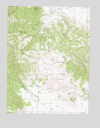
Tickville Spring, UT USGS Topographic Map
Click on map above to begin viewing in our Map Viewer.

This topographic map contains these locations and features:
Feature Name Type Latitude Longitude GNIS ID View Map
Arnold HollowValleyN40.4705°W112.0763°1425173View Map
Black RidgeRidgeN40.4463°W112.0705°1425705View Map
Butterfield TunnelMineN40.4897°W112.1230°1426235View Map
Cedar Fort DitchCanalN40.3786°W112.0861°1426450View Map
Cedar GroveWoodsN40.3994°W112.0824°1435279View Map
Cedar ValleyValleyN40.4030°W112.0680°1426493View Map
City CanyonValleyN40.4222°W112.1213°1426649View Map
City of HerrimanCivilN40.4898°W112.0169°2410750View Map
Draper HollowValleyN40.4897°W112.0677°1427474View Map
Farmers HollowValleyN40.4827°W112.0733°1427886View Map
Fivemile CanyonValleyN40.3752°W112.1091°1455022View Map
FoothillsPopulated PlaceN40.4955°W112.0152°1452990View Map
Fourmile CanyonValleyN40.3752°W112.1138°1428063View Map
Indian HollowValleyN40.4886°W112.0516°1429005View Map
Latimer PointSummitN40.4344°W112.0144°1455008View Map
Left Fork West CanyonValleyN40.4069°W112.1022°1429555View Map
Long RidgeRidgeN40.3788°W112.1044°1429921View Map
Maneuver Training Area Camp WilliamsMilitaryN40.4275°W112.0134°2512271View Map
Oak SpringsSpringN40.4333°W112.0838°1430934View Map
Oak Springs HollowValleyN40.4088°W112.0766°1430936View Map
Rose CanyonValleyN40.4841°W112.0663°1431994View Map
Rose Canyon SpringSpringN40.4490°W112.1023°1431995View Map
Shaggy PeakSummitN40.4972°W112.0822°1432353View Map
Sheps RidgeRidgeN40.4369°W112.1108°1432396View Map
South MountainSummitN40.4669°W112.0391°1432740View Map
Step MountainSummitN40.4744°W112.0669°1432960View Map
Tickville SpringSpringN40.4408°W112.0391°1433512View Map
Unified Fire Department Fire Station 123 - RosecrestBuildingN40.4860°W112.0061°2767281View Map
Water ForkValleyN40.4655°W112.0844°1434007View Map
West CanyonValleyN40.4069°W112.1022°1434055View Map
Wide HollowValleyN40.4930°W112.0558°1434235View Map
Willow PatchBarN40.4208°W112.1147°1436651View Map
Yellow ForkValleyN40.4655°W112.0844°1434500View Map
Yellow Fork Canyon County ParkParkN40.4694°W112.1086°1455007View Map

Note: Coordinates in the location and feature list above are referenced to NAD83 datum.


Copyright (C) 2008-2024 Ryan Niemi / Sunset Dynamics ... All Rights Reserved