TopoQuest Logo
Do you find TopoQuest useful?
Help keep TopoQuest running and adding new maps/features by donating!
Bitcoin:  19c7KJd3qBynnjoSw5npx9KScwjBe4ifkT
Litecoin:  LXs6TkuXGGXo1vDsWCkWVdjQX94eUKd6ui
Home View Maps Find Maps Find Places Resources & Links


San Juan Bautista, California Topographic Map

USGS Map Title: San Juan Bautista, CA
USGS Map MRC: 36121G5
DRG (GeoTIFF) Download: o36121g5.tif


Neighboring USGS Topographic Map Quads:


  Watsonville East, CA  
36121H6
 

  Chittenden, CA  
36121H5
 

  San Felipe, CA  
36121H4
 

  Prunedale, CA  
36121G6
 

  San Juan Bautista, CA  
36121G5
 

  Hollister, CA  
36121G4
 

  Salinas, CA  
36121F6
 

  Natividad, CA  
36121F5
 

  Mount Harlan, CA  
36121F4


Map MRC Location:

N37°
W122°
N37°
W121°
H8 H7 H6 H5 H4 H3 H2 H1
G8 G7 G6 G5 G4 G3 G2 G1
F8 F7 F6 F5 F4 F3 F2 F1
E8 E7 E6 E5 E4 E3 E2 E1
D8 D7 D6 D5 D4 D3 D2 D1
C8 C7 C6 C5 C4 C3 C2 C1
B8 B7 B6 B5 B4 B3 B2 B1
A8 A7 A6 A5 A4 A3 A2 A1
N36°
W122°
N36°
W121°

San Juan Bautista, CA USGS 1:24K Topographic Map Preview:
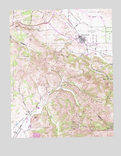
San Juan Bautista, CA USGS Topographic Map
Click on map above to begin viewing in our Map Viewer.

This topographic map contains these locations and features:
Feature Name Type Latitude Longitude GNIS ID View Map
Abbe ParkParkN36.8444°W121.5394°1817429View Map
Aromas School (historical)SchoolN36.8594°W121.6097°1670475View Map
Battle of Natividad State Historic LandmarkParkN36.7605°W121.6122°1873166View Map
Bluebird HotelBuildingN36.8452°W121.5380°1817430View Map
Cherry Tree RidgeRidgeN36.7663°W121.5436°220965View Map
City of San Juan BautistaCivilN36.8456°W121.5382°2411792View Map
Crane HouseBuildingN36.8458°W121.5374°1817431View Map
Crazy Horse CanyonValleyN36.7741°W121.6016°221812View Map
Crazy Horse Canyon LandfillLocaleN36.8031°W121.6183°2726521View Map
Felipe Gardella HouseBuildingN36.8441°W121.5352°1817432View Map
First Baptist Church (historical)ChurchN36.8452°W121.5386°1817433View Map
Fremont PeakSummitN36.7572°W121.5052°223878View Map
Fremont Peak State ParkParkN36.7608°W121.5024°223879View Map
French CanyonValleyN36.8052°W121.5619°223898View Map
Gabilan AcresPopulated PlaceN36.7552°W121.6194°1658595View Map
Gabilan School (historical)SchoolN36.8077°W121.5072°1670478View Map
Galacoma BuildingBuildingN36.8450°W121.5374°1817434View Map
Glad Tidings ChurchChurchN36.8452°W121.5386°1817435View Map
Hollister Fire Station 4BuildingN36.8453°W121.5369°2623759View Map
Jasper Twitchell HouseBuildingN36.8438°W121.5347°1817436View Map
Joe Zbrankik Blacksmith ShopBuildingN36.8455°W121.5380°1817437View Map
John Anderson HouseBuildingN36.8441°W121.5374°1817438View Map
Jose Castro HouseBuildingN36.8447°W121.5358°2501676View Map
Juan de Anza AdobeBuildingN36.8436°W121.5355°1817439View Map
KCAH-TV (Watsonville)TowerN36.7563°W121.5024°1665193View Map
KCBA-TV (Salinas)TowerN36.7561°W121.5024°1665167View Map
KDON-FM (Salinas)TowerN36.7555°W121.5011°1665091View Map
Kemp HouseBuildingN36.8458°W121.5386°1817440View Map
KHIP-FM (Hollister)TowerN36.7563°W121.5024°1665042View Map
KLVM-FM (Prunedale)TowerN36.7561°W121.5024°1665069View Map
KSMS-TV (Monterey)TowerN36.7563°W121.5024°1665157View Map
Lagunita LakeLakeN36.7753°W121.6028°226787View Map
Lagunita SchoolSchoolN36.7729°W121.6049°226788View Map
Las Aromitas Y Agua CalienteCivilN36.8605°W121.6116°234136View Map
Lavagnino HouseBuildingN36.8436°W121.5366°1817441View Map
Los CarnerosCivilN36.8308°W121.6102°227665View Map
Los VergelesCivilN36.7988°W121.5708°227688View Map
Mission San Juan BautistaChurchN36.8458°W121.5352°228846View Map
Mud CreekStreamN36.7816°W121.5861°234339View Map
Muertos CanyonValleyN36.8705°W121.6199°234344View Map
Odd Fellows HallBuildingN36.8452°W121.5377°1817442View Map
Olympia SchoolSchoolN36.8522°W121.5013°230031View Map
Pinecate PeakSummitN36.8586°W121.6152°230729View Map
PopeloutchomAreaN36.8458°W121.5344°1817283View Map
Quinn CanyonValleyN36.8041°W121.5047°1655093View Map
Rocky RidgeRidgeN36.7552°W121.5180°231790View Map
Rozas HouseBuildingN36.8450°W121.5383°1817443View Map
Saint Johns Institute (historical)BuildingN36.8461°W121.5372°1817444View Map
San Juan BautistaPopulated PlaceN36.8455°W121.5380°1659581View Map
San Juan Bautista City HallBuildingN36.8452°W121.5372°1817445View Map
San Juan Bautista City LibraryBuildingN36.8475°W121.5408°1817446View Map
San Juan Bautista DivisionCivilN36.8328°W121.5225°1935289View Map
San Juan Bautista Historic DistrictParkN36.8461°W121.5366°1817447View Map
San Juan Bautista Post OfficePost OfficeN36.8417°W121.5347°1817448View Map
San Juan Bautista State Historic ParkParkN36.8461°W121.5366°1817449View Map
San Juan CanyonValleyN36.8269°W121.5272°234632View Map
San Juan SchoolSchoolN36.8418°W121.5317°2518318View Map
San Juan ValleyValleyN36.8500°W121.5011°232424View Map
Sugarloaf PeakSummitN36.7686°W121.5947°235673View Map
Taix BlockBuildingN36.8450°W121.5372°1817450View Map
Theophile Vache AdobeBuildingN36.8438°W121.5361°1817451View Map
Towne CreekStreamN36.7977°W121.5688°236484View Map
Tract of Land Near San Juan BautistaCivilN36.8458°W121.5697°236500View Map
Tract of Land Near San Juan BautistaCivilN36.8527°W121.5258°236501View Map
Tuccoletta HallBuildingN36.8438°W121.5363°1817452View Map
Vierra CanyonValleyN36.7833°W121.5816°237078View Map

Note: Coordinates in the location and feature list above are referenced to NAD83 datum.


Copyright (C) 2008-2025 Ryan Niemi / Sunset Dynamics ... All Rights Reserved