TopoQuest Logo
Do you find TopoQuest useful?
Help keep TopoQuest running and adding new maps/features by donating!
Bitcoin:  19c7KJd3qBynnjoSw5npx9KScwjBe4ifkT
Litecoin:  LXs6TkuXGGXo1vDsWCkWVdjQX94eUKd6ui
Home View Maps Find Maps Find Places Resources & Links


Watsonville East, California Topographic Map

USGS Map Title: Watsonville East, CA
USGS Map MRC: 36121H6
DRG (GeoTIFF) Download: o36121h6.tif


Neighboring USGS Topographic Map Quads:


  Loma Prieta, CA  
37121A7
 

  Mount Madonna, CA  
37121A6
 

  Gilroy, CA  
37121A5
 

  Watsonville West, CA  
36121H7
 

  Watsonville East, CA  
36121H6
 

  Chittenden, CA  
36121H5
 

  Moss Landing, CA  
36121G7
 

  Prunedale, CA  
36121G6
 

  San Juan Bautista, CA  
36121G5


Map MRC Location:

N37°
W122°
N37°
W121°
H8 H7 H6 H5 H4 H3 H2 H1
G8 G7 G6 G5 G4 G3 G2 G1
F8 F7 F6 F5 F4 F3 F2 F1
E8 E7 E6 E5 E4 E3 E2 E1
D8 D7 D6 D5 D4 D3 D2 D1
C8 C7 C6 C5 C4 C3 C2 C1
B8 B7 B6 B5 B4 B3 B2 B1
A8 A7 A6 A5 A4 A3 A2 A1
N36°
W122°
N36°
W121°

Watsonville East, CA USGS 1:24K Topographic Map Preview:
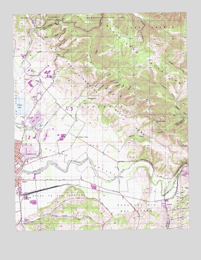
Watsonville East, CA USGS Topographic Map
Click on map above to begin viewing in our Map Viewer.

This topographic map contains these locations and features:
Feature Name Type Latitude Longitude GNIS ID View Map
Alianza Charter SchoolSchoolN36.9606°W121.7315°1873104View Map
Ann Soldo Elementary SchoolSchoolN36.9257°W121.7440°2504522View Map
Arano CanyonValleyN36.9333°W121.6802°1965107View Map
AromasPopulated PlaceN36.8886°W121.6430°1657949View Map
Aromas Branch Monterey County Free LibrariesBuildingN36.8888°W121.6433°1873145View Map
Aromas Census Designated PlaceCensusN36.8771°W121.6404°2407764View Map
Aromas Community ParkParkN36.8908°W121.6447°1873146View Map
Aromas Elementary SchoolSchoolN36.8905°W121.6446°1873147View Map
Aromas Post OfficePost OfficeN36.8882°W121.6446°1873148View Map
Assumption Catholic ChurchChurchN36.9016°W121.7486°1873149View Map
Atherton PeakSummitN36.9372°W121.6488°218446View Map
Atri ParkParkN36.9172°W121.7408°1873134View Map
Bald RidgeRidgeN36.9580°W121.6805°218608View Map
Banks CanyonValleyN36.9902°W121.7358°218646View Map
Calvary Christian CenterChurchN36.9155°W121.7455°1873135View Map
Carlton School (historical)SchoolN36.9486°W121.7211°1670500View Map
Casserly CreekStreamN36.9544°W121.7436°233643View Map
Casserly RidgeRidgeN36.9613°W121.6863°220681View Map
Casserly School (historical)SchoolN36.9744°W121.7422°1670501View Map
Chittenden PassGapN36.9086°W121.6330°221081View Map
Church of Jesus Christ Temple Bethany ChurchChurchN36.9041°W121.7499°1873156View Map
College LakeLakeN36.9469°W121.7477°221381View Map
Community Baptist Church of AromasChurchN36.8894°W121.6433°1873157View Map
Corncob CanyonValleyN36.8844°W121.7272°221569View Map
Corralitos CreekStreamN36.9350°W121.7427°221595View Map
Coward CreekStreamN36.9138°W121.7122°221712View Map
Cummings CanyonValleyN36.9497°W121.6974°221908View Map
Department of Forestry and Fire Protection Aromas Tri - County Fire DistrictBuildingN36.8793°W121.6410°2624020View Map
Department of Forestry and Fire Protection Pajaro ValleyBuildingN36.9743°W121.7419°2624045View Map
Drew LakeLakeN36.9367°W121.7326°222591View Map
East Lake Village Shopping CenterLocaleN36.9241°W121.7449°1873137View Map
Fern CanyonValleyN36.9419°W121.6619°277445View Map
Gaffey CreekStreamN36.9902°W121.7358°224005View Map
Glaum Egg RanchLocaleN36.9342°W121.7231°2677496View Map
Good Samaritan Church of God in ChristChurchN36.9036°W121.7486°1873179View Map
Hatfield CanyonValleyN36.9483°W121.6333°225015View Map
Hecker PassGapN36.9944°W121.7172°225111View Map
Hughes CreekStreamN36.9652°W121.7477°225737View Map
InterlakenPopulated PlaceN36.9513°W121.7338°1867031View Map
Interlaken Census Designated PlaceCensusN36.9505°W121.7363°2408427View Map
Johnston CornerPopulated PlaceN36.9286°W121.7052°252707View Map
Kelly LakeLakeN36.9399°W121.7353°226473View Map
Kinky CanyonValleyN36.9477°W121.6883°256026View Map
Lake TynanLakeN36.9309°W121.7279°236744View Map
Lakeview Middle SchoolSchoolN36.9385°W121.7414°2504401View Map
Linear ParkParkN36.9072°W121.7499°1873139View Map
LoganPopulated PlaceN36.9069°W121.6316°1658994View Map
Long RidgeRidgeN36.9488°W121.6624°277446View Map
Mattos GulchValleyN36.9111°W121.6680°228239View Map
Mill CanyonValleyN36.9463°W121.6797°256024View Map
Mill RidgeRidgeN36.9602°W121.6699°256025View Map
Mount PajaroSummitN36.9238°W121.6283°230245View Map
Murphy CrossingCrossingN36.9055°W121.6763°1659198View Map
Ohlone Elementary SchoolSchoolN36.8988°W121.7486°1873162View Map
Our Lady Help of Christians Valley Roman Catholic ChurchChurchN36.9411°W121.7419°1873053View Map
PajaroPopulated PlaceN36.9041°W121.7486°1659773View Map
Pajaro Census Designated PlaceCensusN36.9017°W121.7417°2409018View Map
Pajaro GapGapN36.9125°W121.6269°230241View Map
Pajaro Middle SchoolSchoolN36.8991°W121.7485°1873163View Map
Pajaro Mobile ManorPopulated PlaceN36.9055°W121.7474°1873164View Map
Pajaro Valley Memorial ParkCemeteryN36.9633°W121.7222°230244View Map
Pentecostal Holiness ChurchChurchN36.9041°W121.7494°1873194View Map
Railroad School (historical)SchoolN36.9258°W121.7008°1670502View Map
Rose ReservoirReservoirN36.9663°W121.7397°231890View Map
Saint Francis CemeteryCemeteryN36.9413°W121.7424°232153View Map
Saint Francis High SchoolSchoolN36.9403°W121.7405°232156View Map
Saint Francis Orphan Asylum (historical)BuildingN36.9408°W121.7419°1670503View Map
SalsipuedesCivilN36.9438°W121.6958°234610View Map
Salsipuedes CreekStreamN36.9097°W121.7452°234611View Map
Salsipuedes Elementary SchoolSchoolN36.9608°W121.7313°232289View Map
Santa Cruz County FairgroundsParkN36.9519°W121.7344°1873141View Map
Simas LakeLakeN36.9975°W121.7394°233154View Map
Spring Hills Golf ClubLocaleN36.9777°W121.7475°1873142View Map
Thompsons GroveWoodsN36.9483°W121.6977°236286View Map
Valley Catholic ChurchChurchN36.9527°W121.7311°1873143View Map
Vega (historical)Populated PlaceN36.8958°W121.6908°1670489View Map
Vega Del Rio Del PajaroCivilN36.8836°W121.6644°237042View Map
Vega School (historical)SchoolN36.8975°W121.6833°1670490View Map
Warner LakeLakeN36.8803°W121.7427°237253View Map
Watsonville Buddhist TempleChurchN36.9133°W121.7458°1873144View Map
Watsonville Charter School of the ArtsSchoolN36.9603°W121.7309°2504523View Map
Watsonville JunctionPopulated PlaceN36.8950°W121.7458°252827View Map

Note: Coordinates in the location and feature list above are referenced to NAD83 datum.


Copyright (C) 2008-2025 Ryan Niemi / Sunset Dynamics ... All Rights Reserved