TopoQuest Logo
Do you find TopoQuest useful?
Help keep TopoQuest running and adding new maps/features by donating!
Bitcoin:  19c7KJd3qBynnjoSw5npx9KScwjBe4ifkT
Litecoin:  LXs6TkuXGGXo1vDsWCkWVdjQX94eUKd6ui
Home View Maps Find Maps Find Places Resources & Links


Sand Gap, Arkansas Topographic Map

USGS Map Title: Sand Gap, AR
USGS Map MRC: 35093F1
DRG (GeoTIFF) Download: o35093f1.tif


Neighboring USGS Topographic Map Quads:


  Deer, AR  
35093G2
 

  Lurton, AR  
35093G1
 

  Moore, AR  
35092G8
 

  Fort Douglas, AR  
35093F2
 

  Sand Gap, AR  
35093F1
 

  Smyrna, AR  
35092F8
 

  Treat, AR  
35093E2
 

  Simpson, AR  
35093E1
 

  Solo, AR  
35092E8


Map MRC Location:

N36°
W94°
N36°
W93°
H8 H7 H6 H5 H4 H3 H2 H1
G8 G7 G6 G5 G4 G3 G2 G1
F8 F7 F6 F5 F4 F3 F2 F1
E8 E7 E6 E5 E4 E3 E2 E1
D8 D7 D6 D5 D4 D3 D2 D1
C8 C7 C6 C5 C4 C3 C2 C1
B8 B7 B6 B5 B4 B3 B2 B1
A8 A7 A6 A5 A4 A3 A2 A1
N35°
W94°
N35°
W93°

Sand Gap, AR USGS 1:24K Topographic Map Preview:
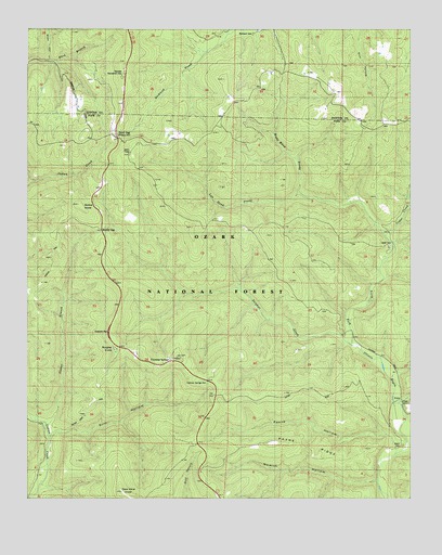
Sand Gap, AR USGS Topographic Map
Click on map above to begin viewing in our Map Viewer.

This topographic map contains these locations and features:
Feature Name Type Latitude Longitude GNIS ID View Map
Arch RockArchN35.7136°W93.0167°2571577View Map
Boss HollowValleyN35.7417°W93.1188°74285View Map
Boss HollowValleyN35.7417°W93.1182°59139View Map
Boyd CemeteryCemeteryN35.6919°W93.0070°59188View Map
Boyd SchoolSchoolN35.6954°W93.0066°70788View Map
Boyd TrailTrailN35.6765°W93.0321°70789View Map
Brock CemeteryCemeteryN35.6392°W93.0024°59189View Map
Burgiss KnobSummitN35.6651°W93.0968°70926View Map
Cedar CreekStreamN35.6951°W93.0082°71079View Map
Cherry Ridge TrailTrailN35.7040°W93.1171°71126View Map
Dare Mine KnobSummitN35.6267°W93.0941°71335View Map
Fairview Fire TowerTowerN35.7395°W93.0930°82427View Map
Fairview Recreation AreaLocaleN35.7376°W93.0943°74513View Map
Fairview Recreation AreaParkN35.7381°W93.0941°59121View Map
Freeman SpringsPopulated PlaceN35.6617°W93.0788°61999View Map
Freeman SpringsSpringN35.6617°W93.0766°71686View Map
Freeman Springs CemeteryCemeteryN35.6566°W93.0663°74507View Map
Gunter BranchStreamN35.6445°W93.1196°77096View Map
Gunter TrailTrailN35.6848°W93.1180°71865View Map
Hurricane TrailTrailN35.7315°W93.1060°72133View Map
Left Hand ProngStreamN35.7073°W93.0366°72307View Map
Mail TrailTrailN35.6617°W93.0471°72542View Map
Morning Shade School (historical)SchoolN35.6581°W93.0041°62000View Map
Muddy GapGapN35.6962°W93.1010°72808View Map
New Freeman CemeteryCemeteryN35.6562°W93.0663°59190View Map
Nowlin CreekStreamN35.6298°W93.0107°61997View Map
Nowlin HollowValleyN35.6295°W93.0099°72902View Map
Payne CreekStreamN35.6367°W93.0052°61998View Map
Payne HollowValleyN35.6384°W93.0055°73023View Map
Payne RidgeRidgeN35.6392°W93.0343°73024View Map
Pedestal RocksArchN35.7100°W93.0211°2571578View Map
Pedestal Rocks Special Interest AreaLocaleN35.7173°W93.0177°74509View Map
Pedestal Rocks TrailTrailN35.7162°W93.0193°74514View Map
Pelsor Post OfficePost OfficeN35.7208°W93.0960°84041View Map
Richland CemeteryCemeteryN35.7490°W93.0516°59140View Map
Right Hand ProngStreamN35.7070°W93.0368°73298View Map
Rotary Ann Picnic AreaLocaleN35.6690°W93.0996°74511View Map
Sand GapPopulated PlaceN35.7209°W93.0960°78290View Map
Silver Point TrailTrailN35.6495°W93.1043°74506View Map
Sollys KnobSummitN35.7031°W93.1085°73639View Map
Still HollowValleyN35.6429°W93.1177°73709View Map
Still Hollow TrailTrailN35.6387°W93.0968°73710View Map
Sulphur CreekStreamN35.6665°W93.0191°73771View Map
Sulphur TrailTrailN35.6876°W93.0396°73779View Map
Township of FreemanCivilN35.6502°W93.0824°69703View Map
VictorPopulated PlaceN35.6506°W93.0027°78656View Map

Note: Coordinates in the location and feature list above are referenced to NAD83 datum.


Copyright (C) 2008-2024 Ryan Niemi / Sunset Dynamics ... All Rights Reserved