TopoQuest Logo
Do you find TopoQuest useful?
Help keep TopoQuest running and adding new maps/features by donating!
Bitcoin:  19c7KJd3qBynnjoSw5npx9KScwjBe4ifkT
Litecoin:  LXs6TkuXGGXo1vDsWCkWVdjQX94eUKd6ui
Home View Maps Find Maps Find Places Resources & Links


Fort Douglas, Arkansas Topographic Map

USGS Map Title: Fort Douglas, AR
USGS Map MRC: 35093F2
DRG (GeoTIFF) Download: o35093f2.tif


Neighboring USGS Topographic Map Quads:


  Swain, AR  
35093G3
 

  Deer, AR  
35093G2
 

  Lurton, AR  
35093G1
 

  Rosetta, AR  
35093F3
 

  Fort Douglas, AR  
35093F2
 

  Sand Gap, AR  
35093F1
 

  Hagarville, AR  
35093E3
 

  Treat, AR  
35093E2
 

  Simpson, AR  
35093E1


Map MRC Location:

N36°
W94°
N36°
W93°
H8 H7 H6 H5 H4 H3 H2 H1
G8 G7 G6 G5 G4 G3 G2 G1
F8 F7 F6 F5 F4 F3 F2 F1
E8 E7 E6 E5 E4 E3 E2 E1
D8 D7 D6 D5 D4 D3 D2 D1
C8 C7 C6 C5 C4 C3 C2 C1
B8 B7 B6 B5 B4 B3 B2 B1
A8 A7 A6 A5 A4 A3 A2 A1
N35°
W94°
N35°
W93°

Fort Douglas, AR USGS 1:24K Topographic Map Preview:
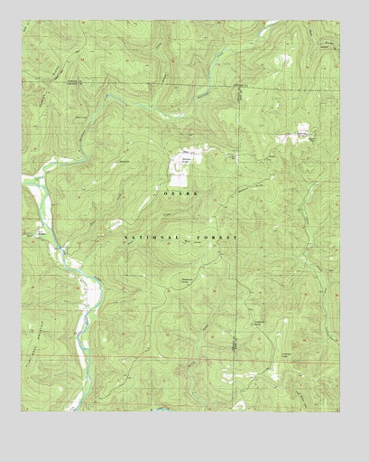
Fort Douglas, AR USGS Topographic Map
Click on map above to begin viewing in our Map Viewer.

This topographic map contains these locations and features:
Feature Name Type Latitude Longitude GNIS ID View Map
Bald KnobSummitN35.6801°W93.1860°70496View Map
Bear CreekStreamN35.6709°W93.2285°70550View Map
Beech Grove SchoolSchoolN35.6390°W93.2243°70613View Map
BerthaPopulated PlaceN35.7065°W93.1535°59194View Map
BerthaLocaleN35.7056°W93.1543°74371View Map
Big Lick SchoolSchoolN35.6684°W93.1310°70672View Map
Buzzard Roost Rocks Natural ArchArchN35.6350°W93.1331°2571579View Map
Coleman CemeteryCemeteryN35.7129°W93.1363°59193View Map
Coleman KnobSummitN35.7134°W93.1402°71197View Map
DillenPopulated PlaceN35.7081°W93.1888°71389View Map
Fort DouglasPopulated PlaceN35.6842°W93.2418°71663View Map
Freeman KnobSummitN35.6537°W93.1593°71685View Map
Greasy CreekStreamN35.7223°W93.1988°71828View Map
Haw CreekStreamN35.6834°W93.2391°71945View Map
Hurricane CreekStreamN35.6981°W93.2446°72125View Map
Hurricane Creek Natural BridgeArchN35.7190°W93.2243°59113View Map
Hurricane Creek WildernessReserveN35.7342°W93.1925°74279View Map
Lick CreekStreamN35.6734°W93.1382°61996View Map
McMinn KnobSummitN35.6965°W93.1530°72616View Map
Meadows KnobSummitN35.6681°W93.1874°72622View Map
Self CemeteryCemeteryN35.7062°W93.1682°59117View Map
Sugar CreekStreamN35.6770°W93.2349°73750View Map
Township of Pilot Rock (historical)CivilN35.6640°W93.2085°66764View Map
Umphers KnobSummitN35.6423°W93.1499°73932View Map
Wheeler CemeteryCemeteryN35.7048°W93.2121°59120View Map
Wheeler KnobSummitN35.7040°W93.1888°74093View Map

Note: Coordinates in the location and feature list above are referenced to NAD83 datum.


Copyright (C) 2008-2025 Ryan Niemi / Sunset Dynamics ... All Rights Reserved