TopoQuest Logo
Do you find TopoQuest useful?
Help keep TopoQuest running and adding new maps/features by donating!
Bitcoin:  19c7KJd3qBynnjoSw5npx9KScwjBe4ifkT
Litecoin:  LXs6TkuXGGXo1vDsWCkWVdjQX94eUKd6ui
Home View Maps Find Maps Find Places Resources & Links


Sardinia, Ohio Topographic Map

USGS Map Title: Sardinia, OH
USGS Map MRC: 39083A7
DRG (GeoTIFF) Download: o39083a7.tif


Neighboring USGS Topographic Map Quads:


  Fayetteville, OH  
39083B8
 

  Lynchburg, OH  
39083B7
 

  New Market, OH  
39083B6
 

  Mount Orab, OH  
39083A8
 

  Sardinia, OH  
39083A7
 

  Sugar Tree Ridge, OH  
39083A6
 

  Hamersville, OH  
38083H8
 

  Ash Ridge, OH  
38083H7
 

  Winchester, OH  
38083H6


Map MRC Location:

N40°
W84°
N40°
W83°
H8 H7 H6 H5 H4 H3 H2 H1
G8 G7 G6 G5 G4 G3 G2 G1
F8 F7 F6 F5 F4 F3 F2 F1
E8 E7 E6 E5 E4 E3 E2 E1
D8 D7 D6 D5 D4 D3 D2 D1
C8 C7 C6 C5 C4 C3 C2 C1
B8 B7 B6 B5 B4 B3 B2 B1
A8 A7 A6 A5 A4 A3 A2 A1
N39°
W84°
N39°
W83°

Sardinia, OH USGS 1:24K Topographic Map Preview:
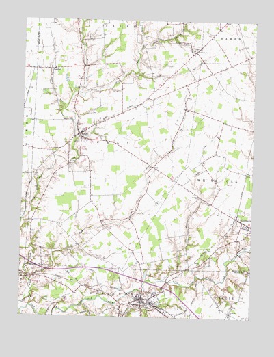
Sardinia, OH USGS Topographic Map
Click on map above to begin viewing in our Map Viewer.

This topographic map contains these locations and features:
Feature Name Type Latitude Longitude GNIS ID View Map
Bell Run School (historical)SchoolN39.0587°W83.7716°1053150View Map
Bells RunStreamN39.0162°W83.7969°1037837View Map
Bells Run CemeteryCemeteryN39.0509°W83.7783°1037839View Map
Bratton CemeteryCemeteryN39.0242°W83.8610°1038271View Map
Brush RunStreamN39.0284°W83.8438°1038419View Map
BufordPopulated PlaceN39.0767°W83.8441°1038503View Map
Buford CemeteryCemeteryN39.0742°W83.8435°1038504View Map
Buford Census Designated PlaceCensusN39.0720°W83.8393°2628870View Map
Buford Elementary SchoolSchoolN39.0776°W83.8430°1055304View Map
Buford Post OfficePost OfficeN39.0765°W83.8444°2009700View Map
Coddaman School (historical)SchoolN39.0020°W83.7610°1053045View Map
Duncanson School (historical)SchoolN39.1028°W83.8430°1053166View Map
Ebenezer CemeteryCemeteryN39.0223°W83.7777°1040049View Map
Ebenezer School (historical)SchoolN39.0270°W83.7849°1053167View Map
Elm School (historical)SchoolN39.1184°W83.8144°1053169View Map
Flat RunStreamN39.0151°W83.8694°1040507View Map
GathPopulated PlaceN39.0634°W83.8041°1061089View Map
Gath Post Office (historical)Post OfficeN39.0640°W83.8041°2009686View Map
Harwood Post Office (historical)Post OfficeN39.1237°W83.8458°2009688View Map
Higgins CemeteryCemeteryN39.0323°W83.8669°1041543View Map
HollowtownPopulated PlaceN39.1117°W83.7816°1041674View Map
Hollowtown CemeteryCemeteryN39.1137°W83.7827°1806558View Map
Hollowtown Post Office (historical)Post OfficeN39.1112°W83.7819°2009689View Map
Indian RunStreamN39.0873°W83.8521°1041966View Map
Katterman ChurchChurchN39.0026°W83.7608°1042181View Map
Lazy Ridge School (historical)SchoolN39.0040°W83.7810°1053089View Map
Lick RunStreamN39.1028°W83.8124°1042534View Map
Little North Fork White Oak CreekStreamN39.0942°W83.8449°1042677View Map
Maple Grove School (historical)SchoolN39.0928°W83.7863°1053190View Map
McNeely CemeteryCemeteryN39.0298°W83.7549°1043183View Map
Memory Lane Tree FarmLocaleN39.0872°W83.8392°2647905View Map
Middle RunStreamN39.0051°W83.8405°1043286View Map
Mount Orab Fire Department Station 2BuildingN39.0800°W83.8450°2548988View Map
Mowrystown Fire and Emergency Medical Services StationBuildingN39.0381°W83.7536°2550570View Map
Mowrystown Police DepartmentBuildingN39.0390°W83.7554°2732611View Map
Needful Post Office (historical)Post OfficeN39.1042°W83.8597°2009711View Map
NeedfullPopulated PlaceN39.1042°W83.8594°1062916View Map
Oakley School (historical)SchoolN39.0242°W83.8327°1053196View Map
Reedy School (historical)SchoolN39.0903°W83.8116°1053203View Map
Ruble RunStreamN39.0748°W83.8455°1045248View Map
SardiniaPopulated PlaceN39.0078°W83.8085°1077345View Map
Sardinia CemeteryCemeteryN39.0089°W83.8041°1045966View Map
Sardinia Emergency Medical ServiceBuildingN39.0075°W83.8041°2733179View Map
Sardinia Fire Department Station 35BuildingN39.0074°W83.8033°2550508View Map
Sardinia Post OfficePost OfficeN39.0084°W83.8083°1965619View Map
Sardinia ReservoirReservoirN39.0179°W83.8068°1079026View Map
Sardinia Reservoir DamDamN39.0167°W83.8083°1079025View Map
Sicily (historical)Populated PlaceN39.0284°W83.8635°1053208View Map
Sicily Post Office (historical)Post OfficeN39.0278°W83.8638°2013533View Map
Slabcamp RunStreamN39.0051°W83.8238°1046326View Map
Stony BranchStreamN39.1148°W83.8096°1046724View Map
Tolle School (historical)SchoolN39.0409°W83.8280°1053215View Map
Township of ClayCivilN39.0729°W83.8301°1086300View Map
Turkey Hole RunStreamN39.0017°W83.8749°1058084View Map
Twin RunStreamN39.0031°W83.8049°1047248View Map
Vance CemeteryCemeteryN39.0195°W83.8666°1047422View Map
Village of MowrystownCivilN39.0406°W83.7518°2399421View Map
Village of SardiniaCivilN39.0087°W83.8009°2399185View Map
White Oak Golf CourseLocaleN39.0142°W83.8655°1053139View Map
White School (historical)SchoolN39.1248°W83.7658°1053225View Map
Workman FarmLocaleN39.1150°W83.8056°2724737View Map
Wright CemeteryCemeteryN39.0073°W83.8513°1048152View Map

Note: Coordinates in the location and feature list above are referenced to NAD83 datum.


Copyright (C) 2008-2025 Ryan Niemi / Sunset Dynamics ... All Rights Reserved