TopoQuest Logo
Do you find TopoQuest useful?
Help keep TopoQuest running and adding new maps/features by donating!
Bitcoin:  19c7KJd3qBynnjoSw5npx9KScwjBe4ifkT
Litecoin:  LXs6TkuXGGXo1vDsWCkWVdjQX94eUKd6ui
Home View Maps Find Maps Find Places Resources & Links


Clatskanie, Oregon Topographic Map

USGS Map Title: Clatskanie, OR
USGS Map MRC: 46123A2
DRG (GeoTIFF) Download: o46123a2.tif


Neighboring USGS Topographic Map Quads:


  Nassa Point, WA  
46123B3
 

  Oak Point, WA  
46123B2
 

  Coal Creek, WA  
46123B1
 

  Marshland, OR  
46123A3
 

  Clatskanie, OR  
46123A2
 

  Delena, OR  
46123A1
 

  Birkenfeld, OR  
45123H3
 

  Pittsburg, OR  
45123H2
 

  Baker Point, OR  
45123H1


Map MRC Location:

N47°
W124°
N47°
W123°
H8 H7 H6 H5 H4 H3 H2 H1
G8 G7 G6 G5 G4 G3 G2 G1
F8 F7 F6 F5 F4 F3 F2 F1
E8 E7 E6 E5 E4 E3 E2 E1
D8 D7 D6 D5 D4 D3 D2 D1
C8 C7 C6 C5 C4 C3 C2 C1
B8 B7 B6 B5 B4 B3 B2 B1
A8 A7 A6 A5 A4 A3 A2 A1
N46°
W124°
N46°
W123°

Clatskanie, OR USGS 1:24K Topographic Map Preview:
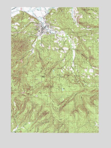
Clatskanie, OR USGS Topographic Map
Click on map above to begin viewing in our Map Viewer.

This topographic map contains these locations and features:
Feature Name Type Latitude Longitude GNIS ID View Map
Alder Grove SchoolLocaleN46.0562°W123.1521°1116833View Map
Beaver Boat RampLocaleN46.1078°W123.2064°2040509View Map
Beaver Dredge CutChannelN46.1243°W123.1943°1134546View Map
Benson LookoutLocaleN46.0396°W123.2101°1117539View Map
Benson PointSummitN46.0401°W123.2110°1132317View Map
Big SpringSpringN46.0443°W123.2162°1162775View Map
Bryant CemeteryCemeteryN46.1052°W123.1929°1118168View Map
City of ClatskanieCivilN46.1047°W123.2045°2409472View Map
ClatskaniePopulated PlaceN46.1012°W123.2068°1118980View Map
Clatskanie - Vernonia Justice CourtBuildingN46.1016°W123.2076°2661066View Map
Clatskanie City HallBuildingN46.1037°W123.2039°2661602View Map
Clatskanie City ParkParkN46.1054°W123.2018°1638910View Map
Clatskanie DivisionCivilN46.0663°W123.1841°1937980View Map
Clatskanie Elementary SchoolSchoolN46.0990°W123.2070°1638908View Map
Clatskanie HeightsPopulated PlaceN46.0564°W123.2049°1136155View Map
Clatskanie Library DistrictBuildingN46.1050°W123.2017°2661070View Map
Clatskanie Middle - High SchoolSchoolN46.1009°W123.2113°1638907View Map
Clatskanie Municipal CourtBuildingN46.1036°W123.2039°2661069View Map
Clatskanie Police DepartmentBuildingN46.1032°W123.2044°2737818View Map
Clatskanie Post OfficePost OfficeN46.1048°W123.2071°1165057View Map
Clatskanie Presbyterian ChurchChurchN46.1031°W123.2044°2507980View Map
Clatskanie Public WorksBuildingN46.0996°W123.2091°2661273View Map
Clatskanie RiverStreamN46.1207°W123.2210°1118982View Map
Clatskanie Rural Fire Main StationBuildingN46.1023°W123.2025°2576563View Map
Clatskanie Sewage Treatment PlantLocaleN46.1084°W123.2057°2660812View Map
Clatskanie StationLocaleN46.1165°W123.2023°1638909View Map
Clatskanie Transit CenterLocaleN46.1042°W123.2033°2668296View Map
Clatskanie Transit Center Park and RideLocaleN46.1041°W123.2032°2668218View Map
Clatskanie United Methodist ChurchChurchN46.1028°W123.2047°2507979View Map
Conyers CreekStreamN46.1015°W123.1982°1119213View Map
Dent Post Office (historical)Post OfficeN46.1040°W123.1407°1164312View Map
East CreekStreamN46.0793°W123.2201°1120290View Map
Eastman CreekStreamN46.0018°W123.2465°1132444View Map
Fall CreekStreamN46.1101°W123.2093°1120605View Map
Gateway Worship CenterChurchN46.1106°W123.2019°2508050View Map
Goat RanchLocaleN46.0059°W123.1251°1121179View Map
Keystone CreekStreamN46.0862°W123.1632°1122716View Map
Langfeld CreekStreamN46.0723°W123.1629°1134548View Map
Maplewood CemeteryCemeteryN46.0994°W123.2042°1123748View Map
Martin CreekStreamN46.1004°W123.1751°1162774View Map
Merril CreekStreamN46.0943°W123.1707°1132316View Map
Messing CreekStreamN46.0009°W123.2468°1132736View Map
Miller CreekStreamN46.0473°W123.1440°1124193View Map
Mist CemeteryCemeteryN46.0006°W123.2479°1162776View Map
Murray Hill CemeteryCemeteryN46.0978°W123.2144°1124558View Map
Page CreekStreamN46.0465°W123.1348°1116761View Map
Palm (historical)LocaleN46.1193°W123.2287°1167939View Map
Palm HillSummitN46.1129°W123.2282°1134547View Map
Roaring CreekStreamN46.0854°W123.2193°1126098View Map
Scout LakeLakeN46.0429°W123.1775°1126701View Map
The BillboardCliffN46.0457°W123.1957°1134550View Map
Vonberg CreekStreamN46.0584°W123.1637°1134549View Map
West CreekStreamN46.0815°W123.2198°1128822View Map
Windy GapGapN46.0382°W123.2248°1134552View Map
Windy MountainSummitN46.0262°W123.1846°1132318View Map
Windy RidgeRidgeN46.0346°W123.1957°1134551View Map

Note: Coordinates in the location and feature list above are referenced to NAD83 datum.


Copyright (C) 2008-2024 Ryan Niemi / Sunset Dynamics ... All Rights Reserved