TopoQuest Logo
Do you find TopoQuest useful?
Help keep TopoQuest running and adding new maps/features by donating!
Bitcoin:  19c7KJd3qBynnjoSw5npx9KScwjBe4ifkT
Litecoin:  LXs6TkuXGGXo1vDsWCkWVdjQX94eUKd6ui
Home View Maps Find Maps Find Places Resources & Links


Marshland, Oregon Topographic Map

USGS Map Title: Marshland, OR
USGS Map MRC: 46123A3
DRG (GeoTIFF) Download: o46123a3.tif


Neighboring USGS Topographic Map Quads:


  Cathlamet, WA  
46123B4
 

  Nassa Point, WA  
46123B3
 

  Oak Point, WA  
46123B2
 

  Nicolai Mountain, OR  
46123A4
 

  Marshland, OR  
46123A3
 

  Clatskanie, OR  
46123A2
 

  Sager Creek, OR  
45123H4
 

  Birkenfeld, OR  
45123H3
 

  Pittsburg, OR  
45123H2


Map MRC Location:

N47°
W124°
N47°
W123°
H8 H7 H6 H5 H4 H3 H2 H1
G8 G7 G6 G5 G4 G3 G2 G1
F8 F7 F6 F5 F4 F3 F2 F1
E8 E7 E6 E5 E4 E3 E2 E1
D8 D7 D6 D5 D4 D3 D2 D1
C8 C7 C6 C5 C4 C3 C2 C1
B8 B7 B6 B5 B4 B3 B2 B1
A8 A7 A6 A5 A4 A3 A2 A1
N46°
W124°
N46°
W123°

Marshland, OR USGS 1:24K Topographic Map Preview:
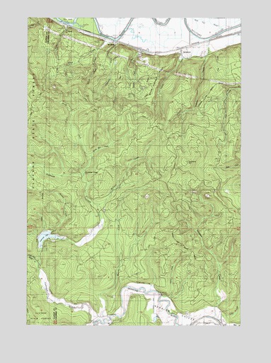
Marshland, OR USGS Topographic Map
Click on map above to begin viewing in our Map Viewer.

This topographic map contains these locations and features:
Feature Name Type Latitude Longitude GNIS ID View Map
Adams CreekStreamN46.0126°W123.2982°1116765View Map
Beaver CreekStreamN46.0021°W123.3351°1117416View Map
Boxer CreekStreamN46.0379°W123.3640°1162750View Map
Calvin CreekStreamN46.0004°W123.2887°1162797View Map
Clatskanie MountainSummitN46.0661°W123.2825°1118981View Map
Eilertsen CreekStreamN46.1159°W123.3251°1120418View Map
Favorite CreekStreamN46.1082°W123.3137°1132309View Map
Fishhawk (historical)Populated PlaceN46.0054°W123.3360°1132303View Map
Fishhawk CemeteryCemeteryN46.0114°W123.3250°1120781View Map
Fishhawk CreekStreamN46.0012°W123.3362°1162753View Map
Fishhawk DamDamN46.0315°W123.3679°1133535View Map
Fishhawk LakeReservoirN46.0315°W123.3679°1133536View Map
Fishhawk Lake Recreation Club Wastewater Treatment FacilityLocaleN46.0315°W123.3675°2660672View Map
Fishhawk Post Office (historical)Post OfficeN46.0054°W123.3360°1165255View Map
Ford CreekStreamN46.1165°W123.2693°1132308View Map
Graham CreekStreamN46.1162°W123.2701°1121280View Map
Horseshoe CampLocaleN46.0623°W123.3429°1162751View Map
KerryPopulated PlaceN46.1209°W123.3518°1637850View Map
Kerry IslandIslandN46.1248°W123.3540°1132310View Map
Kerry Post Office (historical)Post OfficeN46.1209°W123.3518°1165480View Map
Lindgren CreekStreamN46.0037°W123.2679°1120876View Map
Lower Midland BridgeBridgeN46.1195°W123.2810°1638903View Map
Lyons CreekStreamN46.0068°W123.2651°1132304View Map
MarshlandPopulated PlaceN46.1112°W123.2857°1123796View Map
Marshland Post Office (historical)Post OfficeN46.1112°W123.2857°1165590View Map
McCoon CreekStreamN46.0465°W123.3346°1123883View Map
Mist - Birkenfeld Rural Fire Protection DistrictBuildingN46.0131°W123.3097°2576767View Map
Mist - Birkenfeld Rural Fire Protection District Fishhawk Lake StationBuildingN46.0321°W123.3694°2576586View Map
Mist Elementary SchoolSchoolN46.0001°W123.2518°2416120View Map
Mist Underground Gas Storage FacilityLocaleN46.0206°W123.2698°2697268View Map
North Fork Fishhawk CreekStreamN46.0665°W123.3401°1132306View Map
OK CreekStreamN46.1159°W123.3251°1124877View Map
Olsen CreekStreamN46.1173°W123.3304°1124993View Map
Riverside Post Office (historical)Post OfficeN46.0050°W123.2820°1164636View Map
Ross CreekStreamN46.1218°W123.3543°1126310View Map
Skunk Cabbage RidgeRidgeN46.1012°W123.3035°1127044View Map
South Olsen CreekStreamN46.1121°W123.3362°1127335View Map
Tandy CreekStreamN46.1168°W123.2762°1162752View Map
Tunnel MountainSummitN46.0857°W123.3435°1132307View Map
Uncle Tom SloughCanalN46.1221°W123.2651°1132301View Map
Warner CreekStreamN46.0248°W123.3693°1162754View Map
Wood CreekStreamN46.1165°W123.3276°1132302View Map
WoodsonPopulated PlaceN46.1146°W123.3243°1637873View Map
Woodson Post Office (historical)Post OfficeN46.1146°W123.3243°1166209View Map
Wrong Way CreekStreamN46.0665°W123.3387°1132305View Map

Note: Coordinates in the location and feature list above are referenced to NAD83 datum.


Copyright (C) 2008-2025 Ryan Niemi / Sunset Dynamics ... All Rights Reserved