TopoQuest Logo
Do you find TopoQuest useful?
Help keep TopoQuest running and adding new maps/features by donating!
Bitcoin:  19c7KJd3qBynnjoSw5npx9KScwjBe4ifkT
Litecoin:  LXs6TkuXGGXo1vDsWCkWVdjQX94eUKd6ui
Home View Maps Find Maps Find Places Resources & Links


Birmingham, Ohio Topographic Map

USGS Map Title: Birmingham, OH
USGS Map MRC: 40081B4
DRG (GeoTIFF) Download: o40081b4.tif


Neighboring USGS Topographic Map Quads:


  Newcomerstown, OH  
40081C5
 

  Gnadenhutten, OH  
40081C4
 

  Tippecanoe, OH  
40081C3
 

  Kimbolton, OH  
40081B5
 

  Birmingham, OH  
40081B4
 

  Freeport, OH  
40081B3
 

  Cambridge, OH  
40081A5
 

  Old Washington, OH  
40081A4
 

  Antrim, OH  
40081A3


Map MRC Location:

N41°
W82°
N41°
W81°
H8 H7 H6 H5 H4 H3 H2 H1
G8 G7 G6 G5 G4 G3 G2 G1
F8 F7 F6 F5 F4 F3 F2 F1
E8 E7 E6 E5 E4 E3 E2 E1
D8 D7 D6 D5 D4 D3 D2 D1
C8 C7 C6 C5 C4 C3 C2 C1
B8 B7 B6 B5 B4 B3 B2 B1
A8 A7 A6 A5 A4 A3 A2 A1
N40°
W82°
N40°
W81°

Birmingham, OH USGS 1:24K Topographic Map Preview:
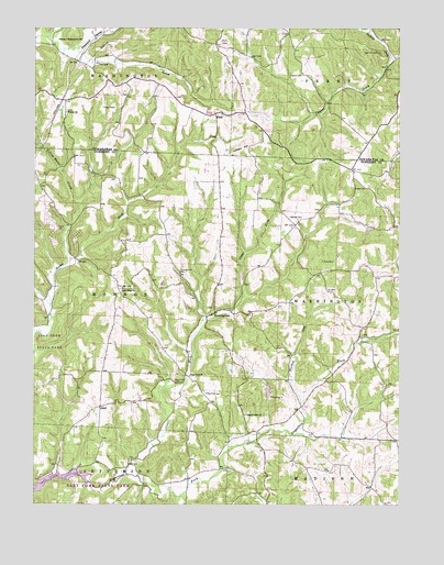
Birmingham, OH USGS Topographic Map
Click on map above to begin viewing in our Map Viewer.

This topographic map contains these locations and features:
Feature Name Type Latitude Longitude GNIS ID View Map
Berwyn (historical)Populated PlaceN40.2426°W81.4893°1062437View Map
BirminghamPopulated PlaceN40.1753°W81.4373°1083968View Map
Birmingham CemeteryCemeteryN40.1769°W81.4406°1963710View Map
Clear ForkStreamN40.1328°W81.4676°1039168View Map
Clear Fork CemeteryCemeteryN40.1545°W81.4412°1039170View Map
Clear Fork CemeteryCemeteryN40.1573°W81.4512°1039171View Map
Clear Fork ChurchChurchN40.1587°W81.4459°1039172View Map
Clear Fork School (historical)SchoolN40.1573°W81.4518°1054670View Map
Colliers HillSummitN40.2187°W81.4262°1048614View Map
Couts Family CemeteryCemeteryN40.2322°W81.4705°1963820View Map
Cumberland CemeteryCemeteryN40.1862°W81.4499°1039532View Map
Darby CemeteryCemeteryN40.1698°W81.3876°1963716View Map
Engle CemeteryCemeteryN40.2081°W81.3862°1040204View Map
George CemeteryCemeteryN40.2009°W81.4118°1040817View Map
Gospel Light ChurchChurchN40.1487°W81.4265°1040981View Map
Grove CemeteryCemeteryN40.2376°W81.4083°1041197View Map
Hickory Hollow LakeReservoirN40.1550°W81.4197°1079373View Map
Hickory Hollow Lake DamDamN40.1534°W81.4198°1079372View Map
High Hill CemeteryCemeteryN40.2434°W81.3815°1041546View Map
Hopewell School (historical)SchoolN40.1817°W81.4696°1054671View Map
Irish RidgeRidgeN40.1812°W81.4707°1084856View Map
Irish Ridge CemeteryCemeteryN40.1817°W81.4701°1963727View Map
Irish Ridge ChurchChurchN40.1820°W81.4696°1041995View Map
Moccasin School (historical)SchoolN40.2017°W81.4154°1054666View Map
New Peoli CemeteryCemeteryN40.2273°W81.4354°1963840View Map
North Union School (historical)SchoolN40.2034°W81.4571°1054669View Map
Oak Grove School (historical)SchoolN40.1501°W81.4118°1054668View Map
OdellPopulated PlaceN40.1509°W81.4768°1049036View Map
Odell Post Office (historical)Post OfficeN40.1501°W81.4762°1988930View Map
Old Peoli CemeteryCemeteryN40.2281°W81.4362°1963841View Map
PeoliPopulated PlaceN40.2273°W81.4384°1049074View Map
Peoli Post Office (historical)Post OfficeN40.2278°W81.4387°2062082View Map
Peoli United Methodist ChurchChurchN40.2276°W81.4357°1063354View Map
Phillips ForkStreamN40.2420°W81.3773°1066890View Map
Pleasant Grove School (historical)SchoolN40.2362°W81.4132°1054378View Map
Pleasant ValleyValleyN40.2434°W81.4843°1044593View Map
Purdue School (historical)SchoolN40.2334°W81.3757°1054377View Map
Salem-Washington SchoolSchoolN40.2470°W81.4915°1045902View Map
Sligo School (historical)SchoolN40.1862°W81.3979°1054667View Map
Township of MonroeCivilN40.1815°W81.4794°1086187View Map
Township of WashingtonCivilN40.1788°W81.3856°1086192View Map
Turkey RunStreamN40.1520°W81.4073°1047207View Map
Wesley Chapel CemeteryCemeteryN40.2278°W81.4890°1963871View Map
Wesley ChurchChurchN40.2278°W81.4890°1047700View Map
Yellow Water CreekStreamN40.2037°W81.4843°1048193View Map

Note: Coordinates in the location and feature list above are referenced to NAD83 datum.


Copyright (C) 2008-2025 Ryan Niemi / Sunset Dynamics ... All Rights Reserved