TopoQuest Logo
Do you find TopoQuest useful?
Help keep TopoQuest running and adding new maps/features by donating!
Bitcoin:  19c7KJd3qBynnjoSw5npx9KScwjBe4ifkT
Litecoin:  LXs6TkuXGGXo1vDsWCkWVdjQX94eUKd6ui
Home View Maps Find Maps Find Places Resources & Links


Antrim, Ohio Topographic Map

USGS Map Title: Antrim, OH
USGS Map MRC: 40081A3
DRG (GeoTIFF) Download: o40081a3.tif


Neighboring USGS Topographic Map Quads:


  Birmingham, OH  
40081B4
 

  Freeport, OH  
40081B3
 

  Piedmont, OH  
40081B2
 

  Old Washington, OH  
40081A4
 

  Antrim, OH  
40081A3
 

  Fairview, OH  
40081A2
 

  Senecaville, OH  
39081H4
 

  Quaker City, OH  
39081H3
 

  Barnesville, OH  
39081H2


Map MRC Location:

N41°
W82°
N41°
W81°
H8 H7 H6 H5 H4 H3 H2 H1
G8 G7 G6 G5 G4 G3 G2 G1
F8 F7 F6 F5 F4 F3 F2 F1
E8 E7 E6 E5 E4 E3 E2 E1
D8 D7 D6 D5 D4 D3 D2 D1
C8 C7 C6 C5 C4 C3 C2 C1
B8 B7 B6 B5 B4 B3 B2 B1
A8 A7 A6 A5 A4 A3 A2 A1
N40°
W82°
N40°
W81°

Antrim, OH USGS 1:24K Topographic Map Preview:
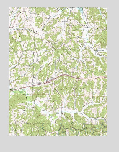
Antrim, OH USGS Topographic Map
Click on map above to begin viewing in our Map Viewer.

This topographic map contains these locations and features:
Feature Name Type Latitude Longitude GNIS ID View Map
AntrimPopulated PlaceN40.1203°W81.3584°1048465View Map
Antrim Community Volunteer Fire DepartmentBuildingN40.1226°W81.3555°2549432View Map
Antrim Mennonite ChurchChurchN40.1245°W81.3518°1080406View Map
Antrim Post Office (historical)Post OfficeN40.1209°W81.3582°1988766View Map
Antrim Presbyterian CemeteryCemeteryN40.1198°W81.3573°1963703View Map
Blooming Grove School (historical)SchoolN40.0873°W81.3207°1054718View Map
Bond CemeteryCemeteryN40.1198°W81.2553°1080408View Map
Bunfills CemeteryCemeteryN40.1048°W81.2676°1963712View Map
Carlisle CemeteryCemeteryN40.0474°W81.3677°1038817View Map
Clark School (historical)SchoolN40.0470°W81.3621°1054722View Map
Fletcher CemeteryCemeteryN40.0340°W81.2607°1080407View Map
Fletcher Church (historical)ChurchN40.0340°W81.2604°1080428View Map
Greenwood School (historical)SchoolN40.0837°W81.2843°1054714View Map
HogbackRidgeN40.0951°W81.3626°1041655View Map
Interchange 193CrossingN40.0526°W81.3248°1054719View Map
Kansas School (historical)SchoolN40.0828°W81.3665°1054721View Map
Leatherwood School (historical)SchoolN40.0009°W81.3648°1054724View Map
McCoy CemeteryCemeteryN40.1040°W81.2668°1963730View Map
MiddlebournePopulated PlaceN40.0512°W81.3365°1061512View Map
Middlebourne Post Office (historical)Post OfficeN40.0515°W81.3359°1988939View Map
Oxford Township SchoolSchoolN40.0559°W81.2879°1044266View Map
Pisgah CemeteryCemeteryN40.0620°W81.2951°1963738View Map
Pisgah Church of ChristChurchN40.0623°W81.2948°1044507View Map
Pleasant Hill School (historical)SchoolN40.0745°W81.2573°1054715View Map
Pleasant Valley School (historical)SchoolN40.0265°W81.2887°1054716View Map
Rosedale School (historical)SchoolN40.0281°W81.3443°1054723View Map
S BridgeBridgeN40.0451°W81.3740°1069149View Map
Salt Fork Baptist CemeteryCemeteryN40.0773°W81.3271°1963743View Map
Salt Fork Baptist ChurchChurchN40.0773°W81.3268°1045914View Map
Sand Hill School (historical)SchoolN40.0045°W81.3176°1054720View Map
School Number 12 (historical)SchoolN40.1087°W81.2854°1054713View Map
School Number 8 (historical)SchoolN40.1145°W81.3234°1054717View Map
Township of OxfordCivilN40.0476°W81.2877°1086188View Map
WOUC-FM (Cambridge)TowerN40.0923°W81.2884°1083782View Map
WOUC-TV (Cambridge)TowerN40.0923°W81.2884°1083912View Map

Note: Coordinates in the location and feature list above are referenced to NAD83 datum.


Copyright (C) 2008-2025 Ryan Niemi / Sunset Dynamics ... All Rights Reserved