TopoQuest Logo
Do you find TopoQuest useful?
Help keep TopoQuest running and adding new maps/features by donating!
Bitcoin:  19c7KJd3qBynnjoSw5npx9KScwjBe4ifkT
Litecoin:  LXs6TkuXGGXo1vDsWCkWVdjQX94eUKd6ui
Home View Maps Find Maps Find Places Resources & Links


Saubee Lake, Michigan Topographic Map

USGS Map Title: Saubee Lake, MI
USGS Map MRC: 42085F1
DRG (GeoTIFF) Download: o42085f1.tif


Neighboring USGS Topographic Map Quads:


  Lake Odessa, MI  
42085G2
 

  Woodbury, MI  
42085G1
 

  Portland South, MI  
42084G8
 

  Woodland, MI  
42085F2
 

  Saubee Lake, MI  
42085F1
 

  Hoytville, MI  
42084F8
 

  Maple Grove, MI  
42085E2
 

  Nashville, MI  
42085E1
 

  Chester, MI  
42084E8


Map MRC Location:

N43°
W86°
N43°
W85°
H8 H7 H6 H5 H4 H3 H2 H1
G8 G7 G6 G5 G4 G3 G2 G1
F8 F7 F6 F5 F4 F3 F2 F1
E8 E7 E6 E5 E4 E3 E2 E1
D8 D7 D6 D5 D4 D3 D2 D1
C8 C7 C6 C5 C4 C3 C2 C1
B8 B7 B6 B5 B4 B3 B2 B1
A8 A7 A6 A5 A4 A3 A2 A1
N42°
W86°
N42°
W85°

Saubee Lake, MI USGS 1:24K Topographic Map Preview:
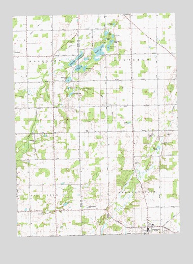
Saubee Lake, MI USGS Topographic Map
Click on map above to begin viewing in our Map Viewer.

This topographic map contains these locations and features:
Feature Name Type Latitude Longitude GNIS ID View Map
Bismarck Post Office (historical)Post OfficeN42.6983°W85.0339°2574838View Map
Bismark SchoolSchoolN42.6973°W85.0150°621462View Map
Blair Post Office (historical)Post OfficeN42.6839°W85.0950°2572393View Map
Carr LakeLakeN42.7200°W85.0751°622777View Map
Chance SchoolSchoolN42.6395°W85.0556°623061View Map
Clinton Junction Post Office (historical)Post OfficeN42.7453°W85.0342°2575122View Map
Clinton Junction Post Office (historical)Post OfficeN42.7453°W85.0342°2575088View Map
Dellwood Post Office (historical)Post OfficeN42.6986°W85.0542°2574837View Map
Durk LakeLakeN42.7361°W85.0536°2109957View Map
First Congregational ChurchChurchN42.6289°W85.0250°2574805View Map
First LakeLakeN42.7054°W85.0815°626013View Map
Hagar CemeteryCemeteryN42.6844°W85.0683°2109958View Map
Hagar CreekStreamN42.7114°W85.1006°627592View Map
Hagar SchoolSchoolN42.6839°W85.0583°627593View Map
Hart LakeLakeN42.7392°W85.0534°627873View Map
Hosmer CemeteryCemeteryN42.6381°W85.1039°628648View Map
Hosmer SchoolSchoolN42.6414°W85.0939°628651View Map
Hunter SchoolSchoolN42.7250°W85.0342°628833View Map
Kilpatrick ChurchChurchN42.7128°W85.0939°629669View Map
Kilpatrick LakeLakeN42.7134°W85.0829°629670View Map
Lookingglass LakeLakeN42.7343°W85.0493°631023View Map
Lost LakeLakeN42.7374°W85.0482°631080View Map
Lovell PondLakeN42.6881°W85.0369°631143View Map
Magden SchoolSchoolN42.7267°W85.0022°631324View Map
Maplewood SchoolSchoolN42.6303°W85.0208°2574803View Map
Mud LakeLakeN42.7197°W85.0705°632940View Map
Opera House Historical MarkerParkN42.6265°W85.0249°2569711View Map
Patterson CemeteryCemeteryN42.6653°W85.0328°634467View Map
Round LakeLakeN42.6738°W85.0151°636287View Map
Saddlebag LakeLakeN42.7248°W85.0770°636480View Map
Saubee LakeLakeN42.7295°W85.0590°637269View Map
Second LakeLakeN42.7089°W85.0828°637519View Map
Tamarock LakeLakeN42.7312°W85.0518°1614576View Map
Township of SunfieldCivilN42.7269°W85.0153°1627139View Map
Township of VermontvilleCivilN42.6400°W85.0159°1627194View Map
VermontvillePopulated PlaceN42.6289°W85.0242°1615548View Map
Vermontville Academy Historical MarkerParkN42.6295°W85.0250°2569712View Map
Vermontville Bible ChurchChurchN42.6314°W85.0239°2575018View Map
Vermontville CemeteryCemeteryN42.6286°W85.0394°2574872View Map
Vermontville City ParkParkN42.6289°W85.0244°2574800View Map
Vermontville Fire and Emergency Medical ServicesBuildingN42.6273°W85.0251°2636054View Map
Vermontville Methodist ChurchChurchN42.6292°W85.0244°2574804View Map
Vermontville Post OfficePost OfficeN42.6278°W85.0244°2574802View Map
Vermontville Township LibraryBuildingN42.6272°W85.0233°2574801View Map
Vermontville United Methodist Church Historical MarkerParkN42.6296°W85.0249°2569713View Map
Village of VermontvilleCivilN42.6269°W85.0249°2400060View Map
Woodland CemeteryCemeteryN42.7045°W85.1153°1616757View Map
Woodlawn CemeteryCemeteryN42.6364°W85.0547°1616769View Map
Zion ChurchChurchN42.7456°W85.1136°1616950View Map

Note: Coordinates in the location and feature list above are referenced to NAD83 datum.


Copyright (C) 2008-2025 Ryan Niemi / Sunset Dynamics ... All Rights Reserved