TopoQuest Logo
Do you find TopoQuest useful?
Help keep TopoQuest running and adding new maps/features by donating!
Bitcoin:  19c7KJd3qBynnjoSw5npx9KScwjBe4ifkT
Litecoin:  LXs6TkuXGGXo1vDsWCkWVdjQX94eUKd6ui
Home View Maps Find Maps Find Places Resources & Links


Towanda, Pennsylvania Topographic Map

USGS Map Title: Towanda, PA
USGS Map MRC: 41076G4
DRG (GeoTIFF) Download: o41076g4.tif


Neighboring USGS Topographic Map Quads:


  Sayre, PA  
41076H5
 

  Litchfield, PA  
41076H4
 

  Windham, PA  
41076H3
 

  Ulster, PA  
41076G5
 

  Towanda, PA  
41076G4
 

  Rome, PA  
41076G3
 

  Powell, PA  
41076F5
 

  Monroeton, PA  
41076F4
 

  Wyalusing, PA  
41076F3


Map MRC Location:

N42°
W77°
N42°
W76°
H8 H7 H6 H5 H4 H3 H2 H1
G8 G7 G6 G5 G4 G3 G2 G1
F8 F7 F6 F5 F4 F3 F2 F1
E8 E7 E6 E5 E4 E3 E2 E1
D8 D7 D6 D5 D4 D3 D2 D1
C8 C7 C6 C5 C4 C3 C2 C1
B8 B7 B6 B5 B4 B3 B2 B1
A8 A7 A6 A5 A4 A3 A2 A1
N41°
W77°
N41°
W76°

Towanda, PA USGS 1:24K Topographic Map Preview:
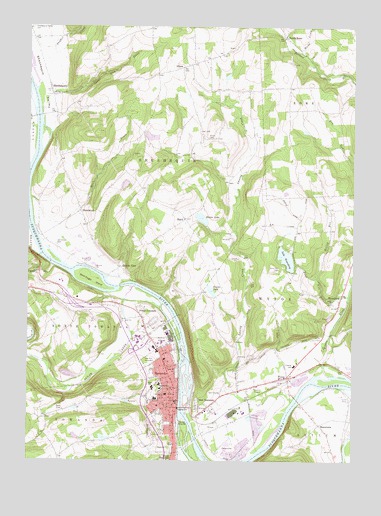
Towanda, PA USGS Topographic Map
Click on map above to begin viewing in our Map Viewer.

This topographic map contains these locations and features:
Feature Name Type Latitude Longitude GNIS ID View Map
Bald Eagle IslandIslandN41.8026°W76.4755°1168629View Map
BlackPopulated PlaceN41.8195°W76.4386°1203108View Map
Black Pond DamDamN41.8184°W76.4313°1195807View Map
Blacks LakeLakeN41.8198°W76.4330°1169774View Map
Borough of TowandaCivilN41.7707°W76.4472°1214959View Map
Bradford County Sheriff's OfficeBuildingN41.7671°W76.4425°2776908View Map
Cash CreekStreamN41.8492°W76.4972°1171303View Map
Central SchoolSchoolN41.7776°W76.3969°1171503View Map
Deer Lick CreekStreamN41.8548°W76.4933°1173092View Map
East TowandaPopulated PlaceN41.7651°W76.4330°1203484View Map
GhentPopulated PlaceN41.8631°W76.4394°1203666View Map
Ghent CemeteryCemeteryN41.8430°W76.4310°1175581View Map
Gillette Family CemeteryCemeteryN41.8476°W76.4885°2776434View Map
Gore CemeteryCemeteryN41.8474°W76.4887°2776436View Map
Guthrie Towanda Memorial HospitalHospitalN41.7844°W76.4478°2718105View Map
Hales Airport (historical)AirportN41.8520°W76.3824°1212955View Map
Hemlock RunStreamN41.8062°W76.4905°1192601View Map
Hicks CreekStreamN41.8679°W76.3949°1176982View Map
Hollow RunStreamN41.8031°W76.3888°1177219View Map
Horn BrookStreamN41.8256°W76.4988°1177413View Map
HornbrookPopulated PlaceN41.8217°W76.4794°1203841View Map
Hornbrook CemeteryCemeteryN41.8123°W76.4894°1177422View Map
J Andrew Morrow Elementary SchoolSchoolN41.7723°W76.4488°1213941View Map
Lake WesaukingLakeN41.8084°W76.4004°1190849View Map
Lake Wesauking DamDamN41.8067°W76.3980°1195799View Map
Laning CreekStreamN41.7676°W76.3977°1178874View Map
MacedoniaPopulated PlaceN41.7604°W76.3872°1204084View Map
Macedonia CemeteryCemeteryN41.7591°W76.3859°2776458View Map
Marrow High SchoolSchoolN41.7720°W76.4488°1180436View Map
Mullberry Street Elementary SchoolSchoolN41.7659°W76.4497°1214520View Map
MyersburgPopulated PlaceN41.7970°W76.3791°1204249View Map
North RomePopulated PlaceN41.8726°W76.4011°1204304View Map
North TowandaPopulated PlaceN41.7879°W76.4538°1204307View Map
North Towanda Fire and RescueBuildingN41.7880°W76.4534°2653184View Map
Oak Hill CemeteryCemeteryN41.7794°W76.4519°1182774View Map
Pennsylvania State Police Troop P Towanda StationBuildingN41.7963°W76.4856°2777274View Map
Pine Grove SchoolSchoolN41.7962°W76.4899°1197336View Map
Pond Hill CemeteryCemeteryN41.8051°W76.4029°1184236View Map
Pond Hill RunStreamN41.7976°W76.3763°1184237View Map
Pond Hill School (historical)SchoolN41.8159°W76.3963°1197337View Map
Post CemeteryCemeteryN41.8157°W76.4391°2776480View Map
Quarry GlenPopulated PlaceN41.8059°W76.4636°1204455View Map
Riverside CemeteryCemeteryN41.7754°W76.4421°1185139View Map
Rome Springs Airport (historical)AirportN41.8520°W76.3835°1194299View Map
Saint Agnes SchoolSchoolN41.7692°W76.4461°1185736View Map
Saint Peter and Paul Parish CemeteryCemeteryN41.7882°W76.4511°2776494View Map
SheshequinPopulated PlaceN41.8554°W76.4908°1187502View Map
Sheshequin ValleyValleyN41.8008°W76.4595°1187503View Map
Sheshequin Valley CemeteryCemeteryN41.8746°W76.4988°1187504View Map
Shores Hill School (historical)SchoolN41.7990°W76.4241°1197338View Map
Shores PondReservoirN41.7995°W76.4297°1187592View Map
Snyder CreekStreamN41.8592°W76.4949°1187953View Map
South TowandaPopulated PlaceN41.7509°W76.4433°1204690View Map
Sugar CreekStreamN41.7998°W76.4597°1188931View Map
TowandaPopulated PlaceN41.7676°W76.4427°1213646View Map
Towanda Area Middle SchoolSchoolN41.7679°W76.4505°1207268View Map
Towanda Area Senior High SchoolSchoolN41.7712°W76.4513°1207269View Map
Towanda Borough Police DepartmentBuildingN41.7676°W76.4422°2777105View Map
Towanda Fire Department Station 15BuildingN41.7708°W76.4486°2653399View Map
Towanda Golf CourseLocaleN41.7698°W76.4274°1205639View Map
Towanda Post OfficePost OfficeN41.7632°W76.4433°2777440View Map
Towanda Township Elementary SchoolSchoolN41.7542°W76.4441°1214521View Map
Township of North TowandaCivilN41.7866°W76.4881°1215985View Map
Township of SheshequinCivilN41.8610°W76.4593°1215991View Map
Township of WysoxCivilN41.7967°W76.3838°1216008View Map
Veit AirportAirportN41.8182°W76.4120°1194294View Map
WTTC-AM (Towanda)TowerN41.7654°W76.4858°1200514View Map
WTTC-FM (Towanda)TowerN41.7654°W76.4858°1214722View Map
WysoxPopulated PlaceN41.7745°W76.3994°1205002View Map
Wysox CemeteryCemeteryN41.7791°W76.3969°2776528View Map
Wysox CreekStreamN41.7748°W76.3863°1191852View Map
Wysox Post OfficePost OfficeN41.7732°W76.4034°2768378View Map
Wysox Volunteer Fire Company Station 21BuildingN41.7765°W76.4004°2653197View Map

Note: Coordinates in the location and feature list above are referenced to NAD83 datum.


Copyright (C) 2008-2025 Ryan Niemi / Sunset Dynamics ... All Rights Reserved