TopoQuest Logo
Do you find TopoQuest useful?
Help keep TopoQuest running and adding new maps/features by donating!
Bitcoin:  19c7KJd3qBynnjoSw5npx9KScwjBe4ifkT
Litecoin:  LXs6TkuXGGXo1vDsWCkWVdjQX94eUKd6ui
Home View Maps Find Maps Find Places Resources & Links


Schaffer, Michigan Topographic Map

USGS Map Title: Schaffer, MI
USGS Map MRC: 45087G3
DRG (GeoTIFF) Download: o45087g3.tif


Neighboring USGS Topographic Map Quads:


  La Branche, MI  
45087H4
 

  Woodlawn, MI  
45087H3
 

  Cornell, MI  
45087H2
 

  Whitney, MI  
45087G4
 

  Schaffer, MI  
45087G3
 

  Chandler, MI  
45087G2
 

  Wilson, MI  
45087F4
 

  Bark River, MI  
45087F3
 

  Ford River, MI  
45087F2


Map MRC Location:

N46°
W88°
N46°
W87°
H8 H7 H6 H5 H4 H3 H2 H1
G8 G7 G6 G5 G4 G3 G2 G1
F8 F7 F6 F5 F4 F3 F2 F1
E8 E7 E6 E5 E4 E3 E2 E1
D8 D7 D6 D5 D4 D3 D2 D1
C8 C7 C6 C5 C4 C3 C2 C1
B8 B7 B6 B5 B4 B3 B2 B1
A8 A7 A6 A5 A4 A3 A2 A1
N45°
W88°
N45°
W87°

Schaffer, MI USGS 1:24K Topographic Map Preview:
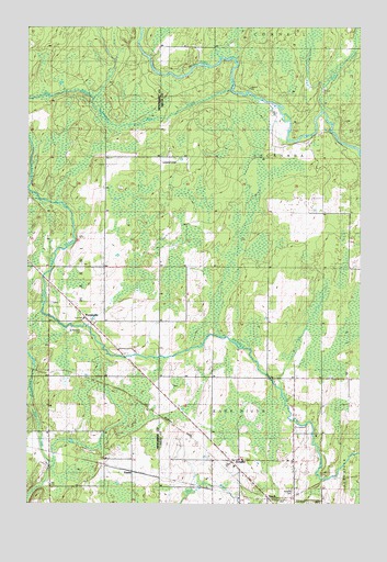
Schaffer, MI USGS Topographic Map
Click on map above to begin viewing in our Map Viewer.

This topographic map contains these locations and features:
Feature Name Type Latitude Longitude GNIS ID View Map
Camp CreekStreamN45.8527°W87.2649°622560View Map
EustisPopulated PlaceN45.7586°W87.3354°1617550View Map
Eustis Post Office (historical)Post OfficeN45.7586°W87.3353°2353175View Map
Eustis Station (historical)LocaleN45.7586°W87.3356°2353176View Map
Harris Township Volunteer Fire Department Station 1BuildingN45.7987°W87.3540°2627014View Map
PerronvillePopulated PlaceN45.7986°W87.3532°634665View Map
Perronville Post OfficePost OfficeN45.7982°W87.3529°2353225View Map
Perronville Station (historical)LocaleN45.7986°W87.3531°2353226View Map
Ramsy Farm Airport (historical)AirportN45.8386°W87.3224°1624100View Map
Saint Michael's Catholic CemeteryCemeteryN45.7951°W87.3544°2353255View Map
Saint Michaels CemeteryCemeteryN45.7953°W87.3544°2099851View Map
SchafferPopulated PlaceN45.7611°W87.2987°637319View Map
Schaffer CemeteryCemeteryN45.7536°W87.2751°637320View Map
Schaffer Post Office (historical)Post OfficeN45.7611°W87.2986°2351123View Map
Schaffer StationLocaleN45.7611°W87.2986°2351124View Map
TeschPopulated PlaceN45.7516°W87.2835°1614691View Map
Twentyfour Mile CreekStreamN45.8583°W87.2990°1615225View Map
West Branch Twentyfour Mile CreekStreamN45.8561°W87.3504°1616081View Map

Note: Coordinates in the location and feature list above are referenced to NAD83 datum.


Copyright (C) 2008-2025 Ryan Niemi / Sunset Dynamics ... All Rights Reserved