TopoQuest Logo
Do you find TopoQuest useful?
Help keep TopoQuest running and adding new maps/features by donating!
Bitcoin:  19c7KJd3qBynnjoSw5npx9KScwjBe4ifkT
Litecoin:  LXs6TkuXGGXo1vDsWCkWVdjQX94eUKd6ui
Home View Maps Find Maps Find Places Resources & Links


Wilson, Michigan Topographic Map

USGS Map Title: Wilson, MI
USGS Map MRC: 45087F4
DRG (GeoTIFF) Download: o45087f4.tif


Neighboring USGS Topographic Map Quads:


  Vega, MI  
45087G5
 

  Whitney, MI  
45087G4
 

  Schaffer, MI  
45087G3
 

  Hermansville, MI  
45087F5
 

  Wilson, MI  
45087F4
 

  Bark River, MI  
45087F3
 

  Nadeau, MI  
45087E5
 

  Gourley, MI  
45087E4
 

  Seagull Point, MI  
45087E3


Map MRC Location:

N46°
W88°
N46°
W87°
H8 H7 H6 H5 H4 H3 H2 H1
G8 G7 G6 G5 G4 G3 G2 G1
F8 F7 F6 F5 F4 F3 F2 F1
E8 E7 E6 E5 E4 E3 E2 E1
D8 D7 D6 D5 D4 D3 D2 D1
C8 C7 C6 C5 C4 C3 C2 C1
B8 B7 B6 B5 B4 B3 B2 B1
A8 A7 A6 A5 A4 A3 A2 A1
N45°
W88°
N45°
W87°

Wilson, MI USGS 1:24K Topographic Map Preview:
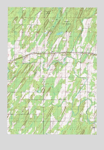
Wilson, MI USGS Topographic Map
Click on map above to begin viewing in our Map Viewer.

This topographic map contains these locations and features:
Feature Name Type Latitude Longitude GNIS ID View Map
Arnold LakeLakeN45.7243°W87.4269°620240View Map
Brook CreekStreamN45.6541°W87.4082°622028View Map
Escanaba River State ForestForestN45.7450°W87.4268°1620793View Map
Fortyseven Mile CreekStreamN45.7014°W87.4110°626304View Map
Gordon CreekStreamN45.6555°W87.4385°626989View Map
Gorginski CreekStreamN45.6964°W87.4487°627000View Map
Hannahvelle Indian ReservationReserveN45.7166°W87.4168°1618871View Map
Hannaville Indian CommunityReserveN45.7355°W87.4168°1616995View Map
Harris CemeteryCemeteryN45.6665°W87.3884°1616994View Map
Harris Church (historical)ChurchN45.6664°W87.3874°627835View Map
HoulePopulated PlaceN45.7055°W87.3968°1617628View Map
Houle CreekStreamN45.6966°W87.4029°628677View Map
Indian CreekStreamN45.7314°W87.4340°628973View Map
IndiantownPopulated PlaceN45.7044°W87.3771°1617639View Map
Kitchners LakeLakeN45.6671°W87.4552°629773View Map
Knap CreekStreamN45.6555°W87.4371°629800View Map
Reed BrookStreamN45.6791°W87.4973°635752View Map
WilsonPopulated PlaceN45.7052°W87.4382°1616553View Map
Wilson CemeteryCemeteryN45.7064°W87.4486°2353259View Map
Wilson CreekStreamN45.7016°W87.4510°1616562View Map
Wilson Post OfficePost OfficeN45.7056°W87.4347°2353193View Map
Wilson StationLocaleN45.7056°W87.4389°2353192View Map
Zion ChurchChurchN45.7055°W87.4482°1616957View Map

Note: Coordinates in the location and feature list above are referenced to NAD83 datum.


Copyright (C) 2008-2025 Ryan Niemi / Sunset Dynamics ... All Rights Reserved