TopoQuest Logo
Do you find TopoQuest useful?
Help keep TopoQuest running and adding new maps/features by donating!
Bitcoin:  19c7KJd3qBynnjoSw5npx9KScwjBe4ifkT
Litecoin:  LXs6TkuXGGXo1vDsWCkWVdjQX94eUKd6ui
Home View Maps Find Maps Find Places Resources & Links


Chandler, Michigan Topographic Map

USGS Map Title: Chandler, MI
USGS Map MRC: 45087G2
DRG (GeoTIFF) Download: o45087g2.tif


Neighboring USGS Topographic Map Quads:


  Woodlawn, MI  
45087H3
 

  Cornell, MI  
45087H2
 

  Perkins, MI  
45087H1
 

  Schaffer, MI  
45087G3
 

  Chandler, MI  
45087G2
 

  Gladstone, MI  
45087G1
 

  Bark River, MI  
45087F3
 

  Ford River, MI  
45087F2
 

  Escanaba, MI  
45087F1


Map MRC Location:

N46°
W88°
N46°
W87°
H8 H7 H6 H5 H4 H3 H2 H1
G8 G7 G6 G5 G4 G3 G2 G1
F8 F7 F6 F5 F4 F3 F2 F1
E8 E7 E6 E5 E4 E3 E2 E1
D8 D7 D6 D5 D4 D3 D2 D1
C8 C7 C6 C5 C4 C3 C2 C1
B8 B7 B6 B5 B4 B3 B2 B1
A8 A7 A6 A5 A4 A3 A2 A1
N45°
W88°
N45°
W87°

Chandler, MI USGS 1:24K Topographic Map Preview:
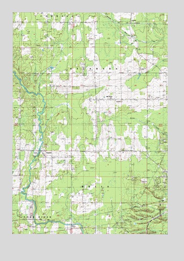
Chandler, MI USGS Topographic Map
Click on map above to begin viewing in our Map Viewer.

This topographic map contains these locations and features:
Feature Name Type Latitude Longitude GNIS ID View Map
Berean Baptist ChurchChurchN45.7967°W87.1314°2351083View Map
ChandlerPopulated PlaceN45.8700°W87.1560°1617482View Map
Escanaba Township Volunteer Fire DepartmentBuildingN45.8265°W87.1361°2626840View Map
Flat RockPopulated PlaceN45.8258°W87.1835°626147View Map
Flat Rock CemeteryCemeteryN45.8255°W87.1878°2352327View Map
Flat Rock Post Office (historical)Post OfficeN45.8258°W87.1833°2356460View Map
Holy Family ChurchChurchN45.8258°W87.1667°2099850View Map
Moser Community CenterBuildingN45.7969°W87.1625°2099849View Map
Newhall SchoolSchoolN45.7936°W87.2187°633362View Map
RiverlandPopulated PlaceN45.7966°W87.2268°635976View Map
Tenmile CreekStreamN45.7552°W87.2299°1614682View Map
Township of EscanabaCivilN45.8461°W87.1778°1626248View Map
Township of WellsCivilN45.7762°W87.1642°1627241View Map
WCHT-AM (Escanaba)TowerN45.8052°W87.1704°1625187View Map

Note: Coordinates in the location and feature list above are referenced to NAD83 datum.


Copyright (C) 2008-2025 Ryan Niemi / Sunset Dynamics ... All Rights Reserved