TopoQuest Logo
Do you find TopoQuest useful?
Help keep TopoQuest running and adding new maps/features by donating!
Bitcoin:  19c7KJd3qBynnjoSw5npx9KScwjBe4ifkT
Litecoin:  LXs6TkuXGGXo1vDsWCkWVdjQX94eUKd6ui
Home View Maps Find Maps Find Places Resources & Links


Scotts Mills, Oregon Topographic Map

USGS Map Title: Scotts Mills, OR
USGS Map MRC: 45122A6
DRG (GeoTIFF) Download: o45122a6.tif


Neighboring USGS Topographic Map Quads:


  Woodburn, OR  
45122B7
 

  Yoder, OR  
45122B6
 

  Molalla, OR  
45122B5
 

  Silverton, OR  
45122A7
 

  Scotts Mills, OR  
45122A6
 

  Wilhoit, OR  
45122A5
 

  Stayton NE, OR  
44122H7
 

  Drake Crossing, OR  
44122H6
 

  Elk Prairie, OR  
44122H5


Map MRC Location:

N46°
W123°
N46°
W122°
H8 H7 H6 H5 H4 H3 H2 H1
G8 G7 G6 G5 G4 G3 G2 G1
F8 F7 F6 F5 F4 F3 F2 F1
E8 E7 E6 E5 E4 E3 E2 E1
D8 D7 D6 D5 D4 D3 D2 D1
C8 C7 C6 C5 C4 C3 C2 C1
B8 B7 B6 B5 B4 B3 B2 B1
A8 A7 A6 A5 A4 A3 A2 A1
N45°
W123°
N45°
W122°

Scotts Mills, OR USGS 1:24K Topographic Map Preview:
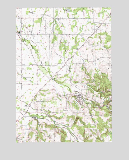
Scotts Mills, OR USGS Topographic Map
Click on map above to begin viewing in our Map Viewer.

This topographic map contains these locations and features:
Feature Name Type Latitude Longitude GNIS ID View Map
Alder CreekStreamN45.0137°W122.6845°1116829View Map
Butte CreekLakeN45.0359°W122.6580°1118393View Map
Butte Creek (historical)Populated PlaceN45.0651°W122.6970°1163552View Map
Butte Creek Elementary SchoolSchoolN45.0633°W122.6989°2485888View Map
Butte Creek Elementary SchoolSchoolN45.0634°W122.6989°1162869View Map
Butte Creek Post Office (historical)Post OfficeN45.0651°W122.6970°1164991View Map
Chapel of The Holy Family and Retreat House at Saint Nicholas RanchChurchN45.0039°W122.6633°2508206View Map
City of Scotts MillsCivilN45.0410°W122.6689°2411843View Map
Comer CreekStreamN45.1010°W122.6679°1162913View Map
Davis CreekStreamN45.0257°W122.7262°1159033View Map
Dobbes LakeLakeN45.0912°W122.6727°1130507View Map
Drescher ReservoirReservoirN45.1070°W122.7384°1130506View Map
Dunagan BridgeBridgeN45.0079°W122.6774°1162149View Map
Evans ValleyValleyN45.0165°W122.7373°1638752View Map
Evans Valley School (historical)SchoolN45.0037°W122.7487°1120542View Map
Garret CreekStreamN45.1221°W122.6573°1158257View Map
Glad Tidings Post Office (historical)Post OfficeN45.1046°W122.6456°1638255View Map
GladtidingsLocaleN45.1046°W122.6456°1158259View Map
Goschie FarmsLocaleN45.0686°W122.7414°2663827View Map
Harding (historical)LocaleN45.1151°W122.7284°1161023View Map
Hartman DamDamN45.0540°W122.6915°1161022View Map
Jacks BridgeBridgeN45.0593°W122.7054°1161020View Map
Kaiser CreekStreamN45.1248°W122.6643°1122623View Map
Loes ReservoirsReservoirN45.0126°W122.7326°1130509View Map
Log PondReservoirN45.1223°W122.6819°1123350View Map
Lone Pine CornerLocaleN45.0532°W122.7131°1163554View Map
Maplewood Pioneer CemeteryCemeteryN45.0492°W122.6588°1123747View Map
MarquamPopulated PlaceN45.0732°W122.6870°1136517View Map
Marquam CreekStreamN45.1010°W122.6679°1123780View Map
Marquam Post Office (historical)Post OfficeN45.0732°W122.6870°1165589View Map
Marquam ReservoirReservoirN45.0631°W122.6784°1163551View Map
Marquam United Methodist ChurchChurchN45.0722°W122.6881°2440074View Map
McLaughlin School (historical)SchoolN45.0235°W122.7254°1123999View Map
Meridian Post Office (historical)Post OfficeN45.0710°W122.7437°1164514View Map
Mill CreekStreamN45.0360°W122.6581°1163555View Map
Miller CemeteryCemeteryN45.0390°W122.7290°1124186View Map
MonitorPopulated PlaceN45.1015°W122.7481°1163155View Map
Monitor BridgeBridgeN45.1016°W122.7461°1638751View Map
Monitor Elementary SchoolSchoolN45.1002°W122.7487°1163550View Map
Monitor Post Office (historical)Post OfficeN45.1015°W122.7481°1165653View Map
Monitor Rural Fire Protection District Station 58BuildingN45.1012°W122.7490°2576591View Map
Monte Cristo (historical)LocaleN45.1012°W122.7123°1130505View Map
Noble (historical)Populated PlaceN45.0021°W122.6401°1161021View Map
Noble Post Office (historical)Post OfficeN45.0012°W122.6393°1164551View Map
Nowlen BridgeBridgeN45.0435°W122.6660°1163553View Map
OaklawnPopulated PlaceN45.1193°W122.7295°1124924View Map
Orr CreekStreamN45.0151°W122.6970°1163556View Map
Powers CreekStreamN45.0162°W122.6995°1163211View Map
Rockie Four CornersLocaleN45.0337°W122.7337°1126223View Map
Ross BridgeBridgeN45.0712°W122.7176°1162147View Map
Scotts MillsPopulated PlaceN45.0429°W122.6684°1163262View Map
Scotts Mills City HallBuildingN45.0425°W122.6675°2699803View Map
Scotts Mills County ParkParkN45.0398°W122.6643°1966219View Map
Scotts Mills Elementary SchoolSchoolN45.0452°W122.6761°1162148View Map
Scotts Mills Friends ChurchChurchN45.0412°W122.6685°2508216View Map
Scotts Mills Post OfficePost OfficeN45.0437°W122.6671°1165922View Map
Silverton Fire District Station 3 AbiquaBuildingN45.0215°W122.7036°2576874View Map
Silverton Fire District Station 8 Scotts MillsBuildingN45.0437°W122.6711°2577034View Map
Spring ReservoirReservoirN45.0235°W122.6531°1130508View Map
Thomas CreekStreamN45.1204°W122.6387°1128021View Map
Trinity Lutheran ChurchChurchN45.0712°W122.7429°1128230View Map
Valley View CemeteryCemeteryN45.0059°W122.7479°1128499View Map

Note: Coordinates in the location and feature list above are referenced to NAD83 datum.


Copyright (C) 2008-2025 Ryan Niemi / Sunset Dynamics ... All Rights Reserved