TopoQuest Logo
Do you find TopoQuest useful?
Help keep TopoQuest running and adding new maps/features by donating!
Bitcoin:  19c7KJd3qBynnjoSw5npx9KScwjBe4ifkT
Litecoin:  LXs6TkuXGGXo1vDsWCkWVdjQX94eUKd6ui
Home View Maps Find Maps Find Places Resources & Links


Drake Crossing, Oregon Topographic Map

USGS Map Title: Drake Crossing, OR
USGS Map MRC: 44122H6
DRG (GeoTIFF) Download: o44122h6.tif


Neighboring USGS Topographic Map Quads:


  Silverton, OR  
45122A7
 

  Scotts Mills, OR  
45122A6
 

  Wilhoit, OR  
45122A5
 

  Stayton NE, OR  
44122H7
 

  Drake Crossing, OR  
44122H6
 

  Elk Prairie, OR  
44122H5
 

  Stayton, OR  
44122G7
 

  Stout Mountain, OR  
44122G6
 

  Lyons, OR  
44122G5


Map MRC Location:

N45°
W123°
N45°
W122°
H8 H7 H6 H5 H4 H3 H2 H1
G8 G7 G6 G5 G4 G3 G2 G1
F8 F7 F6 F5 F4 F3 F2 F1
E8 E7 E6 E5 E4 E3 E2 E1
D8 D7 D6 D5 D4 D3 D2 D1
C8 C7 C6 C5 C4 C3 C2 C1
B8 B7 B6 B5 B4 B3 B2 B1
A8 A7 A6 A5 A4 A3 A2 A1
N44°
W123°
N44°
W122°

Drake Crossing, OR USGS 1:24K Topographic Map Preview:
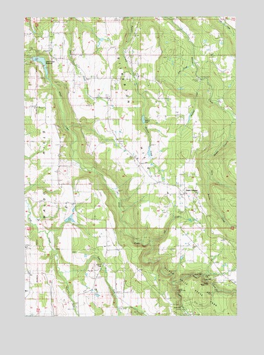
Drake Crossing, OR USGS Topographic Map
Click on map above to begin viewing in our Map Viewer.

This topographic map contains these locations and features:
Feature Name Type Latitude Longitude GNIS ID View Map
Argenti Post Office (historical)Post OfficeN44.9262°W122.6962°1164186View Map
Brooks CreekStreamN44.9326°W122.6412°1118113View Map
Double FallsFallsN44.8920°W122.6450°1120038View Map
Drake CrossingPopulated PlaceN44.9260°W122.6559°1120070View Map
Drake FallsFallsN44.8896°W122.6458°1120071View Map
Drakes Crossing Rural Fire Protection DistrictBuildingN44.9264°W122.6571°2576835View Map
Drift Creek FallsFallsN44.8990°W122.7073°1162950View Map
East Fork Drift CreekStreamN44.8935°W122.7281°1162958View Map
Echo CreekStreamN44.9665°W122.6595°1163593View Map
Fox DamDamN44.9151°W122.7248°1133543View Map
Fox ReservoirReservoirN44.9155°W122.7244°1131481View Map
Hammond CreekStreamN44.9735°W122.6456°1131485View Map
Hullt (historical)Populated PlaceN44.8971°W122.6401°1131477View Map
Hullt Post Office (historical)Post OfficeN44.8971°W122.6401°1165421View Map
Jeff CreekStreamN44.9054°W122.6762°1131479View Map
KECH-TVTowerN44.9998°W122.6948°1131168View Map
Knight Post Office (historical)Post OfficeN44.9110°W122.7026°1165496View Map
Koehler ReservoirReservoirN44.9356°W122.6697°1131482View Map
KSKD-FMTowerN44.9993°W122.6948°1158724View Map
Lewis CemeteryCemeteryN44.9299°W122.7125°1163592View Map
Little Abiqua CreekStreamN44.9579°W122.6273°1123118View Map
Lower North FallsFallsN44.8917°W122.6468°1131478View Map
Lower South FallsFallsN44.8854°W122.6610°1163113View Map
Middle North FallsFallsN44.8887°W122.6430°1162311View Map
Mountain View CemeteryCemeteryN44.9263°W122.6509°1124425View Map
North Fork Silver CreekStreamN44.8765°W122.6490°1163178View Map
North Silver Creek Youth CampLocaleN44.8887°W122.6276°1162315View Map
Pichette ReservoirReservoirN44.9592°W122.6283°1131483View Map
Silver Creek DamDamN44.9832°W122.7462°1133677View Map
Silver Creek ReservoirReservoirN44.9821°W122.7412°1133678View Map
Silver Crest Elementary SchoolSchoolN44.9267°W122.6666°1126974View Map
Silverton DivisionCivilN44.9346°W122.6475°1938121View Map
Silverton HillsSummitN44.9460°W122.6806°1136757View Map
Silverton Hills GrangeBuildingN44.9454°W122.6918°1126976View Map
Silverton Reservoir City Marine Park Boat DocksLocaleN44.9832°W122.7442°2699818View Map
Silverton Reservoir City Marine Park Boat RampLocaleN44.9832°W122.7449°2699819View Map
Skookum Tum Tum ParkParkN44.9610°W122.6318°1162312View Map
South FallsFallsN44.8788°W122.6590°1127252View Map
South Fork Silver CreekStreamN44.8893°W122.6634°1127320View Map
Sublimity Fire District Station 52 SubstationBuildingN44.8840°W122.7196°2576753View Map
Twin FallsFallsN44.8852°W122.6371°1128343View Map
Union Hill CemeteryCemeteryN44.8893°W122.7370°1163314View Map
Union Hill GrangeBuildingN44.8768°W122.7348°1163315View Map
West Fork Drift CreekStreamN44.8935°W122.7281°1163340View Map
Willards DamDamN44.9548°W122.6812°1133721View Map
Willards PoolLakeN44.9569°W122.6809°1131484View Map
Winter FallsFallsN44.8844°W122.6409°1129244View Map

Note: Coordinates in the location and feature list above are referenced to NAD83 datum.


Copyright (C) 2008-2025 Ryan Niemi / Sunset Dynamics ... All Rights Reserved