TopoQuest Logo
Do you find TopoQuest useful?
Help keep TopoQuest running and adding new maps/features by donating!
Bitcoin:  19c7KJd3qBynnjoSw5npx9KScwjBe4ifkT
Litecoin:  LXs6TkuXGGXo1vDsWCkWVdjQX94eUKd6ui
Home View Maps Find Maps Find Places Resources & Links


Seaman, Ohio Topographic Map

USGS Map Title: Seaman, OH
USGS Map MRC: 38083H5
DRG (GeoTIFF) Download: o38083h5.tif


Neighboring USGS Topographic Map Quads:


  Sugar Tree Ridge, OH  
39083A6
 

  Belfast, OH  
39083A5
 

  Sinking Spring, OH  
39083A4
 

  Winchester, OH  
38083H6
 

  Seaman, OH  
38083H5
 

  Peebles, OH  
38083H4
 

  Decatur, OH  
38083G6
 

  West Union, OH  
38083G5
 

  Lynx, OH  
38083G4


Map MRC Location:

N39°
W84°
N39°
W83°
H8 H7 H6 H5 H4 H3 H2 H1
G8 G7 G6 G5 G4 G3 G2 G1
F8 F7 F6 F5 F4 F3 F2 F1
E8 E7 E6 E5 E4 E3 E2 E1
D8 D7 D6 D5 D4 D3 D2 D1
C8 C7 C6 C5 C4 C3 C2 C1
B8 B7 B6 B5 B4 B3 B2 B1
A8 A7 A6 A5 A4 A3 A2 A1
N38°
W84°
N38°
W83°

Seaman, OH USGS 1:24K Topographic Map Preview:
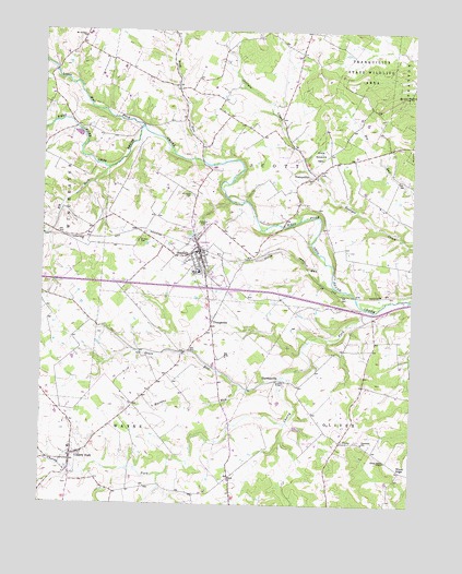
Seaman, OH USGS Topographic Map
Click on map above to begin viewing in our Map Viewer.

This topographic map contains these locations and features:
Feature Name Type Latitude Longitude GNIS ID View Map
Adams County Regional Medical CenterHospitalN38.9340°W83.5847°2548822View Map
Buck RunStreamN38.9651°W83.5680°1038465View Map
Buck Run (historical)Populated PlaceN38.9856°W83.5796°1055820View Map
Buck Run Post Office (historical)Post OfficeN38.9856°W83.5796°1956158View Map
Buck Run School (historical)SchoolN38.9876°W83.5799°1055821View Map
Buckeye School (historical)SchoolN38.8784°W83.5763°1055822View Map
Cherry ForkStreamN38.9262°W83.5130°1039020View Map
Cherry ForkPopulated PlaceN38.8876°W83.6144°1060952View Map
Cherry Fork CemeteryCemeteryN38.8803°W83.6160°1731180View Map
Cherry Fork Census Designated PlaceCensusN38.8868°W83.6124°2785006View Map
Cherry Fork Post OfficePost OfficeN38.8876°W83.6138°1958747View Map
Elk ForkStreamN38.9634°W83.6033°1065997View Map
Eureka School (historical)SchoolN38.9995°W83.5363°1055839View Map
Fairview ChurchChurchN38.9831°W83.5021°1040346View Map
Fairview School (historical)SchoolN38.9801°W83.5096°1055841View Map
Grace RunStreamN38.9090°W83.5435°1061107View Map
Gregg RunStreamN38.9328°W83.5269°1041177View Map
Harmony School (historical)SchoolN38.9440°W83.5149°1055851View Map
HarshasvillePopulated PlaceN38.9081°W83.5444°1064803View Map
Harshasville BridgeBridgeN38.9078°W83.5435°1055853View Map
Harshasville Post Office (historical)Post OfficeN38.9076°W83.5424°1956288View Map
Irvington (historical)Populated PlaceN38.9409°W83.5510°1055858View Map
Irvington Post Office (historical)Post OfficeN38.9409°W83.5510°1956646View Map
Irvington School (historical)SchoolN38.9420°W83.5516°1055859View Map
Little West Fork Ohio Brush CreekStreamN38.9748°W83.5913°1042642View Map
Lower Brush Creek School (historical)SchoolN38.9740°W83.6149°1055873View Map
Martins RunStreamN38.9059°W83.5569°1043030View Map
Mount Calvary CemeteryCemeteryN38.9984°W83.6110°1731202View Map
Mount Leigh (historical)Populated PlaceN38.9556°W83.5735°1084811View Map
Mount Leigh CemeteryCemeteryN38.9567°W83.5749°1043578View Map
Mount Leigh Post Office (historical)Post OfficeN38.9556°W83.5735°1956622View Map
Mount Zion (historical)Populated PlaceN38.9465°W83.5910°1055889View Map
Mount Zion CemeteryCemeteryN38.9445°W83.5924°1043641View Map
North Adams High SchoolSchoolN38.9365°W83.5721°1055892View Map
Scott Township Fire DepartmentBuildingN38.9399°W83.5802°2550178View Map
SeamanPopulated PlaceN38.9420°W83.5724°1058010View Map
Seaman Elementary SchoolSchoolN38.9370°W83.5721°1055915View Map
Seaman Post OfficePost OfficeN38.9415°W83.5738°1956292View Map
Seaman Volunteer Emergency Medical ServiceBuildingN38.9429°W83.5727°2550855View Map
Sunnyside School (historical)SchoolN38.9059°W83.5880°1055929View Map
Township of OliverCivilN38.8896°W83.5059°1085683View Map
Township of ScottCivilN38.9774°W83.5490°1085684View Map
Township of WayneCivilN38.8875°W83.6118°1085687View Map
TranquilityPopulated PlaceN38.9626°W83.5330°1061700View Map
Tranquility CemeteryCemeteryN38.9623°W83.5310°1731214View Map
Tranquillity Post Office (historical)Post OfficeN38.9626°W83.5330°1956624View Map
UnityPopulated PlaceN38.8917°W83.5232°1049260View Map
Unity CemeteryCemeteryN38.8920°W83.5232°1731216View Map
Upper Georges Creek School (historical)SchoolN38.9701°W83.5435°1055935View Map
Village of Cherry Fork (historical)CivilN38.8864°W83.6144°2397611View Map
Village of SeamanCivilN38.9331°W83.5677°2399778View Map
Wayne Elementary SchoolSchoolN38.8898°W83.6149°1055937View Map
Wayne Township Volunteer Fire DepartmentBuildingN38.8895°W83.6148°2550517View Map
Wheat RidgePopulated PlaceN38.8842°W83.5032°1063088View Map
Wheat Ridge ChapelChurchN38.8867°W83.5082°1047843View Map
YoungsvillePopulated PlaceN38.9228°W83.5674°1048216View Map

Note: Coordinates in the location and feature list above are referenced to NAD83 datum.


Copyright (C) 2008-2025 Ryan Niemi / Sunset Dynamics ... All Rights Reserved