TopoQuest Logo
Do you find TopoQuest useful?
Help keep TopoQuest running and adding new maps/features by donating!
Bitcoin:  19c7KJd3qBynnjoSw5npx9KScwjBe4ifkT
Litecoin:  LXs6TkuXGGXo1vDsWCkWVdjQX94eUKd6ui
Home View Maps Find Maps Find Places Resources & Links


West Union, Ohio Topographic Map

USGS Map Title: West Union, OH
USGS Map MRC: 38083G5
DRG (GeoTIFF) Download: o38083g5.tif


Neighboring USGS Topographic Map Quads:


  Winchester, OH  
38083H6
 

  Seaman, OH  
38083H5
 

  Peebles, OH  
38083H4
 

  Decatur, OH  
38083G6
 

  West Union, OH  
38083G5
 

  Lynx, OH  
38083G4
 

  Maysville East, KY  
38083F6
 

  Manchester Islands, KY  
38083F5
 

  Concord, KY  
38083F4


Map MRC Location:

N39°
W84°
N39°
W83°
H8 H7 H6 H5 H4 H3 H2 H1
G8 G7 G6 G5 G4 G3 G2 G1
F8 F7 F6 F5 F4 F3 F2 F1
E8 E7 E6 E5 E4 E3 E2 E1
D8 D7 D6 D5 D4 D3 D2 D1
C8 C7 C6 C5 C4 C3 C2 C1
B8 B7 B6 B5 B4 B3 B2 B1
A8 A7 A6 A5 A4 A3 A2 A1
N38°
W84°
N38°
W83°

West Union, OH USGS 1:24K Topographic Map Preview:
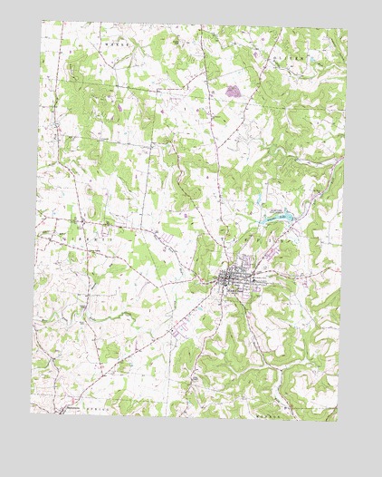
West Union, OH USGS Topographic Map
Click on map above to begin viewing in our Map Viewer.

This topographic map contains these locations and features:
Feature Name Type Latitude Longitude GNIS ID View Map
Adams County HospitalHospitalN38.7942°W83.5355°1073272View Map
Adams County Hospital HeliportAirportN38.7945°W83.5346°1083114View Map
Adams County LandfillLocaleN38.7731°W83.5469°2677589View Map
Adams County Sheriff's OfficeBuildingN38.7954°W83.5461°2732765View Map
Adams LakeReservoirN38.8134°W83.5166°1070658View Map
Adams Lake DamDamN38.8134°W83.5166°1078071View Map
Adams Lake State ParkParkN38.8142°W83.5266°1037317View Map
Alexander Salamon AirportAirportN38.8549°W83.5635°1083112View Map
Cave HillSummitN38.8501°W83.6021°1048586View Map
Chaparral CemeteryCemeteryN38.8370°W83.5988°1038985View Map
Chaparral Prairie Nature PreserveParkN38.8390°W83.5749°1731179View Map
Chaparral School (historical)SchoolN38.8370°W83.6002°1055832View Map
Coon HillSummitN38.8687°W83.5669°1048629View Map
Dodge PondReservoirN38.8478°W83.5918°1078060View Map
Dodge Pond DamDamN38.8467°W83.5899°1078059View Map
Ellison School (historical)SchoolN38.7506°W83.5594°1055837View Map
First Baptist ChurchChurchN38.7951°W83.5496°1731220View Map
Hale CemeteryCemeteryN38.7673°W83.5882°1731184View Map
Hannah RunStreamN38.7840°W83.6027°1066031View Map
Independent Order of Oddfellows CemeteryCemeteryN38.7981°W83.5307°1731187View Map
Jerusalem School (historical)SchoolN38.8006°W83.5946°1055862View Map
Johnson Ridge State Nature PreserveParkN38.8542°W83.5332°1731217View Map
Kirker BridgeBridgeN38.7842°W83.6033°1055866View Map
Kirker CemeteryCemeteryN38.7784°W83.6027°1042300View Map
Kirker School (historical)SchoolN38.7715°W83.5983°1055867View Map
Laurel School (historical)SchoolN38.8445°W83.5549°1055869View Map
Liberty ChapelChurchN38.8020°W83.6027°1042505View Map
Lick Fork ChurchChurchN38.8220°W83.5091°1042532View Map
Logans Lane Greenhouse and NurseryBuildingN38.8300°W83.5267°2652242View Map
Lovejoy CemeteryCemeteryN38.7881°W83.5332°1042800View Map
Nixon CemeteryCemeteryN38.7617°W83.5591°1731204View Map
Nixon ChapelChurchN38.7620°W83.5591°1043881View Map
Oak Grove CemeteryCemeteryN38.8451°W83.5541°1731205View Map
Oak Grove ChurchChurchN38.8451°W83.5538°1044032View Map
Olive School (historical)SchoolN38.8656°W83.5313°1055895View Map
PanhandlePopulated PlaceN38.8112°W83.6060°1068993View Map
Pumpkin Ridge CemeteryCemeteryN38.7892°W83.5466°1731207View Map
Spencer HillSummitN38.8590°W83.6113°1049200View Map
Township of TiffinCivilN38.8086°W83.5016°1085686View Map
Trotter School (historical)SchoolN38.7676°W83.5213°1055932View Map
Village of West UnionCivilN38.7917°W83.5441°2400146View Map
West UnionPopulated PlaceN38.7945°W83.5452°1061755View Map
West Union Church of the NazareneChurchN38.7940°W83.5446°1731224View Map
West Union Elementary SchoolSchoolN38.7923°W83.5474°1055938View Map
West Union High SchoolSchoolN38.7923°W83.5466°1055939View Map
West Union Police DepartmentBuildingN38.7974°W83.5434°2732776View Map
West Union Post OfficePost OfficeN38.7967°W83.5463°1956294View Map
West Union Presbyterian ChurchChurchN38.7934°W83.5438°1077442View Map
West Union United Methodist ChurchChurchN38.7953°W83.5444°1731225View Map
West Union Volunteer Fire Department Station 18BuildingN38.7977°W83.5433°2550177View Map
West Union Volunteer Life SquadBuildingN38.7982°W83.5441°2550854View Map
WhippoorwillPopulated PlaceN38.8323°W83.5030°1068995View Map
Whippoorwill School (historical)SchoolN38.8342°W83.5038°1055942View Map
Wideawake School (historical)SchoolN38.8187°W83.5616°1055944View Map
WRAC-FM (West Union)TowerN38.8570°W83.6105°1083897View Map
WVXM-FM (West Union)TowerN38.8601°W83.6116°1083896View Map

Note: Coordinates in the location and feature list above are referenced to NAD83 datum.


Copyright (C) 2008-2024 Ryan Niemi / Sunset Dynamics ... All Rights Reserved