TopoQuest Logo
Do you find TopoQuest useful?
Help keep TopoQuest running and adding new maps/features by donating!
Bitcoin:  19c7KJd3qBynnjoSw5npx9KScwjBe4ifkT
Litecoin:  LXs6TkuXGGXo1vDsWCkWVdjQX94eUKd6ui
Home View Maps Find Maps Find Places Resources & Links


Semmes, Alabama Topographic Map

USGS Map Title: Semmes, AL
USGS Map MRC: 30088G3
DRG (GeoTIFF) Download: o30088g3.tif


Neighboring USGS Topographic Map Quads:


  Earlville, AL  
30088H4
 

  Georgetown, AL  
30088H3
 

  Chunchula, AL  
30088H2
 

  Howell, MS  
30088G4
 

  Semmes, AL  
30088G3
 

  Kushla, AL  
30088G2
 

  Hurley, MS  
30088F4
 

  Tanner Williams, AL  
30088F3
 

  Spring Hill, AL  
30088F2


Map MRC Location:

N31°
W89°
N31°
W88°
H8 H7 H6 H5 H4 H3 H2 H1
G8 G7 G6 G5 G4 G3 G2 G1
F8 F7 F6 F5 F4 F3 F2 F1
E8 E7 E6 E5 E4 E3 E2 E1
D8 D7 D6 D5 D4 D3 D2 D1
C8 C7 C6 C5 C4 C3 C2 C1
B8 B7 B6 B5 B4 B3 B2 B1
A8 A7 A6 A5 A4 A3 A2 A1
N30°
W89°
N30°
W88°

Semmes, AL USGS 1:24K Topographic Map Preview:
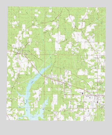
Semmes, AL USGS Topographic Map
Click on map above to begin viewing in our Map Viewer.

This topographic map contains these locations and features:
Feature Name Type Latitude Longitude GNIS ID View Map
Allentown CemeteryCemeteryN30.7610°W88.3022°143102View Map
Barton ChurchChurchN30.7919°W88.2936°143127View Map
Big Creek ChurchChurchN30.7946°W88.3122°143155View Map
Big Lake Heights ChurchChurchN30.7974°W88.3220°1729955View Map
Blackwell NurseryLocaleN30.7775°W88.2698°2579008View Map
Boggy BranchStreamN30.7710°W88.3506°114654View Map
Camellia ChurchChurchN30.7891°W88.2933°143184View Map
Chapel of Praise CemeteryCemeteryN30.8033°W88.2503°2579003View Map
Ching DairyLocaleN30.8422°W88.2864°2704564View Map
Church of Jesus ChristChurchN30.7632°W88.2770°143448View Map
Churchill DownsPopulated PlaceN30.7663°W88.2820°143245View Map
Collins CreekStreamN30.8124°W88.3183°116445View Map
Corner Stone ChurchChurchN30.8729°W88.3047°2579376View Map
Cornerstone Baptist ChurchChurchN30.7817°W88.2697°1730028View Map
Crooked CreekStreamN30.7507°W88.3375°116882View Map
FairviewPopulated PlaceN30.7932°W88.3014°143322View Map
Faith Baptist ChurchChurchN30.8665°W88.2959°2579375View Map
Faith ChurchChurchN30.8002°W88.3183°1729968View Map
First Baptist Church of WilmerChurchN30.8225°W88.3607°2579356View Map
First Pentecostal ChurchChurchN30.7999°W88.3023°1729969View Map
First United Pentecostal Church of FairviewChurchN30.7972°W88.3162°2579353View Map
Ford CemeteryCemeteryN30.8643°W88.3447°143345View Map
George Spring BranchStreamN30.8602°W88.2597°118903View Map
Grace Assembly of God ChurchChurchN30.7922°W88.3031°2579352View Map
Grimes FieldAirportN30.7646°W88.3041°2676351View Map
Gum BranchStreamN30.8463°W88.2989°119474View Map
Haven Woods Baptist ChurchChurchN30.8389°W88.2713°143947View Map
Havoc BranchStreamN30.7560°W88.3486°119859View Map
Holiness ChurchChurchN30.7619°W88.2931°120226View Map
Jackson BranchStreamN30.8580°W88.3347°120759View Map
Juniper CreekStreamN30.8210°W88.3200°121075View Map
Juniper Creek Mobile Home ParkPopulated PlaceN30.8557°W88.2885°2579859View Map
Keithley Mobile Home ParkPopulated PlaceN30.7636°W88.2788°2579841View Map
Long BranchStreamN30.8030°W88.3314°121980View Map
Lord ChurchChurchN30.7905°W88.2961°1729999View Map
LottPopulated PlaceN30.8113°W88.2514°143498View Map
Mary G Montgomery High School Airport (historical)AirportN30.7852°W88.2839°129381View Map
McCrary Road Baptist ChurchChurchN30.8044°W88.2605°2580525View Map
Mill BranchStreamN30.7657°W88.3500°122734View Map
Miller CemeteryCemeteryN30.8036°W88.2506°2579004View Map
MillertownPopulated PlaceN30.8210°W88.2583°143535View Map
Mobile County Health Department Semmes ClinicBuildingN30.7706°W88.2593°2579874View Map
Mobile County Sheriff's Office Bridges Northside SubstationBuildingN30.7854°W88.2815°2751809View Map
Montgomery High SchoolSchoolN30.7817°W88.2786°143560View Map
Morris CemeteryCemeteryN30.8557°W88.3437°2579377View Map
Myles Manor Trailer ParkPopulated PlaceN30.7707°W88.2523°2579001View Map
Nature's Way Mobile Home ParkPopulated PlaceN30.8275°W88.2585°2579843View Map
New Hope Missionary Baptist ChurchChurchN30.8224°W88.3523°2579354View Map
New Testament ChurchChurchN30.8499°W88.2811°1730010View Map
Peaceful Valley ChurchChurchN30.7969°W88.3603°143649View Map
Powell CemeteryCemeteryN30.8094°W88.2634°2579011View Map
River of Life MinistriesChurchN30.8080°W88.2590°143533View Map
Schoolhouse BranchStreamN30.8463°W88.3328°126464View Map
SemmesPopulated PlaceN30.7782°W88.2592°126546View Map
Semmes CemeteryCemeteryN30.7666°W88.2608°126547View Map
Semmes CemeteryCemeteryN30.7674°W88.2606°1730029View Map
Semmes ChurchChurchN30.7785°W88.2772°1730030View Map
Semmes Church of GodChurchN30.7705°W88.2605°154680View Map
Semmes Commercial ParkLocaleN30.7574°W88.2742°2579010View Map
Semmes DivisionCivilN30.8393°W88.3374°165895View Map
Semmes Elementary SchoolSchoolN30.7710°W88.2592°143790View Map
Semmes First Baptist ChurchChurchN30.7755°W88.2586°154681View Map
Semmes Lookout TowerTowerN30.7655°W88.2508°143791View Map
Semmes Mobile Home ParkPopulated PlaceN30.7805°W88.2548°2579007View Map
Semmes Post OfficePost OfficeN30.7781°W88.2561°2788950View Map
Semmes Post Office (historical)Post OfficeN30.7763°W88.2556°168277View Map
Semmes Volunteer Fire DepartmentBuildingN30.7690°W88.2599°2691258View Map
Semmes Volunteer Fire Department Station 2BuildingN30.8329°W88.2657°2691343View Map
Strait Way ChurchChurchN30.8588°W88.2795°143842View Map
Stringfellow CemeteryCemeteryN30.8552°W88.3456°127471View Map
Stringfellow ChurchChurchN30.8566°W88.3436°143843View Map
The Church of Jesus ChristChurchN30.8602°W88.2811°1730036View Map
Valmont Memorial ChurchChurchN30.8077°W88.2522°143905View Map
WarleyPopulated PlaceN30.8282°W88.3656°157217View Map
WilmerPopulated PlaceN30.8232°W88.3614°129064View Map
Wilmer CemeteryCemeteryN30.8305°W88.3672°143937View Map
Wilmer Elementary SchoolSchoolN30.8238°W88.3622°143939View Map
Wilmer Post OfficePost OfficeN30.8227°W88.3576°168275View Map
Wilmer United Methodist ChurchChurchN30.8255°W88.3608°2579355View Map
Wilmer Volunteer Fire DepartmentBuildingN30.8222°W88.3520°2330975View Map
Yonder Wood Mobile Home ParkPopulated PlaceN30.7854°W88.2608°2579002View Map

Note: Coordinates in the location and feature list above are referenced to NAD83 datum.


Copyright (C) 2008-2025 Ryan Niemi / Sunset Dynamics ... All Rights Reserved