TopoQuest Logo
Do you find TopoQuest useful?
Help keep TopoQuest running and adding new maps/features by donating!
Bitcoin:  19c7KJd3qBynnjoSw5npx9KScwjBe4ifkT
Litecoin:  LXs6TkuXGGXo1vDsWCkWVdjQX94eUKd6ui
Home View Maps Find Maps Find Places Resources & Links


Dunsmuir, California Topographic Map

USGS Map Title: Dunsmuir, CA
USGS Map MRC: 41122B3
DRG (GeoTIFF) Download: o41122b3.tif


Neighboring USGS Topographic Map Quads:


  Mount Eddy, CA  
41122C4
 

  City of Mount Shasta, CA  
41122C3
 

  McCloud, CA  
41122C2
 

  Seven Lakes Basin, CA  
41122B4
 

  Dunsmuir, CA  
41122B3
 

  Girard Ridge, CA  
41122B2
 

  Chicken Hawk Hill, CA  
41122A4
 

  Tombstone Mountain, CA  
41122A3
 

  Yellowjacket Mountain, CA  
41122A2


Map MRC Location:

N42°
W123°
N42°
W122°
H8 H7 H6 H5 H4 H3 H2 H1
G8 G7 G6 G5 G4 G3 G2 G1
F8 F7 F6 F5 F4 F3 F2 F1
E8 E7 E6 E5 E4 E3 E2 E1
D8 D7 D6 D5 D4 D3 D2 D1
C8 C7 C6 C5 C4 C3 C2 C1
B8 B7 B6 B5 B4 B3 B2 B1
A8 A7 A6 A5 A4 A3 A2 A1
N41°
W123°
N41°
W122°

Dunsmuir, CA USGS 1:24K Topographic Map Preview:
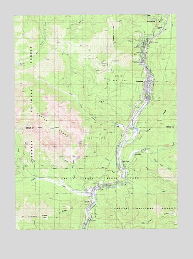
Dunsmuir, CA USGS Topographic Map
Click on map above to begin viewing in our Map Viewer.

This topographic map contains these locations and features:
Feature Name Type Latitude Longitude GNIS ID View Map
Assembly of God Church of DunsmuirChurchN41.2224°W122.2767°1985655View Map
Bear CreekStreamN41.2310°W122.2789°256638View Map
CastellaPopulated PlaceN41.1385°W122.3178°258050View Map
Castella Fire Protection DistrictBuildingN41.1429°W122.3166°2622215View Map
Castella Post OfficePost OfficeN41.1487°W122.3174°2783791View Map
Castle CragPopulated PlaceN41.1627°W122.2920°1655875View Map
Castle CragsCliffN41.1852°W122.3439°258052View Map
Castle Crags Post Office (historical)Post OfficeN41.1627°W122.2920°2026849View Map
Castle Crags State ParkParkN41.1710°W122.3517°258053View Map
Castle CreekStreamN41.1452°W122.3136°258054View Map
Castle Creek CampgroundLocaleN41.1540°W122.3697°258055View Map
Castle DomeSummitN41.1749°W122.3267°1661782View Map
Castle Lake TrailTrailN41.2238°W122.3528°258060View Map
Castle Rock Elementary SchoolSchoolN41.1428°W122.3167°258067View Map
Cave SpringsSpringN41.2276°W122.2764°1657560View Map
Church of ChristChurchN41.2315°W122.2717°1985658View Map
City of DunsmuirCivilN41.2316°W122.2715°2410372View Map
City of Dunsmuir Fire DepartmentBuildingN41.2096°W122.2725°2621861View Map
Crags TrailTrailN41.1618°W122.3220°1682474View Map
DirigoPopulated PlaceN41.1493°W122.3106°1655970View Map
DunsmuirPopulated PlaceN41.2082°W122.2720°277501View Map
Dunsmuir Branch Siskiyou County Public LibraryBuildingN41.2118°W122.2720°1701850View Map
Dunsmuir CemeteryCemeteryN41.2032°W122.2742°1985653View Map
Dunsmuir DivisionCivilN41.2261°W122.3272°1935078View Map
Dunsmuir Elementary SchoolSchoolN41.2271°W122.2739°1701851View Map
Dunsmuir High SchoolSchoolN41.2103°W122.2763°1701852View Map
Dunsmuir Post OfficePost OfficeN41.2134°W122.2714°1657562View Map
Fall CreekStreamN41.1527°W122.2895°260029View Map
Flume Creek RidgeRidgeN41.1315°W122.3695°260220View Map
Girard LookoutLocaleN41.1282°W122.2795°277039View Map
Hedge CreekStreamN41.2377°W122.2700°261224View Map
Indian CreekStreamN41.1471°W122.3236°261723View Map
Indian Creek TrailTrailN41.1510°W122.3275°1682496View Map
Indian SpringsSpringN41.1667°W122.3258°1661812View Map
Kettlebelly RidgeRidgeN41.1588°W122.3042°262156View Map
Little Castle CreekStreamN41.1843°W122.2845°262563View Map
Little Castle LakeLakeN41.2215°W122.3724°262564View Map
Mossbrae FallsFallsN41.2415°W122.2670°263880View Map
Mount BradleySummitN41.2215°W122.3092°257429View Map
North Fork Castle CreekStreamN41.1546°W122.3608°264146View Map
Popcorn SpringSpringN41.1751°W122.3686°1661852View Map
River TrailTrailN41.1510°W122.2983°1682512View Map
Riverwood Mobile Home EstatesPopulated PlaceN41.1875°W122.2825°2515993View Map
Root CreekStreamN41.1627°W122.2953°265563View Map
Root Creek TrailTrailN41.1652°W122.3131°1682513View Map
Saint Johns Catholic ChurchChurchN41.2124°W122.2725°1985659View Map
Shasta RetreatPopulated PlaceN41.2354°W122.2725°1656288View Map
Shasta SpringsPopulated PlaceN41.2468°W122.2611°266053View Map
Siskiyou County Sheriff's Office DunsmuirBuildingN41.2096°W122.2725°2751066View Map
Siskiyou Police DepartmentBuildingN41.2097°W122.2730°2751088View Map
SmallLocaleN41.2490°W122.2731°267263View Map
Soda CreekStreamN41.1593°W122.2920°267361View Map
Soda SpringSpringN41.1686°W122.2841°267372View Map
Soda SpringsSpringN41.1498°W122.3076°1682523View Map
South Soda CreekStreamN41.1715°W122.2742°267533View Map
Sulphur CreekStreamN41.1557°W122.3620°267891View Map
SweetbriarPopulated PlaceN41.1299°W122.3203°1656351View Map
Upper Soda SpringsSpringN41.2219°W122.2768°1657564View Map
Winton CanyonValleyN41.1590°W122.3311°269253View Map

Note: Coordinates in the location and feature list above are referenced to NAD83 datum.


Copyright (C) 2008-2024 Ryan Niemi / Sunset Dynamics ... All Rights Reserved