TopoQuest Logo
Do you find TopoQuest useful?
Help keep TopoQuest running and adding new maps/features by donating!
Bitcoin:  19c7KJd3qBynnjoSw5npx9KScwjBe4ifkT
Litecoin:  LXs6TkuXGGXo1vDsWCkWVdjQX94eUKd6ui
Home View Maps Find Maps Find Places Resources & Links


Chicken Hawk Hill, California Topographic Map

USGS Map Title: Chicken Hawk Hill, CA
USGS Map MRC: 41122A4
DRG (GeoTIFF) Download: o41122a4.tif


Neighboring USGS Topographic Map Quads:


  Mumbo Basin, CA  
41122B5
 

  Seven Lakes Basin, CA  
41122B4
 

  Dunsmuir, CA  
41122B3
 

  Whisky Bill Peak, CA  
41122A5
 

  Chicken Hawk Hill, CA  
41122A4
 

  Tombstone Mountain, CA  
41122A3
 

  Damnation Peak, CA  
40122H5
 

  Lamoine, CA  
40122H4
 

  Hanland Peak, CA  
40122H3


Map MRC Location:

N42°
W123°
N42°
W122°
H8 H7 H6 H5 H4 H3 H2 H1
G8 G7 G6 G5 G4 G3 G2 G1
F8 F7 F6 F5 F4 F3 F2 F1
E8 E7 E6 E5 E4 E3 E2 E1
D8 D7 D6 D5 D4 D3 D2 D1
C8 C7 C6 C5 C4 C3 C2 C1
B8 B7 B6 B5 B4 B3 B2 B1
A8 A7 A6 A5 A4 A3 A2 A1
N41°
W123°
N41°
W122°

Chicken Hawk Hill, CA USGS 1:24K Topographic Map Preview:
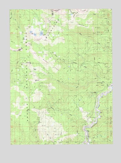
Chicken Hawk Hill, CA USGS Topographic Map
Click on map above to begin viewing in our Map Viewer.

This topographic map contains these locations and features:
Feature Name Type Latitude Longitude GNIS ID View Map
Baker HollowBasinN41.0988°W122.4845°266404View Map
Boulder CreekStreamN41.0160°W122.4058°257376View Map
Chicken Hawk HillSummitN41.0751°W122.4750°258268View Map
Cold SpringSpringN41.0310°W122.4770°258548View Map
FisherPopulated PlaceN41.0363°W122.3933°1656018View Map
GibsonPopulated PlaceN41.0118°W122.4089°1656044View Map
Grey Rock LakeLakeN41.1201°W122.4254°260889View Map
Mears RidgeRidgeN41.1065°W122.3925°263432View Map
Middle RidgeRidgeN41.0924°W122.4775°274733View Map
North Fork Shotgun CreekStreamN41.0585°W122.3906°264210View Map
Rattlesnake HillSummitN41.0599°W122.4717°265215View Map
Sardine SpringSpringN41.0698°W122.4723°265847View Map
Shiloah Mineral SpringsSpringN41.0459°W122.3911°266119View Map
Shotgun CreekStreamN41.0524°W122.3767°266140View Map
Slate Ridge TrailTrailN41.0301°W122.4736°266278View Map
Smith CreekStreamN41.1190°W122.4986°233326View Map
South Fork Shotgun CreekStreamN41.0585°W122.3906°267503View Map
Stuckeys PlaceLocaleN41.1018°W122.3789°277009View Map
Tamarack LakeLakeN41.1024°W122.4626°268082View Map
Twin LakesLakeN41.1015°W122.4704°268532View Map

Note: Coordinates in the location and feature list above are referenced to NAD83 datum.


Copyright (C) 2008-2024 Ryan Niemi / Sunset Dynamics ... All Rights Reserved