TopoQuest Logo
Do you find TopoQuest useful?
Help keep TopoQuest running and adding new maps/features by donating!
Bitcoin:  19c7KJd3qBynnjoSw5npx9KScwjBe4ifkT
Litecoin:  LXs6TkuXGGXo1vDsWCkWVdjQX94eUKd6ui
Home View Maps Find Maps Find Places Resources & Links


Buckhorn, New Mexico Topographic Map

USGS Map Title: Buckhorn, NM
USGS Map MRC: 33108A6
DRG (GeoTIFF) Download: o33108a6.tif


Neighboring USGS Topographic Map Quads:


  Moon Ranch, NM  
33108B7
 

  Rice Ranch, NM  
33108B6
 

  Shelley Peak, NM  
33108B5
 

  Bear Mountain, NM  
33108A7
 

  Buckhorn, NM  
33108A6
 

  Canteen Canyon, NM  
33108A5
 

  Applegate Mountain, NM  
32108H7
 

  Antelope Ridge, NM  
32108H6
 

  Cliff, NM  
32108H5


Map MRC Location:

N34°
W109°
N34°
W108°
H8 H7 H6 H5 H4 H3 H2 H1
G8 G7 G6 G5 G4 G3 G2 G1
F8 F7 F6 F5 F4 F3 F2 F1
E8 E7 E6 E5 E4 E3 E2 E1
D8 D7 D6 D5 D4 D3 D2 D1
C8 C7 C6 C5 C4 C3 C2 C1
B8 B7 B6 B5 B4 B3 B2 B1
A8 A7 A6 A5 A4 A3 A2 A1
N33°
W109°
N33°
W108°

Buckhorn, NM USGS 1:24K Topographic Map Preview:
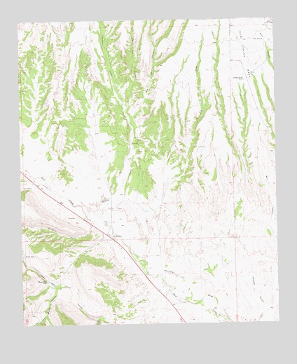
Buckhorn, NM USGS Topographic Map
Click on map above to begin viewing in our Map Viewer.

This topographic map contains these locations and features:
Feature Name Type Latitude Longitude GNIS ID View Map
10000 Water WellWellN33.0412°W108.7017°919560View Map
10008 Water WellWellN33.0109°W108.6678°919559View Map
Big Pat CanyonValleyN33.0828°W108.6962°903802View Map
Brown CanyonValleyN33.0151°W108.7339°904098View Map
BuckhornPopulated PlaceN33.0370°W108.7084°904146View Map
Buckhorn Census Designated PlaceCensusN33.0315°W108.6944°2584061View Map
Buckhorn CreekStreamN33.0417°W108.7109°904149View Map
Buckhorn Post OfficePost OfficeN33.0344°W108.7052°2781525View Map
Buckhorn Store Water WellWellN33.0345°W108.7398°918817View Map
Buckhorn Weather StationLocaleN33.0370°W108.7084°931667View Map
Fivemile CreekStreamN33.0559°W108.7359°906291View Map
Foster CanyonValleyN33.0017°W108.7137°906341View Map
George Clark TankReservoirN33.1001°W108.6406°906518View Map
Gliff Gila Volunteer Fire Department Buck 1 Station 2BuildingN33.0288°W108.6979°2658226View Map
Hells HoleValleyN33.0042°W108.7389°906919View Map
Horse LakeLakeN33.0288°W108.7493°912750View Map
Horse Lake TankReservoirN33.0181°W108.7382°907098View Map
Little Pat CanyonValleyN33.0881°W108.6989°908039View Map
Mud SpringSpringN33.1164°W108.6309°908942View Map
Mud Spring MesaBenchN33.1081°W108.6395°908952View Map
Sacaton CreekStreamN33.0409°W108.7078°910500View Map
StevensonLocaleN33.0790°W108.6926°929290View Map
The DikeLeveeN33.0198°W108.6737°911630View Map

Note: Coordinates in the location and feature list above are referenced to NAD83 datum.


Copyright (C) 2008-2024 Ryan Niemi / Sunset Dynamics ... All Rights Reserved