TopoQuest Logo
Do you find TopoQuest useful?
Help keep TopoQuest running and adding new maps/features by donating!
Bitcoin:  19c7KJd3qBynnjoSw5npx9KScwjBe4ifkT
Litecoin:  LXs6TkuXGGXo1vDsWCkWVdjQX94eUKd6ui
Home View Maps Find Maps Find Places Resources & Links


Shennington, Wisconsin Topographic Map

USGS Map Title: Shennington, WI
USGS Map MRC: 44090A3
DRG (GeoTIFF) Download: o44090a3.tif


Neighboring USGS Topographic Map Quads:


  Warrens East, WI  
44090B4
 

  Mather, WI  
44090B3
 

  Finley, WI  
44090B2
 

  Wyeville, WI  
44090A4
 

  Shennington, WI  
44090A3
 

  Cutler, WI  
44090A2
 

  Oakdale, WI  
43090H4
 

  Camp Douglas, WI  
43090H3
 

  New Lisbon North, WI  
43090H2


Map MRC Location:

N45°
W91°
N45°
W90°
H8 H7 H6 H5 H4 H3 H2 H1
G8 G7 G6 G5 G4 G3 G2 G1
F8 F7 F6 F5 F4 F3 F2 F1
E8 E7 E6 E5 E4 E3 E2 E1
D8 D7 D6 D5 D4 D3 D2 D1
C8 C7 C6 C5 C4 C3 C2 C1
B8 B7 B6 B5 B4 B3 B2 B1
A8 A7 A6 A5 A4 A3 A2 A1
N44°
W91°
N44°
W90°

Shennington, WI USGS 1:24K Topographic Map Preview:
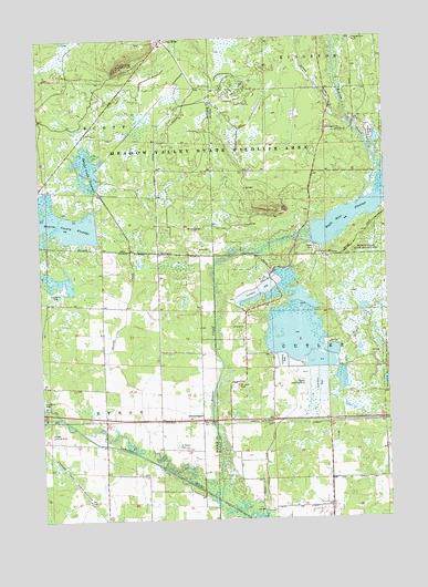
Shennington, WI USGS Topographic Map
Click on map above to begin viewing in our Map Viewer.

This topographic map contains these locations and features:
Feature Name Type Latitude Longitude GNIS ID View Map
2 ReservoirReservoirN44.0620°W90.3682°1792709View Map
5 ReservoirReservoirN44.1116°W90.2735°1792686View Map
Adventist ChurchChurchN44.0500°W90.3018°1834281View Map
Beaver CreekStreamN44.0047°W90.3115°1561445View Map
Beaver Creek 2 DamDamN44.1116°W90.2735°1792685View Map
Campground Number FourLocaleN44.1244°W90.2607°1562693View Map
Cutler DitchCanalN44.0291°W90.2671°1563646View Map
Cutler Volunteer Fire CompanyBuildingN44.0370°W90.2910°2697938View Map
Dandy CreekStreamN44.0158°W90.3374°1563695View Map
Dandy Creek 6 C6118d6 DamDamN44.0733°W90.3718°1792706View Map
Dandy Creek 9 C6118-D9 DamDamN44.0583°W90.3735°1792708View Map
Dandy Creek FlowageReservoirN44.0876°W90.3571°1563696View Map
Eagle Nest FlowageReservoirN44.0782°W90.2635°1564254View Map
East Fork Lemonweir RiverStreamN44.0269°W90.3685°1564324View Map
Holiday Landing Strip (historical)AirportN44.0216°W90.3724°1846221View Map
Mayflower School (historical)SchoolN44.0266°W90.3529°1846242View Map
Monroe County FlowageReservoirN44.0771°W90.3701°1569660View Map
Mud DitchCanalN44.0200°W90.2929°1569899View Map
Norway RidgePopulated PlaceN44.1247°W90.3293°1570548View Map
Norway Ridge Lookout TowerTowerN44.1180°W90.3451°1581298View Map
Potter Landing Strip (historical)AirportN44.0350°W90.2804°1834330View Map
Potters Reservoir 2WP 188 DamDamN44.0726°W90.2768°1792677View Map
Saint Johns CemeteryCemeteryN44.0347°W90.3048°1573047View Map
Saint Peters CemeteryCemeteryN44.0191°W90.3268°1573520View Map
ShenningtonPopulated PlaceN44.0258°W90.3176°1574009View Map
Silver CreekStreamN44.1036°W90.2635°1574113View Map
South Fork Lemonweir RiverStreamN44.0269°W90.3685°1574448View Map
Town of ByronCivilN44.0277°W90.3735°1582897View Map
Town of CutlerCivilN44.0463°W90.2520°1583040View Map
Town of ScottCivilN44.1146°W90.3740°1584118View Map

Note: Coordinates in the location and feature list above are referenced to NAD83 datum.


Copyright (C) 2008-2024 Ryan Niemi / Sunset Dynamics ... All Rights Reserved