TopoQuest Logo
Do you find TopoQuest useful?
Help keep TopoQuest running and adding new maps/features by donating!
Bitcoin:  19c7KJd3qBynnjoSw5npx9KScwjBe4ifkT
Litecoin:  LXs6TkuXGGXo1vDsWCkWVdjQX94eUKd6ui
Home View Maps Find Maps Find Places Resources & Links


Oakdale, Wisconsin Topographic Map

USGS Map Title: Oakdale, WI
USGS Map MRC: 43090H4
DRG (GeoTIFF) Download: o43090h4.tif


Neighboring USGS Topographic Map Quads:


  Tunnel City, WI  
44090A5
 

  Wyeville, WI  
44090A4
 

  Shennington, WI  
44090A3
 

  Tomah, WI  
43090H5
 

  Oakdale, WI  
43090H4
 

  Camp Douglas, WI  
43090H3
 

  Wilton, WI  
43090G5
 

  Kendall West, WI  
43090G4
 

  Kendall East, WI  
43090G3


Map MRC Location:

N44°
W91°
N44°
W90°
H8 H7 H6 H5 H4 H3 H2 H1
G8 G7 G6 G5 G4 G3 G2 G1
F8 F7 F6 F5 F4 F3 F2 F1
E8 E7 E6 E5 E4 E3 E2 E1
D8 D7 D6 D5 D4 D3 D2 D1
C8 C7 C6 C5 C4 C3 C2 C1
B8 B7 B6 B5 B4 B3 B2 B1
A8 A7 A6 A5 A4 A3 A2 A1
N43°
W91°
N43°
W90°

Oakdale, WI USGS 1:24K Topographic Map Preview:
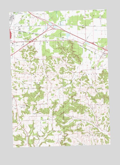
Oakdale, WI USGS Topographic Map
Click on map above to begin viewing in our Map Viewer.

This topographic map contains these locations and features:
Feature Name Type Latitude Longitude GNIS ID View Map
Bear Creek SchoolSchoolN43.9289°W90.4499°1561372View Map
Bloyer FieldAirportN43.9732°W90.4853°1582240View Map
Camels HumpSummitN43.9747°W90.4774°1562567View Map
City of TomahCivilN43.9883°W90.4997°1584282View Map
Council CreekStreamN43.9989°W90.4757°1563441View Map
Council Creek SchoolSchoolN43.9230°W90.4990°1563442View Map
Council Creek SpringSpringN43.9121°W90.4892°1563443View Map
Deer CreekStreamN43.9969°W90.4985°1563823View Map
Fireman ParkParkN43.9777°W90.4968°1846209View Map
Gerke QuarryMineN43.9075°W90.4356°2633160View Map
Glendale Ball ParkParkN43.9880°W90.4993°1846215View Map
Hill SchoolSchoolN43.9555°W90.4599°1566422View Map
Indian CreekStreamN43.9805°W90.3890°1566906View Map
Indian RidgeRidgeN43.9186°W90.3846°1566931View Map
Kingdom HallChurchN43.9111°W90.4946°1846227View Map
Lemonweir Elementary SchoolSchoolN43.9941°W90.4945°1846237View Map
Mound View SchoolSchoolN43.9994°W90.4049°1569798View Map
OakdalePopulated PlaceN43.9597°W90.3818°1570692View Map
Oakdale Area Fire Association Oakdale StationBuildingN43.9586°W90.3787°2697479View Map
Oakdale CemeteryCemeteryN43.9458°W90.3940°1570693View Map
Oakdale Elementary SchoolSchoolN43.9583°W90.3805°1846256View Map
Robert Kupper Learning CenterSchoolN43.9870°W90.4824°2715755View Map
Saint Michael ChurchChurchN43.9089°W90.3979°1573369View Map
Saint Peter ChurchChurchN43.8927°W90.3932°1573507View Map
Stone BluffCliffN43.9839°W90.4071°1574915View Map
Sunny Ridge SchoolSchoolN43.9000°W90.4557°1575090View Map
Tomah Industrial ParkLocaleN43.9847°W90.4860°1846307View Map
Town of TomahCivilN43.9387°W90.4924°1584283View Map
Veterans ParkParkN43.9983°W90.4974°1846316View Map
Village of OakdaleCivilN43.9619°W90.3789°1583836View Map
Western Wisconsin Technical College - Tomah CenterSchoolN43.9872°W90.4849°1846322View Map
WRTL-FM (Tomah)TowerN43.8989°W90.4899°1582473View Map

Note: Coordinates in the location and feature list above are referenced to NAD83 datum.


Copyright (C) 2008-2025 Ryan Niemi / Sunset Dynamics ... All Rights Reserved