TopoQuest Logo
Do you find TopoQuest useful?
Help keep TopoQuest running and adding new maps/features by donating!
Bitcoin:  19c7KJd3qBynnjoSw5npx9KScwjBe4ifkT
Litecoin:  LXs6TkuXGGXo1vDsWCkWVdjQX94eUKd6ui
Home View Maps Find Maps Find Places Resources & Links


Shumway, Illinois Topographic Map

USGS Map Title: Shumway, IL
USGS Map MRC: 39088B6
DRG (GeoTIFF) Download: o39088b6.tif


Neighboring USGS Topographic Map Quads:


  Fancher, IL  
39088C7
 

  Stewardson West, IL  
39088C6
 

  Stewardson East, IL  
39088C5
 

  Beecher City, IL  
39088B7
 

  Shumway, IL  
39088B6
 

  Effingham North, IL  
39088B5
 

  Altamont West, IL  
39088A7
 

  Altamont East, IL  
39088A6
 

  Effingham South, IL  
39088A5


Map MRC Location:

N40°
W89°
N40°
W88°
H8 H7 H6 H5 H4 H3 H2 H1
G8 G7 G6 G5 G4 G3 G2 G1
F8 F7 F6 F5 F4 F3 F2 F1
E8 E7 E6 E5 E4 E3 E2 E1
D8 D7 D6 D5 D4 D3 D2 D1
C8 C7 C6 C5 C4 C3 C2 C1
B8 B7 B6 B5 B4 B3 B2 B1
A8 A7 A6 A5 A4 A3 A2 A1
N39°
W89°
N39°
W88°

Shumway, IL USGS 1:24K Topographic Map Preview:
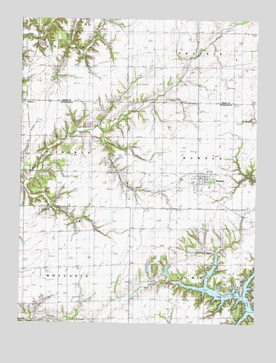
Shumway, IL USGS Topographic Map
Click on map above to begin viewing in our Map Viewer.

This topographic map contains these locations and features:
Feature Name Type Latitude Longitude GNIS ID View Map
Agney CemeteryCemeteryN39.2074°W88.7078°403366View Map
Blue Point Baptist CemeteryCemeteryN39.1487°W88.6512°1810473View Map
Blue Point School (historical)SchoolN39.1459°W88.6509°404603View Map
Brown CemeteryCemeteryN39.1422°W88.6324°1810477View Map
Brush Creek Post Office (historical)Post OfficeN39.2306°W88.7123°1821157View Map
Giles CemeteryCemeteryN39.2323°W88.7453°409010View Map
HollandPopulated PlaceN39.2159°W88.7489°422814View Map
Kyle School (historical)SchoolN39.1623°W88.7101°411630View Map
Lake SaraReservoirN39.1366°W88.6362°422281View Map
Laue FarmsLocaleN39.1339°W88.6908°2705985View Map
Morris CreekStreamN39.2059°W88.7092°413841View Map
Saint Marys CemeteryCemeteryN39.1784°W88.6559°417557View Map
ShumwayPopulated PlaceN39.1850°W88.6523°418483View Map
Shumway CemeteryCemeteryN39.1863°W88.6554°1810544View Map
Shumway Grade SchoolSchoolN39.1823°W88.6564°1810545View Map
Shumway International AirportAirportN39.1912°W88.6714°2717153View Map
Shumway Post OfficePost OfficeN39.1849°W88.6522°2788220View Map
Township of BannerCivilN39.1940°W88.6378°428632View Map
Township of HollandCivilN39.2486°W88.7500°429140View Map
Township of LibertyCivilN39.1942°W88.7496°429254View Map
Township of MoccasinCivilN39.1305°W88.7490°429378View Map
Township of SummitCivilN39.1317°W88.6341°429814View Map
Trinity Lutheran CemeteryCemeteryN39.2009°W88.6557°1810550View Map
Van Treese ChurchChurchN39.1637°W88.6509°420220View Map
Village of ShumwayCivilN39.1834°W88.6532°2399816View Map
Wachtel FarmsLocaleN39.1467°W88.7192°2705516View Map
Wendte FarmsLocaleN39.1611°W88.7192°2705513View Map
White Chapel (historical)ChurchN39.1945°W88.7114°421027View Map
Wolf Creek CemeteryCemeteryN39.2303°W88.6761°421383View Map

Note: Coordinates in the location and feature list above are referenced to NAD83 datum.


Copyright (C) 2008-2025 Ryan Niemi / Sunset Dynamics ... All Rights Reserved