TopoQuest Logo
Do you find TopoQuest useful?
Help keep TopoQuest running and adding new maps/features by donating!
Bitcoin:  19c7KJd3qBynnjoSw5npx9KScwjBe4ifkT
Litecoin:  LXs6TkuXGGXo1vDsWCkWVdjQX94eUKd6ui
Home View Maps Find Maps Find Places Resources & Links


Effingham North, Illinois Topographic Map

USGS Map Title: Effingham North, IL
USGS Map MRC: 39088B5
DRG (GeoTIFF) Download: o39088b5.tif


Neighboring USGS Topographic Map Quads:


  Stewardson West, IL  
39088C6
 

  Stewardson East, IL  
39088C5
 

  Neoga, IL  
39088C4
 

  Shumway, IL  
39088B6
 

  Effingham North, IL  
39088B5
 

  Teutopolis, IL  
39088B4
 

  Altamont East, IL  
39088A6
 

  Effingham South, IL  
39088A5
 

  Dieterich, IL  
39088A4


Map MRC Location:

N40°
W89°
N40°
W88°
H8 H7 H6 H5 H4 H3 H2 H1
G8 G7 G6 G5 G4 G3 G2 G1
F8 F7 F6 F5 F4 F3 F2 F1
E8 E7 E6 E5 E4 E3 E2 E1
D8 D7 D6 D5 D4 D3 D2 D1
C8 C7 C6 C5 C4 C3 C2 C1
B8 B7 B6 B5 B4 B3 B2 B1
A8 A7 A6 A5 A4 A3 A2 A1
N39°
W89°
N39°
W88°

Effingham North, IL USGS 1:24K Topographic Map Preview:
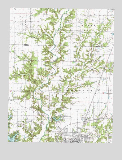
Effingham North, IL USGS Topographic Map
Click on map above to begin viewing in our Map Viewer.

This topographic map contains these locations and features:
Feature Name Type Latitude Longitude GNIS ID View Map
Banner School (historical)SchoolN39.1945°W88.6076°403876View Map
East Branch Green CreekStreamN39.1917°W88.5359°407606View Map
Ebenezer ChurchChurchN39.1648°W88.6106°407740View Map
Effingham City CemeteryCemeteryN39.1256°W88.5292°1810488View Map
Effingham Veterinary ClinicBuildingN39.1258°W88.5572°2705280View Map
Flat School (historical)SchoolN39.1934°W88.5634°408446View Map
Green CreekPopulated PlaceN39.2028°W88.5234°409377View Map
Green CreekStreamN39.1475°W88.5762°409379View Map
Green Creek CemeteryCemeteryN39.2017°W88.5259°1810502View Map
Green Creek Grade SchoolSchoolN39.2025°W88.5239°1810503View Map
Greuel Dairy FarmLocaleN39.2139°W88.5319°2680762View Map
Henry CreekStreamN39.1981°W88.5342°410070View Map
Henry FarmsLocaleN39.1744°W88.5028°2705281View Map
Hog CreekStreamN39.2409°W88.5628°410350View Map
Interchange 160CrossingN39.1348°W88.5628°1810515View Map
Interchange 162CrossingN39.1453°W88.5312°1810516View Map
Interchange 163CrossingN39.1503°W88.5081°1810517View Map
Lake PaulineReservoirN39.1457°W88.5666°1692186View Map
Lake Sara DamDamN39.1250°W88.6167°1691732View Map
Latch FarmsLocaleN39.1556°W88.6156°2705285View Map
Milton BranchStreamN39.1273°W88.5851°413633View Map
Mound CemeteryCemeteryN39.2364°W88.6096°1821184View Map
Mound School (historical)SchoolN39.2367°W88.6103°413916View Map
North Fork Shoal CreekStreamN39.1867°W88.6001°414609View Map
North School (historical)SchoolN39.1489°W88.5420°414660View Map
Pauline Lake DamDamN39.1467°W88.5717°1692185View Map
Ramsey CemeteryCemeteryN39.2051°W88.5794°1810530View Map
Ramsey Chapel (historical)ChurchN39.2045°W88.5748°416368View Map
Rattlesnake CreekStreamN39.2228°W88.5731°416402View Map
Rentfrow CemeteryCemeteryN39.1730°W88.6097°416539View Map
Saint Anthony Catholic CemeteryCemeteryN39.1312°W88.5428°1810533View Map
Saint Anthony's Memorial HospitalHospitalN39.1254°W88.5504°1810534View Map
Saint Anthonys Roman Catholic ChurchChurchN39.1253°W88.5412°1810535View Map
Shoal CreekStreamN39.1759°W88.5876°418444View Map
Shumway Fire Protection DistrictBuildingN39.1343°W88.6119°2682573View Map
Sporleder FarmsLocaleN39.1619°W88.6144°2705284View Map
Sugar ForkStreamN39.1767°W88.5539°419298View Map
Tebbe FarmsLocaleN39.1831°W88.5231°2705326View Map
Township of DouglasCivilN39.1643°W88.5374°428906View Map
Township of SigelCivilN39.2442°W88.5264°429752View Map

Note: Coordinates in the location and feature list above are referenced to NAD83 datum.


Copyright (C) 2008-2024 Ryan Niemi / Sunset Dynamics ... All Rights Reserved