TopoQuest Logo
Do you find TopoQuest useful?
Help keep TopoQuest running and adding new maps/features by donating!
Bitcoin:  19c7KJd3qBynnjoSw5npx9KScwjBe4ifkT
Litecoin:  LXs6TkuXGGXo1vDsWCkWVdjQX94eUKd6ui
Home View Maps Find Maps Find Places Resources & Links


Broadway, Virginia Topographic Map

USGS Map Title: Broadway, VA
USGS Map MRC: 38078E7
DRG (GeoTIFF) Download: o38078e7.tif


Neighboring USGS Topographic Map Quads:


  Fulks Run, VA  
38078F8
 

  Timberville, VA  
38078F7
 

  New Market, VA  
38078F6
 

  Singers Glen, VA  
38078E8
 

  Broadway, VA  
38078E7
 

  Tenth Legion, VA  
38078E6
 

  Bridgewater, VA  
38078D8
 

  Harrisonburg, VA  
38078D7
 

  Elkton West, VA  
38078D6


Map MRC Location:

N39°
W79°
N39°
W78°
H8 H7 H6 H5 H4 H3 H2 H1
G8 G7 G6 G5 G4 G3 G2 G1
F8 F7 F6 F5 F4 F3 F2 F1
E8 E7 E6 E5 E4 E3 E2 E1
D8 D7 D6 D5 D4 D3 D2 D1
C8 C7 C6 C5 C4 C3 C2 C1
B8 B7 B6 B5 B4 B3 B2 B1
A8 A7 A6 A5 A4 A3 A2 A1
N38°
W79°
N38°
W78°

Broadway, VA USGS 1:24K Topographic Map Preview:
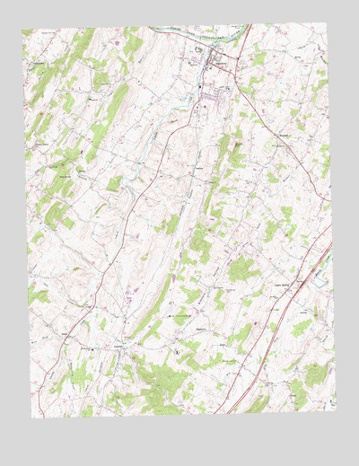
Broadway, VA USGS Topographic Map
Click on map above to begin viewing in our Map Viewer.

This topographic map contains these locations and features:
Feature Name Type Latitude Longitude GNIS ID View Map
Bethel ChurchChurchN38.5854°W78.7714°1463203View Map
BroadwayPopulated PlaceN38.6132°W78.7989°1492636View Map
Broadway Emergency SquadBuildingN38.6018°W78.8015°2085990View Map
Broadway High SchoolSchoolN38.6057°W78.7944°1779312View Map
Broadway Municipal BuildingBuildingN38.6129°W78.7989°1779313View Map
Broadway Police DepartmentBuildingN38.6126°W78.7982°2766938View Map
Broadway Post OfficePost OfficeN38.6143°W78.7975°1779314View Map
Broadway Volunteer Fire CompanyBuildingN38.6134°W78.7978°2086020View Map
Brock CreekStreamN38.6146°W78.8639°1482023View Map
Buttermilk CreekStreamN38.5223°W78.8606°1482187View Map
Cedar RunStreamN38.6237°W78.8192°1464646View Map
Cedar Run ChurchChurchN38.6062°W78.8389°1464652View Map
Cherry GrovePopulated PlaceN38.5868°W78.8714°1492748View Map
DaphnaPopulated PlaceN38.5798°W78.8050°1492838View Map
Daphna CreekStreamN38.6040°W78.8034°1465600View Map
Dry ForkStreamN38.5387°W78.7581°1483118View Map
EdomPopulated PlaceN38.5257°W78.8589°1492900View Map
Fellowship ChurchChurchN38.5087°W78.7784°1466525View Map
Harrisonburg Men's Diversion CenterBuildingN38.5319°W78.8171°2767099View Map
HightownPopulated PlaceN38.5265°W78.8039°1493086View Map
J Frank Hillyard Middle SchoolSchoolN38.6173°W78.8023°2497757View Map
Joes CreekStreamN38.5421°W78.8481°1484456View Map
John C Myers Elementary SchoolSchoolN38.6130°W78.8062°1471298View Map
Lacey SpringPopulated PlaceN38.5412°W78.7664°1493172View Map
Lacey Spring Elementary SchoolSchoolN38.5414°W78.7724°2497745View Map
Lacey Spring Post OfficePost OfficeN38.5439°W78.7645°2766233View Map
Lindale ChurchChurchN38.5357°W78.8486°1469440View Map
LinvillePopulated PlaceN38.5204°W78.8375°1493204View Map
Linville - Edom Elementary SchoolSchoolN38.5217°W78.8488°1469450View Map
Linville CreekStreamN38.6196°W78.7936°1484860View Map
Linville Creek BridgeBridgeN38.6032°W78.8056°1779330View Map
Linville Creek ChurchChurchN38.6043°W78.7903°1469449View Map
Linville Post OfficePost OfficeN38.5232°W78.8513°2766383View Map
Linville-Edom AirportAirportN38.5485°W78.8725°2675601View Map
MaylandPopulated PlaceN38.5885°W78.7711°1493260View Map
Melrose CavernsLocaleN38.5171°W78.7900°1470350View Map
Mount Tabor ChurchChurchN38.5368°W78.7725°1471083View Map
Mountain RunStreamN38.5048°W78.7509°1485685View Map
Pine Grove CemeteryCemeteryN38.5396°W78.7936°1472342View Map
Pine Grove ChurchChurchN38.5412°W78.7984°1472350View Map
Pleasant View ChurchChurchN38.6237°W78.8611°1472521View Map
Round HillSummitN38.5862°W78.7886°1473574View Map
Simmers HollowValleyN38.5538°W78.7876°1474605View Map
State Prison Camp Number 8LocaleN38.5318°W78.8172°1491272View Map
Tide SpringSpringN38.5773°W78.8556°1475705View Map
Tide Spring BranchStreamN38.5748°W78.8353°1487910View Map
Town of BroadwayCivilN38.6083°W78.8016°2390753View Map
Trissel ChurchChurchN38.6021°W78.8475°1475885View Map
TurleytownPopulated PlaceN38.6140°W78.8711°1493724View Map
WBTX-AM (Broadway-Timberville)TowerN38.6235°W78.8142°1498923View Map
West Fork Linville CreekStreamN38.5235°W78.8592°1488254View Map
ZendaPopulated PlaceN38.5054°W78.7689°1493568View Map
Zion ChurchChurchN38.5743°W78.7995°1474403View Map

Note: Coordinates in the location and feature list above are referenced to NAD83 datum.


Copyright (C) 2008-2024 Ryan Niemi / Sunset Dynamics ... All Rights Reserved