TopoQuest Logo
Do you find TopoQuest useful?
Help keep TopoQuest running and adding new maps/features by donating!
Bitcoin:  19c7KJd3qBynnjoSw5npx9KScwjBe4ifkT
Litecoin:  LXs6TkuXGGXo1vDsWCkWVdjQX94eUKd6ui
Home View Maps Find Maps Find Places Resources & Links


Sisterdale, Texas Topographic Map

USGS Map Title: Sisterdale, TX
USGS Map MRC: 29098H6
DRG (GeoTIFF) Download: o29098h6.tif


Neighboring USGS Topographic Map Quads:


  Rafter Hollow, TX  
30098A7
 

  Whitworth Ranch, TX  
30098A6
 

  Crabapple Creek, TX  
30098A5
 

  Waring, TX  
29098H7
 

  Sisterdale, TX  
29098H6
 

  Kendalia, TX  
29098H5
 

  Ranger Creek, TX  
29098G7
 

  Boerne, TX  
29098G6
 

  Bergheim, TX  
29098G5


Map MRC Location:

N30°
W99°
N30°
W98°
H8 H7 H6 H5 H4 H3 H2 H1
G8 G7 G6 G5 G4 G3 G2 G1
F8 F7 F6 F5 F4 F3 F2 F1
E8 E7 E6 E5 E4 E3 E2 E1
D8 D7 D6 D5 D4 D3 D2 D1
C8 C7 C6 C5 C4 C3 C2 C1
B8 B7 B6 B5 B4 B3 B2 B1
A8 A7 A6 A5 A4 A3 A2 A1
N29°
W99°
N29°
W98°

Sisterdale, TX USGS 1:24K Topographic Map Preview:
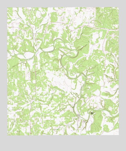
Sisterdale, TX USGS Topographic Map
Click on map above to begin viewing in our Map Viewer.

This topographic map contains these locations and features:
Feature Name Type Latitude Longitude GNIS ID View Map
Ammans CrossingPopulated PlaceN29.8949°W98.6711°1377935View Map
B. J. Mc Combs Sisterdale AirportAirportN29.9717°W98.7414°1386407View Map
Baptist ChurchChurchN29.8811°W98.7253°2039975View Map
Bear CreekStreamN29.9027°W98.6753°1330206View Map
Camp AlzafarLocaleN29.8966°W98.6553°1331938View Map
Darmstadt CreekStreamN29.9869°W98.7320°1334050View Map
East Sister CreekStreamN29.9624°W98.7203°1334996View Map
Elm HollowValleyN29.9288°W98.6269°1335390View Map
Guadalupe River RanchLocaleN29.8888°W98.6645°1336653View Map
Jacobs CreekStreamN29.9655°W98.6767°1338611View Map
Kendall CountyCivilN29.9447°W98.7116°1383915View Map
Sabinas CreekStreamN29.8944°W98.6711°1375873View Map
Sister CreekStreamN29.9572°W98.7170°1347178View Map
SisterdalePopulated PlaceN29.9730°W98.7209°1347179View Map
Sisterdale Community CenterBuildingN29.9999°W98.7253°2039976View Map
Sisterdale Post Office (historical)Post OfficeN29.9752°W98.7214°2039977View Map
Sisterdale Volunteer Fire DepartmentBuildingN29.9762°W98.7212°2039978View Map
Spicewood CanyonValleyN29.9571°W98.6711°1347652View Map
Violet CreekStreamN29.9494°W98.7289°1349303View Map
Wasp CreekStreamN29.9110°W98.6692°1376655View Map
Werner CemeteryCemeteryN29.9841°W98.6804°2499038View Map
Werner CreekStreamN29.9585°W98.6770°1329146View Map
West Sister CreekStreamN29.9624°W98.7203°1349810View Map

Note: Coordinates in the location and feature list above are referenced to NAD83 datum.


Copyright (C) 2008-2025 Ryan Niemi / Sunset Dynamics ... All Rights Reserved