TopoQuest Logo
Do you find TopoQuest useful?
Help keep TopoQuest running and adding new maps/features by donating!
Bitcoin:  19c7KJd3qBynnjoSw5npx9KScwjBe4ifkT
Litecoin:  LXs6TkuXGGXo1vDsWCkWVdjQX94eUKd6ui
Home View Maps Find Maps Find Places Resources & Links


Waring, Texas Topographic Map

USGS Map Title: Waring, TX
USGS Map MRC: 29098H7
DRG (GeoTIFF) Download: o29098h7.tif


Neighboring USGS Topographic Map Quads:


  Cypress Creek, TX  
30098A8
 

  Rafter Hollow, TX  
30098A7
 

  Whitworth Ranch, TX  
30098A6
 

  Comfort, TX  
29098H8
 

  Waring, TX  
29098H7
 

  Sisterdale, TX  
29098H6
 

  Turkey Knob, TX  
29098G8
 

  Ranger Creek, TX  
29098G7
 

  Boerne, TX  
29098G6


Map MRC Location:

N30°
W99°
N30°
W98°
H8 H7 H6 H5 H4 H3 H2 H1
G8 G7 G6 G5 G4 G3 G2 G1
F8 F7 F6 F5 F4 F3 F2 F1
E8 E7 E6 E5 E4 E3 E2 E1
D8 D7 D6 D5 D4 D3 D2 D1
C8 C7 C6 C5 C4 C3 C2 C1
B8 B7 B6 B5 B4 B3 B2 B1
A8 A7 A6 A5 A4 A3 A2 A1
N29°
W99°
N29°
W98°

Waring, TX USGS 1:24K Topographic Map Preview:
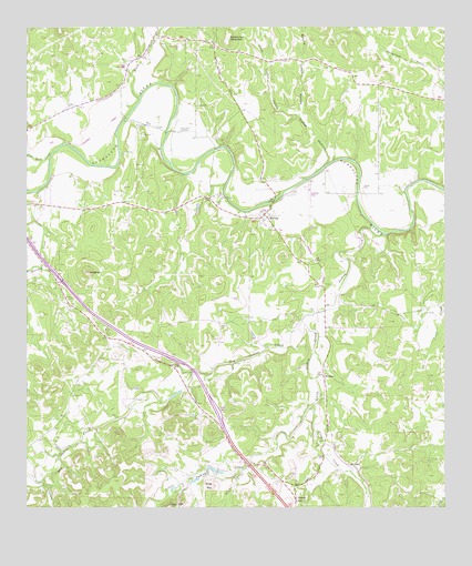
Waring, TX USGS Topographic Map
Click on map above to begin viewing in our Map Viewer.

This topographic map contains these locations and features:
Feature Name Type Latitude Longitude GNIS ID View Map
Allen CreekStreamN29.8849°W98.8100°1372270View Map
Ammann CemeteryCemeteryN29.9332°W98.7841°2493631View Map
Beseler CemeteryCemeteryN29.9087°W98.7894°2498384View Map
Big Joshua CreekStreamN29.9252°W98.7895°1372558View Map
Block CreekStreamN29.9819°W98.8411°1330876View Map
Brownsboro CemeteryCemeteryN29.9733°W98.8289°1331376View Map
Camp CapersLocaleN29.9569°W98.8170°1331954View Map
Camp Capers ChurchChurchN29.9558°W98.8173°2052437View Map
Coffee HollowValleyN29.9638°W98.7862°1333060View Map
First Coffee HollowValleyN29.9763°W98.7932°1335813View Map
Flat Rock CreekStreamN29.9672°W98.8678°1335915View Map
Holliday CreekStreamN29.9574°W98.8742°1372160View Map
Insall CemeteryCemeteryN29.9749°W98.8398°1338481View Map
James Kiehl River Bend ParkParkN29.9718°W98.8353°2499877View Map
Joshua CreekStreamN29.9463°W98.7681°1338889View Map
JungfrauSummitN29.9366°W98.8570°1338928View Map
Little Joshua CreekStreamN29.9252°W98.7895°1374590View Map
Nelson CityPopulated PlaceN29.8774°W98.7953°1378733View Map
Possum CreekStreamN29.8824°W98.8709°1375539View Map
Ring MountainSummitN29.8808°W98.8203°1345238View Map
Rust FieldAirportN29.9572°W98.7906°1387710View Map
Schleicher MountainSummitN29.9977°W98.8139°1376036View Map
Second Coffee HollowValleyN29.9764°W98.7932°1346862View Map
WaringPopulated PlaceN29.9508°W98.8031°1349492View Map
Waring Baptist ChurchChurchN29.9524°W98.8045°2052439View Map
Waring Community CenterBuildingN29.9527°W98.8045°2052438View Map
Waring Post OfficePost OfficeN29.9508°W98.8039°2052440View Map
Waring Volunteer Fire DepartmentBuildingN29.9504°W98.8036°2052444View Map
WelfarePopulated PlaceN29.9216°W98.7867°2034977View Map
WelfareLocaleN29.9094°W98.7867°1349632View Map
White CemeteryCemeteryN29.8829°W98.8261°2492717View Map
Zinke CreekStreamN29.9019°W98.7898°1376898View Map
Zoeller CemeteryCemeteryN29.9585°W98.7748°1350770View Map

Note: Coordinates in the location and feature list above are referenced to NAD83 datum.


Copyright (C) 2008-2025 Ryan Niemi / Sunset Dynamics ... All Rights Reserved