TopoQuest Logo
Do you find TopoQuest useful?
Help keep TopoQuest running and adding new maps/features by donating!
Bitcoin:  19c7KJd3qBynnjoSw5npx9KScwjBe4ifkT
Litecoin:  LXs6TkuXGGXo1vDsWCkWVdjQX94eUKd6ui
Home View Maps Find Maps Find Places Resources & Links


Black Mountain, Utah Topographic Map

USGS Map Title: Black Mountain, UT
USGS Map MRC: 39111B5
DRG (GeoTIFF) Download: o39111b5.tif


Neighboring USGS Topographic Map Quads:


  Manti, UT  
39111C6
 

  Ephraim, UT  
39111C5
 

  Danish Knoll, UT  
39111C4
 

  Sterling, UT  
39111B6
 

  Black Mountain, UT  
39111B5
 

  Ferron Reservoir, UT  
39111B4
 

  Mayfield, UT  
39111A6
 

  Woods Lake, UT  
39111A5
 

  Heliotrope Mountain, UT  
39111A4


Map MRC Location:

N40°
W112°
N40°
W111°
H8 H7 H6 H5 H4 H3 H2 H1
G8 G7 G6 G5 G4 G3 G2 G1
F8 F7 F6 F5 F4 F3 F2 F1
E8 E7 E6 E5 E4 E3 E2 E1
D8 D7 D6 D5 D4 D3 D2 D1
C8 C7 C6 C5 C4 C3 C2 C1
B8 B7 B6 B5 B4 B3 B2 B1
A8 A7 A6 A5 A4 A3 A2 A1
N39°
W112°
N39°
W111°

Black Mountain, UT USGS 1:24K Topographic Map Preview:
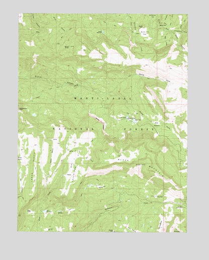
Black Mountain, UT USGS Topographic Map
Click on map above to begin viewing in our Map Viewer.

This topographic map contains these locations and features:
Feature Name Type Latitude Longitude GNIS ID View Map
Bear HoleBasinN39.1366°W111.6169°1438469View Map
Black HoleBasinN39.1627°W111.5355°1438850View Map
Black MountainSummitN39.1652°W111.5299°1438859View Map
Blue MeadowsFlatN39.1869°W111.5232°1438946View Map
Bub Arthurs FlatFlatN39.2483°W111.5171°1439211View Map
Burnt HillSummitN39.2427°W111.5335°1439353View Map
Burnt Hill FlatFlatN39.2389°W111.5321°1439354View Map
Dry Hole ReservoirReservoirN39.1262°W111.6033°1440637View Map
Ephraim-Manti DivisionCivilN39.1976°W111.5114°1939365View Map
Grove of the Aspen Giants Scenic AreaLocaleN39.1452°W111.5182°1441517View Map
Harmon TrailTrailN39.2052°W111.6060°1441599View Map
Hougaard ForkStreamN39.2397°W111.5113°1441925View Map
Julius PastureFlatN39.1258°W111.5424°1442242View Map
Leo SpringSpringN39.2087°W111.5804°1442560View Map
Loveridge FlatFlatN39.1636°W111.5824°1442990View Map
Lower PondLakeN39.1906°W111.5452°1443017View Map
Lower RanchSlopeN39.1616°W111.6144°1443020View Map
Metcalf SpringSpringN39.2311°W111.5878°1443316View Map
Middle MountainSummitN39.1252°W111.5549°1443369View Map
Milk CreekStreamN39.2405°W111.5166°1443390View Map
Milky FallsFallsN39.2433°W111.5216°1443395View Map
Mount BaldySummitN39.1255°W111.5102°1438372View Map
Mount Baldy Guard StationLocaleN39.1391°W111.5041°1443624View Map
Newfield ReservoirReservoirN39.1367°W111.5948°1443814View Map
North Fork Sixmile CanyonValleyN39.2044°W111.5599°1443935View Map
Patton ReservoirReservoirN39.2394°W111.5634°1444245View Map
Peacock Wildlife Management AreaParkN39.2475°W111.6235°1448821View Map
Sixmile PondsLakeN39.1916°W111.5444°1445628View Map
South Fork Sixmile CanyonValleyN39.2047°W111.5599°1445876View Map
Spring HillSummitN39.1505°W111.5627°1446033View Map
Town ReservoirReservoirN39.1365°W111.6057°1446660View Map
Town Reservoir DamDamN39.1366°W111.6074°1447769View Map
Upper PondLakeN39.1888°W111.5398°1446873View Map
Upper RanchSlopeN39.1683°W111.5999°1446877View Map
White LedgesCliffN39.1875°W111.5632°1447259View Map
WildwestAreaN39.1266°W111.5205°1447367View Map

Note: Coordinates in the location and feature list above are referenced to NAD83 datum.


Copyright (C) 2008-2025 Ryan Niemi / Sunset Dynamics ... All Rights Reserved