TopoQuest Logo
Do you find TopoQuest useful?
Help keep TopoQuest running and adding new maps/features by donating!
Bitcoin:  19c7KJd3qBynnjoSw5npx9KScwjBe4ifkT
Litecoin:  LXs6TkuXGGXo1vDsWCkWVdjQX94eUKd6ui
Home View Maps Find Maps Find Places Resources & Links


Danish Knoll, Utah Topographic Map

USGS Map Title: Danish Knoll, UT
USGS Map MRC: 39111C4
DRG (GeoTIFF) Download: o39111c4.tif


Neighboring USGS Topographic Map Quads:


  Chester, UT  
39111D5
 

  Spring City, UT  
39111D4
 

  South Tent Mountain, UT  
39111D3
 

  Ephraim, UT  
39111C5
 

  Danish Knoll, UT  
39111C4
 

  Joes Valley Reservoir, UT  
39111C3
 

  Black Mountain, UT  
39111B5
 

  Ferron Reservoir, UT  
39111B4
 

  Ferron Canyon, UT  
39111B3


Map MRC Location:

N40°
W112°
N40°
W111°
H8 H7 H6 H5 H4 H3 H2 H1
G8 G7 G6 G5 G4 G3 G2 G1
F8 F7 F6 F5 F4 F3 F2 F1
E8 E7 E6 E5 E4 E3 E2 E1
D8 D7 D6 D5 D4 D3 D2 D1
C8 C7 C6 C5 C4 C3 C2 C1
B8 B7 B6 B5 B4 B3 B2 B1
A8 A7 A6 A5 A4 A3 A2 A1
N39°
W112°
N39°
W111°

Danish Knoll, UT USGS 1:24K Topographic Map Preview:
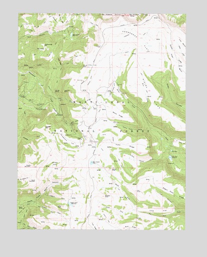
Danish Knoll, UT USGS Topographic Map
Click on map above to begin viewing in our Map Viewer.

This topographic map contains these locations and features:
Feature Name Type Latitude Longitude GNIS ID View Map
Alpine Experiment StationLocaleN39.3011°W111.4471°1454386View Map
Beaver DamsDamN39.2864°W111.3877°1451186View Map
Becks CreekStreamN39.3077°W111.4002°1438553View Map
Becks RidgeRidgeN39.3166°W111.4263°1438555View Map
Bluebell FlatFlatN39.3180°W111.4719°1438967View Map
Cherry FlatFlatN39.2558°W111.4341°1439656View Map
Cox CanyonValleyN39.2608°W111.3832°1440102View Map
Cox KnollSummitN39.2733°W111.4119°1440106View Map
Danish KnollSummitN39.2847°W111.4313°1440263View Map
Dusterburgs HillSummitN39.3569°W111.4816°1440734View Map
Elks KnollSummitN39.2630°W111.4677°1440917View Map
Ephiraim TunnelTunnelN39.3258°W111.4435°1440943View Map
Flat Iron PointCliffN39.3300°W111.4666°1441127View Map
Freds FlatFlatN39.3514°W111.4763°1441220View Map
Great Basin Experiment StationLocaleN39.3197°W111.4863°1454438View Map
Haystack MountainSummitN39.3086°W111.4807°1441650View Map
Horseshoe DitchCanalN39.3630°W111.4410°1441909View Map
Horseshoe FlatFlatN39.3594°W111.4105°1441910View Map
Horseshoe TunnelTunnelN39.3558°W111.4382°1441917View Map
John August LakeReservoirN39.2886°W111.4457°1442166View Map
Jolleys HoleBasinN39.2880°W111.4727°1442199View Map
Lake Hill CampgroundLocaleN39.3269°W111.4985°1442413View Map
Larsen DitchCanalN39.3525°W111.4135°1442442View Map
Larson TunnelTunnelN39.3450°W111.4452°1442444View Map
Left Fork Cotton CreekStreamN39.3272°W111.4780°1442491View Map
Lemons BenchBenchN39.2589°W111.4996°1442558View Map
Little Petes HoleValleyN39.2989°W111.3871°1442759View Map
Loggers ForkValleyN39.2708°W111.4802°1442863View Map
Loggers Fork DamDamN39.2655°W111.4641°1447782View Map
Loggers Fork ReservoirReservoirN39.2645°W111.4613°1442864View Map
Long FlatFlatN39.2608°W111.3955°1442907View Map
Lowry ForkValleyN39.2658°W111.4891°1443033View Map
Madsen DitchCanalN39.3158°W111.4413°1443065View Map
Manti-La Sal National ForestForestN39.2833°W111.4246°1878756View Map
Middle MountainSummitN39.2858°W111.4902°1443365View Map
Mud SpringSpringN39.3544°W111.4812°1443697View Map
New Canyon ReservoirReservoirN39.3626°W111.4610°1443806View Map
North Ephraim DitchCanalN39.3316°W111.4296°1443880View Map
North Fork Big Bear CreekStreamN39.2608°W111.4113°1443888View Map
Petes Hole DamDamN39.2933°W111.3874°1447788View Map
Petes Hole ReservoirReservoirN39.2919°W111.3872°1447787View Map
Philadelphia FlatFlatN39.3008°W111.4635°1444329View Map
Ridley RidgeRidgeN39.3280°W111.4018°1444900View Map
Rock CreekStreamN39.3105°W111.4638°1445057View Map
Rock CreekStreamN39.3180°W111.4091°1445058View Map
Seely Guard StationLocaleN39.3122°W111.4296°1445424View Map
Soup BowlReservoirN39.2959°W111.3863°1445788View Map
South Ephraim DitchCanalN39.3002°W111.4335°1445818View Map
South Fork Big Bear CreekStreamN39.2611°W111.4113°1445826View Map
South MountainSummitN39.2783°W111.4866°1445906View Map
Swasey RidgeRidgeN39.3519°W111.3838°1446282View Map
Swedish KnollSummitN39.2691°W111.4355°1446285View Map
Swens SpringSpringN39.2630°W111.4995°1446297View Map
The Big SpringSpringN39.3297°W111.4731°1446416View Map
Toms HoleValleyN39.3077°W111.4013°1446643View Map
Toms RidgeRidgeN39.2986°W111.4196°1446645View Map
Wasatch DitchCanalN39.3333°W111.4491°1447003View Map
White LedgeBenchN39.3469°W111.4696°1447256View Map

Note: Coordinates in the location and feature list above are referenced to NAD83 datum.


Copyright (C) 2008-2025 Ryan Niemi / Sunset Dynamics ... All Rights Reserved