TopoQuest Logo
Do you find TopoQuest useful?
Help keep TopoQuest running and adding new maps/features by donating!
Bitcoin:  19c7KJd3qBynnjoSw5npx9KScwjBe4ifkT
Litecoin:  LXs6TkuXGGXo1vDsWCkWVdjQX94eUKd6ui
Home View Maps Find Maps Find Places Resources & Links


Slate Shoals, Texas Topographic Map

USGS Map Title: Slate Shoals, TX
USGS Map MRC: 33095G4
DRG (GeoTIFF) Download: o33095g4.tif


Neighboring USGS Topographic Map Quads:


  Grant, OK  
33095H5
 

  Shoals, OK  
33095H4
 

  Frogville, OK  
33095H3
 

  Pat Mayse Lake East, TX  
33095G5
 

  Slate Shoals, TX  
33095G4
 

  Woodland, TX  
33095G3
 

  Paris, TX  
33095F5
 

  Blossom, TX  
33095F4
 

  Detroit, TX  
33095F3


Map MRC Location:

N34°
W96°
N34°
W95°
H8 H7 H6 H5 H4 H3 H2 H1
G8 G7 G6 G5 G4 G3 G2 G1
F8 F7 F6 F5 F4 F3 F2 F1
E8 E7 E6 E5 E4 E3 E2 E1
D8 D7 D6 D5 D4 D3 D2 D1
C8 C7 C6 C5 C4 C3 C2 C1
B8 B7 B6 B5 B4 B3 B2 B1
A8 A7 A6 A5 A4 A3 A2 A1
N33°
W96°
N33°
W95°

Slate Shoals, TX USGS 1:24K Topographic Map Preview:
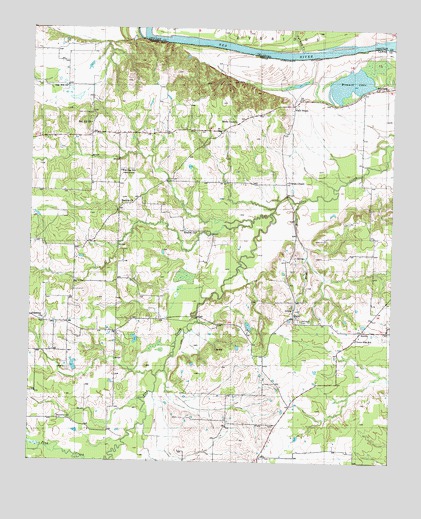
Slate Shoals, TX USGS Topographic Map
Click on map above to begin viewing in our Map Viewer.

This topographic map contains these locations and features:
Feature Name Type Latitude Longitude GNIS ID View Map
Bounds ChurchChurchN33.8243°W95.4683°1352726View Map
Bradley ChurchChurchN33.8162°W95.4425°1352811View Map
Carney CreekStreamN33.8690°W95.4072°1090984View Map
Howard LakeReservoirN33.7751°W95.4836°1864551View Map
Howard Lake DamDamN33.7751°W95.4836°1864550View Map
KBUS-FM (Paris)TowerN33.7512°W95.4144°1388056View Map
KOYN-FM (Paris)TowerN33.8268°W95.4638°1388057View Map
Lone StarPopulated PlaceN33.7857°W95.3877°2034648View Map
Lone Star SchoolSchoolN33.7859°W95.3869°1361672View Map
Long CemeteryCemeteryN33.7765°W95.4866°1361717View Map
MedillPopulated PlaceN33.7932°W95.4086°1380172View Map
Moran BranchStreamN33.8251°W95.4072°1363139View Map
Newbether CemeteryCemeteryN33.7626°W95.4902°1363838View Map
Ninemile CreekStreamN33.7607°W95.4594°1363895View Map
NovicePopulated PlaceN33.7882°W95.3850°1380268View Map
Novice Volunteer Fire DepartmentBuildingN33.7870°W95.3857°2655519View Map
Oak Hill CemeteryCemeteryN33.8503°W95.4799°1364289View Map
Oak Hill ChurchChurchN33.8584°W95.4880°1364290View Map
Palestine ChurchChurchN33.7909°W95.4955°1364715View Map
Pee Dee SchoolSchoolN33.8337°W95.4688°1365011View Map
Red Hill ChurchChurchN33.8476°W95.4797°1366162View Map
Reeds ChapelChurchN33.8484°W95.4294°1366308View Map
Riverside ChurchChurchN33.8579°W95.3816°1366534View Map
Slate ShoalsPopulated PlaceN33.8532°W95.4091°1368402View Map
Soil Conservation Service Site 14 DamDamN33.7618°W95.4769°1857894View Map
Soil Conservation Service Site 14 ReservoirReservoirN33.7618°W95.4769°1857895View Map
Soil Conservation Service Site 15 DamDamN33.7668°W95.4286°1857896View Map
Soil Conservation Service Site 15 ReservoirReservoirN33.7668°W95.4286°1857897View Map
Soil Conservation Service Site 16 DamDamN33.7801°W95.4719°1857898View Map
Soil Conservation Service Site 16 ReservoirReservoirN33.7801°W95.4719°1857899View Map
Soil Conservation Service Site 17 DamDamN33.8118°W95.4702°1857900View Map
Soil Conservation Service Site 17 ReservoirReservoirN33.8118°W95.4702°1857901View Map
Soil Conservation Service Site 18 DamDamN33.8151°W95.4419°1857902View Map
Soil Conservation Service Site 18 ReservoirReservoirN33.8151°W95.4419°1857903View Map
Springhill CemeteryCemeteryN33.7909°W95.4063°1369040View Map
Stallings LakeReservoirN33.7801°W95.4669°1857893View Map
Stallings Lake DamDamN33.7801°W95.4669°1857892View Map
Womack LakeLakeN33.8597°W95.3900°1371879View Map
Womack Plantation Airport (historical)AirportN33.8537°W95.4077°1387291View Map
Youngs ChapelChurchN33.8312°W95.4113°1372066View Map

Note: Coordinates in the location and feature list above are referenced to NAD83 datum.


Copyright (C) 2008-2025 Ryan Niemi / Sunset Dynamics ... All Rights Reserved