TopoQuest Logo
Do you find TopoQuest useful?
Help keep TopoQuest running and adding new maps/features by donating!
Bitcoin:  19c7KJd3qBynnjoSw5npx9KScwjBe4ifkT
Litecoin:  LXs6TkuXGGXo1vDsWCkWVdjQX94eUKd6ui
Home View Maps Find Maps Find Places Resources & Links


Snowdoun, Alabama Topographic Map

USGS Map Title: Snowdoun, AL
USGS Map MRC: 32086B3
DRG (GeoTIFF) Download: o32086b3.tif


Neighboring USGS Topographic Map Quads:


  Cantelous, AL  
32086C4
 

  Montgomery South, AL  
32086C3
 

  Barachias, AL  
32086C2
 

  Letohatchee, AL  
32086B4
 

  Snowdoun, AL  
32086B3
 

  Davis Crossroads, AL  
32086B2
 

  Sandy Ridge, AL  
32086A4
 

  Sellers, AL  
32086A3
 

  Ramer, AL  
32086A2


Map MRC Location:

N33°
W87°
N33°
W86°
H8 H7 H6 H5 H4 H3 H2 H1
G8 G7 G6 G5 G4 G3 G2 G1
F8 F7 F6 F5 F4 F3 F2 F1
E8 E7 E6 E5 E4 E3 E2 E1
D8 D7 D6 D5 D4 D3 D2 D1
C8 C7 C6 C5 C4 C3 C2 C1
B8 B7 B6 B5 B4 B3 B2 B1
A8 A7 A6 A5 A4 A3 A2 A1
N32°
W87°
N32°
W86°

Snowdoun, AL USGS 1:24K Topographic Map Preview:
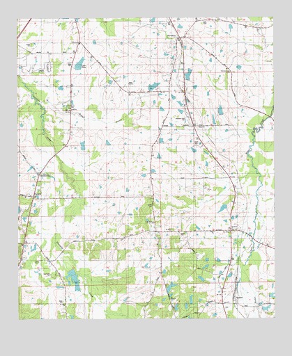
Snowdoun, AL USGS Topographic Map
Click on map above to begin viewing in our Map Viewer.

This topographic map contains these locations and features:
Feature Name Type Latitude Longitude GNIS ID View Map
Ball CemeteryCemeteryN32.1493°W86.3647°113419View Map
Bethel CemeteryCemeteryN32.1860°W86.3627°114017View Map
Beulah ChurchChurchN32.2124°W86.3491°114181View Map
Butler Mill ChurchChurchN32.1596°W86.3069°115318View Map
Butler Mill Road ChurchChurchN32.1649°W86.3091°115319View Map
CanaanPopulated PlaceN32.2049°W86.3036°115514View Map
Davis Lakes Number OneReservoirN32.1444°W86.3489°117135View Map
Davis Number One DamDamN32.1451°W86.3500°130207View Map
Duggar DamDamN32.2301°W86.3433°130325View Map
Edward Myers DamDamN32.1718°W86.2733°130228View Map
Edwards PondsLakeN32.1267°W86.2795°117882View Map
Faulkner DamDamN32.1985°W86.3016°130279View Map
Faulkner LakeReservoirN32.1995°W86.3004°130280View Map
Flowers DamDamN32.1285°W86.2983°130189View Map
Flowers LakeReservoirN32.1297°W86.2980°118454View Map
Ganey CemeteryCemeteryN32.1326°W86.3533°142558View Map
Gormley FarmLocaleN32.1683°W86.2750°2649852View Map
Griggs PondsReservoirN32.1718°W86.2730°119415View Map
Hall DamDamN32.2085°W86.2750°130292View Map
Hall LakeReservoirN32.2085°W86.2750°130293View Map
Hill and Hill DamDamN32.1368°W86.3016°130197View Map
Hill and Hill LakeReservoirN32.1383°W86.3006°120090View Map
Hope Hull ChurchChurchN32.1438°W86.3569°142621View Map
Hope Hull DivisionCivilN32.2003°W86.3409°165904View Map
Hubie Cauthen Number 1 DamDamN32.1285°W86.2616°130186View Map
Hubie Cauthen Number 2 DamDamN32.1351°W86.2566°130193View Map
Hubie Cauthen Number One LakeReservoirN32.1285°W86.2616°130185View Map
Hubie Cauthen Number Two LakeReservoirN32.1351°W86.2566°130192View Map
Hunting DownsPopulated PlaceN32.2404°W86.3466°142630View Map
Lake EdnaReservoirN32.2310°W86.3445°117873View Map
Lake WeilReservoirN32.1285°W86.2916°130187View Map
Lassiter DamDamN32.1968°W86.3433°130275View Map
Lassiter LakeReservoirN32.1971°W86.3431°130274View Map
Le GrandPopulated PlaceN32.1624°W86.2686°152006View Map
Liberty ChurchChurchN32.1560°W86.3730°121544View Map
McLean Junior High SchoolSchoolN32.2326°W86.3583°122584View Map
Mount Moab ChurchChurchN32.1618°W86.3002°123246View Map
Mount Sinai ChurchChurchN32.1310°W86.3522°152509View Map
Myers Number 2 DamDamN32.1718°W86.2750°130229View Map
Myers Number Two LakeReservoirN32.1709°W86.2750°130230View Map
New Center CemeteryCemeteryN32.1435°W86.3586°123736View Map
Old Sardis ChurchChurchN32.1338°W86.3008°124248View Map
Phillips SchoolSchoolN32.1429°W86.3041°152884View Map
Pine NeedlesPopulated PlaceN32.1729°W86.3161°142795View Map
PintlalaPopulated PlaceN32.1757°W86.3675°124905View Map
Pintlala Elementary SchoolSchoolN32.1760°W86.3714°142800View Map
Pintlala Volunteer Fire Department Station 1BuildingN32.1770°W86.3718°2691135View Map
Pintlalla ChurchChurchN32.1757°W86.3686°142799View Map
Pirtle DamDamN32.2235°W86.2916°130319View Map
Pirtle LakeReservoirN32.2265°W86.2916°130320View Map
Providence ChurchChurchN32.1621°W86.2708°142810View Map
RoxanaPopulated PlaceN32.1832°W86.2716°157000View Map
Roxana School (historical)SchoolN32.1868°W86.2755°142833View Map
Sankey CemeteryCemeteryN32.1718°W86.3097°126389View Map
Sardis ChurchChurchN32.1613°W86.2797°153335View Map
Shackelford CemeteryCemeteryN32.1846°W86.3641°126574View Map
Sharp CemeteryCemeteryN32.1593°W86.2955°126634View Map
Sims Lake Number OneReservoirN32.2222°W86.3073°130317View Map
Sims Lake Number TwoReservoirN32.2210°W86.3098°130311View Map
Sims Number 1 DamDamN32.2218°W86.3066°130318View Map
Sims Number 2 DamDamN32.2201°W86.3100°130312View Map
SnowdounPopulated PlaceN32.2415°W86.2964°127083View Map
Snowdoun Valley ChurchChurchN32.2274°W86.2716°127084View Map
Snowdoun Volunteer Fire DepartmentBuildingN32.2423°W86.2919°2691073View Map
Snowdoun Volunteer Fire Department Sprague StationBuildingN32.1329°W86.2695°2691489View Map
Snowdown ChurchChurchN32.2421°W86.2930°142866View Map
Soapstone (historical)LocaleN32.2446°W86.3725°144687View Map
SpraguePopulated PlaceN32.1329°W86.2700°127206View Map
Sprague CemeteryCemeteryN32.1296°W86.2744°142878View Map
Stallings DamDamN32.2451°W86.2700°130340View Map
Stallings LakeReservoirN32.2462°W86.2708°130339View Map
Strokes CemeteryCemeteryN32.2387°W86.3672°127472View Map
Tankersley SchoolSchoolN32.1418°W86.3564°127662View Map
TharinPopulated PlaceN32.2046°W86.2839°127917View Map
Weil DamDamN32.1285°W86.2916°130188View Map
Woodland Hills CemeteryCemeteryN32.2096°W86.2919°122647View Map

Note: Coordinates in the location and feature list above are referenced to NAD83 datum.


Copyright (C) 2008-2024 Ryan Niemi / Sunset Dynamics ... All Rights Reserved