TopoQuest Logo
Do you find TopoQuest useful?
Help keep TopoQuest running and adding new maps/features by donating!
Bitcoin:  19c7KJd3qBynnjoSw5npx9KScwjBe4ifkT
Litecoin:  LXs6TkuXGGXo1vDsWCkWVdjQX94eUKd6ui
Home View Maps Find Maps Find Places Resources & Links


Wattsburg, Pennsylvania Topographic Map

USGS Map Title: Wattsburg, PA
USGS Map MRC: 42079A7
DRG (GeoTIFF) Download: o42079a7.tif


Neighboring USGS Topographic Map Quads:


  Harborcreek, PA  
42079B8
 

  North East, PA  
42079B7
 

  South Ripley, NY  
42079B6
 

  Hammett, PA  
42079A8
 

  Wattsburg, PA  
42079A7
 

  Clymer, NY  
42079A6
 

  Waterford, PA  
41079H8
 

  Union City, PA  
41079H7
 

  Corry, PA  
41079H6


Map MRC Location:

N43°
W80°
N43°
W79°
H8 H7 H6 H5 H4 H3 H2 H1
G8 G7 G6 G5 G4 G3 G2 G1
F8 F7 F6 F5 F4 F3 F2 F1
E8 E7 E6 E5 E4 E3 E2 E1
D8 D7 D6 D5 D4 D3 D2 D1
C8 C7 C6 C5 C4 C3 C2 C1
B8 B7 B6 B5 B4 B3 B2 B1
A8 A7 A6 A5 A4 A3 A2 A1
N42°
W80°
N42°
W79°

Wattsburg, PA USGS 1:24K Topographic Map Preview:
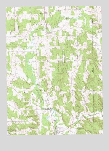
Wattsburg, PA USGS Topographic Map
Click on map above to begin viewing in our Map Viewer.

This topographic map contains these locations and features:
Feature Name Type Latitude Longitude GNIS ID View Map
Alder BrookStreamN42.0576°W79.8417°1168128View Map
Ashton CornersLocaleN42.1217°W79.7814°1168465View Map
Bailey BrookStreamN42.0337°W79.8278°1168573View Map
Borough of WattsburgCivilN42.0030°W79.8071°1215220View Map
Colts StationPopulated PlaceN42.1184°W79.8234°1172241View Map
Darrow BrookStreamN42.1161°W79.7772°948041View Map
DrumlinsRidgeN42.0737°W79.7731°1201325View Map
Erie County Airport (historical)AirportN42.0417°W79.8522°1194327View Map
Greenfield CemeteryCemeteryN42.0991°W79.8200°2712268View Map
Greenfield Township Elementary SchoolSchoolN42.1176°W79.8301°1211439View Map
Greenfield Township Volunteer Fire Company Station 70BuildingN42.1165°W79.8607°2644887View Map
Herrick CreekStreamN42.0228°W79.7545°952634View Map
HornbyPopulated PlaceN42.1162°W79.8628°1203842View Map
Little HopePopulated PlaceN42.0989°W79.8189°1179564View Map
LowvillePopulated PlaceN42.0248°W79.8214°1180047View Map
Lowville Pit 1MineN42.0408°W79.8278°2711961View Map
Seneca High SchoolSchoolN42.0062°W79.8098°1211440View Map
State Game Lands Number 155ParkN42.0028°W79.8698°1188457View Map
State Game Lands Number 191ParkN42.0717°W79.8001°1188477View Map
Strawberry Acres Airport (historical)AirportN42.0148°W79.8172°1194325View Map
Townley RunStreamN42.0842°W79.8487°1189693View Map
Township of GreenfieldCivilN42.1211°W79.8319°1216415View Map
Township of VenangoCivilN42.0430°W79.8328°1216425View Map
WattsburgPopulated PlaceN42.0037°W79.8109°1190706View Map
Wattsburg Hose Company Station 17BuildingN42.0024°W79.8106°2645384View Map
Wattsburg Post OfficePost OfficeN42.0028°W79.8112°2779996View Map
West Mina CemeteryCemeteryN42.0885°W79.7566°970803View Map

Note: Coordinates in the location and feature list above are referenced to NAD83 datum.


Copyright (C) 2008-2025 Ryan Niemi / Sunset Dynamics ... All Rights Reserved