TopoQuest Logo
Do you find TopoQuest useful?
Help keep TopoQuest running and adding new maps/features by donating!
Bitcoin:  19c7KJd3qBynnjoSw5npx9KScwjBe4ifkT
Litecoin:  LXs6TkuXGGXo1vDsWCkWVdjQX94eUKd6ui
Home View Maps Find Maps Find Places Resources & Links


Spring Creek, Pennsylvania Topographic Map

USGS Map Title: Spring Creek, PA
USGS Map MRC: 41079G5
DRG (GeoTIFF) Download: o41079g5.tif


Neighboring USGS Topographic Map Quads:


  Corry, PA  
41079H6
 

  Columbus, PA  
41079H5
 

  Lottsville, PA  
41079H4
 

  Spartansburg, PA  
41079G6
 

  Spring Creek, PA  
41079G5
 

  Pittsfield, PA  
41079G4
 

  Titusville North, PA  
41079F6
 

  Grand Valley, PA  
41079F5
 

  Tidioute, PA  
41079F4


Map MRC Location:

N42°
W80°
N42°
W79°
H8 H7 H6 H5 H4 H3 H2 H1
G8 G7 G6 G5 G4 G3 G2 G1
F8 F7 F6 F5 F4 F3 F2 F1
E8 E7 E6 E5 E4 E3 E2 E1
D8 D7 D6 D5 D4 D3 D2 D1
C8 C7 C6 C5 C4 C3 C2 C1
B8 B7 B6 B5 B4 B3 B2 B1
A8 A7 A6 A5 A4 A3 A2 A1
N41°
W80°
N41°
W79°

Spring Creek, PA USGS 1:24K Topographic Map Preview:
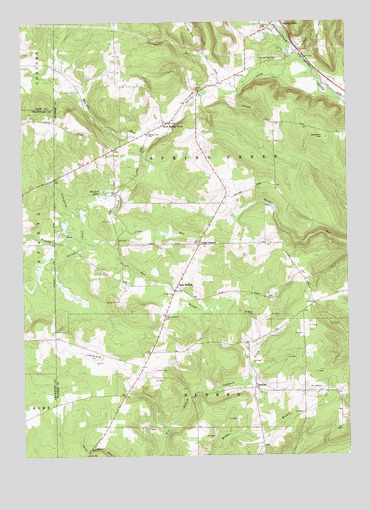
Spring Creek, PA USGS Topographic Map
Click on map above to begin viewing in our Map Viewer.

This topographic map contains these locations and features:
Feature Name Type Latitude Longitude GNIS ID View Map
Armitage School (historical)SchoolN41.8259°W79.5462°1201178View Map
Brandy RunStreamN41.8114°W79.6003°1170164View Map
Cobbs CornersLocaleN41.8109°W79.5570°1172098View Map
Cobbs RunStreamN41.8159°W79.5848°1172101View Map
Coldspring CreekStreamN41.8123°W79.6026°1172168View Map
EagleLocaleN41.7676°W79.5859°1206951View Map
East BranchPopulated PlaceN41.7987°W79.5653°1203471View Map
East Branch CemeteryCemeteryN41.7899°W79.5700°1173735View Map
East Branch Spring CreekStreamN41.8103°W79.5898°1173771View Map
Eastman School (historical)SchoolN41.8006°W79.5864°1200895View Map
Ferrin RunStreamN41.8598°W79.5420°1174711View Map
Hemlock LakesLakeN41.8265°W79.5941°1176812View Map
Jackson HillSummitN41.8417°W79.5089°1177920View Map
Mickel Hill ChurchChurchN41.7989°W79.5153°1200893View Map
Neils RidgeRidgeN41.8701°W79.5481°1201179View Map
Nichols AirportAirportN41.7793°W79.5964°1194285View Map
Rays CornersLocaleN41.7826°W79.5467°1212048View Map
Ross CornersLocaleN41.8553°W79.5148°1212098View Map
SanfordPopulated PlaceN41.7695°W79.5359°1204584View Map
Spring CreekStreamN41.8631°W79.5151°1188215View Map
Spring Creek CemeteryCemeteryN41.8642°W79.5253°1188222View Map
Spring Creek Post OfficePost OfficeN41.8743°W79.5279°2772986View Map
Spring Creek SchoolSchoolN41.8426°W79.5767°1188224View Map
Spring Creek Township Volunteer Fire Department Station 64BuildingN41.8750°W79.5240°2645390View Map
Township of Spring CreekCivilN41.8452°W79.5463°1217177View Map
Trimm CemeteryCemeteryN41.7746°W79.5746°1189764View Map
Trimms CornersLocaleN41.7759°W79.5792°1212047View Map
Tubbs School (historical)SchoolN41.8020°W79.5184°1200894View Map
West Spring CreekPopulated PlaceN41.8456°W79.5695°1191114View Map
White Chapel (historical)ChurchN41.7903°W79.5178°1200738View Map
Whitney RunStreamN41.8456°W79.5659°1193661View Map

Note: Coordinates in the location and feature list above are referenced to NAD83 datum.


Copyright (C) 2008-2024 Ryan Niemi / Sunset Dynamics ... All Rights Reserved