TopoQuest Logo
Do you find TopoQuest useful?
Help keep TopoQuest running and adding new maps/features by donating!
Bitcoin:  19c7KJd3qBynnjoSw5npx9KScwjBe4ifkT
Litecoin:  LXs6TkuXGGXo1vDsWCkWVdjQX94eUKd6ui
Home View Maps Find Maps Find Places Resources & Links


Springfield Corners, Wisconsin Topographic Map

USGS Map Title: Springfield Corners, WI
USGS Map MRC: 43089B5
DRG (GeoTIFF) Download: o43089b5.tif


Neighboring USGS Topographic Map Quads:


  Sauk City, WI  
43089C6
 

  Lodi, WI  
43089C5
 

  Arlington, WI  
43089C4
 

  Black Earth, WI  
43089B6
 

  Springfield Corners, WI  
43089B5
 

  Waunakee, WI  
43089B4
 

  Cross Plains, WI  
43089A6
 

  Middleton, WI  
43089A5
 

  Madison West, WI  
43089A4


Map MRC Location:

N44°
W90°
N44°
W89°
H8 H7 H6 H5 H4 H3 H2 H1
G8 G7 G6 G5 G4 G3 G2 G1
F8 F7 F6 F5 F4 F3 F2 F1
E8 E7 E6 E5 E4 E3 E2 E1
D8 D7 D6 D5 D4 D3 D2 D1
C8 C7 C6 C5 C4 C3 C2 C1
B8 B7 B6 B5 B4 B3 B2 B1
A8 A7 A6 A5 A4 A3 A2 A1
N43°
W90°
N43°
W89°

Springfield Corners, WI USGS 1:24K Topographic Map Preview:
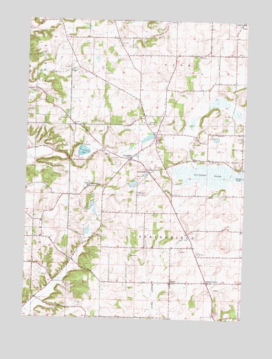
Springfield Corners, WI USGS Topographic Map
Click on map above to begin viewing in our Map Viewer.

This topographic map contains these locations and features:
Feature Name Type Latitude Longitude GNIS ID View Map
AshtonPopulated PlaceN43.1405°W89.5415°1560983View Map
Ashton CornersPopulated PlaceN43.1403°W89.5207°1560984View Map
Barbian PondLakeN43.2004°W89.5159°2761874View Map
Bicklers Apple FarmLocaleN43.1328°W89.5008°2516916View Map
Brandenburg LakeLakeN43.1950°W89.5924°1562144View Map
Camp BrandenburgLocaleN43.1978°W89.5962°1562583View Map
Carl Buechner PondLakeN43.1615°W89.5896°2761875View Map
Dahmen PondLakeN43.1638°W89.5619°2761876View Map
Dane CemeteryCemeteryN43.2277°W89.5814°1572694View Map
Diedrich PondLakeN43.2009°W89.5554°2761877View Map
Dons Mobile ManorPopulated PlaceN43.1531°W89.5256°2515653View Map
Empire Prairies State Natural AreaParkN43.1458°W89.5296°1989924View Map
Kalscheur PondLakeN43.1774°W89.5735°2761897View Map
Koch PrairieAreaN43.1458°W89.5296°1989932View Map
Kohlman CemeteryCemeteryN43.1770°W89.5412°1567603View Map
Louis Buechner PondLakeN43.1816°W89.5633°2761898View Map
Lutheran HillPopulated PlaceN43.2083°W89.6007°1842511View Map
MartinsvillePopulated PlaceN43.1803°W89.5901°1569097View Map
Meier PondLakeN43.1720°W89.5875°2761900View Map
Saint John's Lutheran CemeteryCemeteryN43.2061°W89.5990°1573033View Map
Saint Johns ChurchChurchN43.2086°W89.6018°1573081View Map
Saint Martin's CemeteryCemeteryN43.1825°W89.5904°2781276View Map
Saint Martins Catholic ChurchChurchN43.1814°W89.5904°1842657View Map
Saint Michael's CemeteryCemeteryN43.2494°W89.5004°2781279View Map
Saint Michaels Parochial Grade SchoolSchoolN43.2493°W89.5015°2716852View Map
Saint Peter Catholic SchoolSchoolN43.1395°W89.5410°2716676View Map
Saint Peter's CemeteryCemeteryN43.1386°W89.5410°2781286View Map
Saint Peters Catholic ChurchChurchN43.1397°W89.5412°1842668View Map
Springfield CornersPopulated PlaceN43.1919°W89.5665°1574723View Map
Springfield PondLakeN43.1931°W89.5617°2761903View Map
Springfield SchoolSchoolN43.1867°W89.5568°1574724View Map
Town of SpringfieldCivilN43.1628°W89.5413°1584192View Map
Truehl CemeteryCemeteryN43.2144°W89.6107°2781303View Map
Wagner Dairy FarmLocaleN43.1258°W89.5511°2704139View Map
Waunakee MarshSwampN43.1858°W89.5190°1576319View Map
Waunakee Marsh State Wildlife Management AreaParkN43.1858°W89.5140°1842749View Map
WMLI-FM (Sauk City)TowerN43.2103°W89.5993°1582456View Map
Ziegler Dairy FarmsLocaleN43.1300°W89.5436°2704143View Map
Ziegler QuarryMineN43.1303°W89.5133°2649941View Map

Note: Coordinates in the location and feature list above are referenced to NAD83 datum.


Copyright (C) 2008-2025 Ryan Niemi / Sunset Dynamics ... All Rights Reserved