TopoQuest Logo
Do you find TopoQuest useful?
Help keep TopoQuest running and adding new maps/features by donating!
Bitcoin:  19c7KJd3qBynnjoSw5npx9KScwjBe4ifkT
Litecoin:  LXs6TkuXGGXo1vDsWCkWVdjQX94eUKd6ui
Home View Maps Find Maps Find Places Resources & Links


Spruce Hill, Pennsylvania Topographic Map

USGS Map Title: Spruce Hill, PA
USGS Map MRC: 40077D4
DRG (GeoTIFF) Download: o40077d4.tif


Neighboring USGS Topographic Map Quads:


  Lewistown, PA  
40077E5
 

  Mifflintown, PA  
40077E4
 

  Mexico, PA  
40077E3
 

  McCoysville, PA  
40077D5
 

  Spruce Hill, PA  
40077D4
 

  Ickesburg, PA  
40077D3
 

  Blain, PA  
40077C5
 

  Andersonburg, PA  
40077C4
 

  Landisburg, PA  
40077C3


Map MRC Location:

N41°
W78°
N41°
W77°
H8 H7 H6 H5 H4 H3 H2 H1
G8 G7 G6 G5 G4 G3 G2 G1
F8 F7 F6 F5 F4 F3 F2 F1
E8 E7 E6 E5 E4 E3 E2 E1
D8 D7 D6 D5 D4 D3 D2 D1
C8 C7 C6 C5 C4 C3 C2 C1
B8 B7 B6 B5 B4 B3 B2 B1
A8 A7 A6 A5 A4 A3 A2 A1
N40°
W78°
N40°
W77°

Spruce Hill, PA USGS 1:24K Topographic Map Preview:
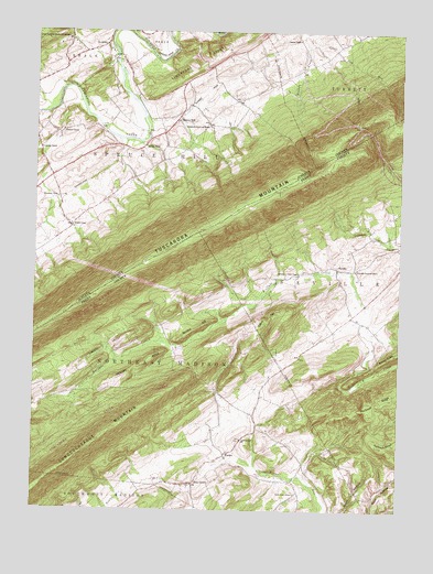
Spruce Hill, PA USGS Topographic Map
Click on map above to begin viewing in our Map Viewer.

This topographic map contains these locations and features:
Feature Name Type Latitude Longitude GNIS ID View Map
AcademiaPopulated PlaceN40.4965°W77.4758°1192057View Map
Academia SchoolSchoolN40.4984°W77.4880°1197132View Map
Brethren in Christ ChapelChurchN40.4373°W77.4089°1170207View Map
Buckeye RidgeRidgeN40.4045°W77.3783°1170560View Map
Bunker HillSummitN40.4209°W77.4469°1170673View Map
Cabin HillSummitN40.4237°W77.4155°1170854View Map
Center SchoolSchoolN40.4909°W77.4397°1197127View Map
Doyle RunStreamN40.4815°W77.4922°1168002View Map
Ebenezer ChurchChurchN40.4742°W77.4905°1173950View Map
Emanuals Reformed ChurchChurchN40.4379°W77.3900°1174200View Map
Emory Green SchoolSchoolN40.3795°W77.4097°1174246View Map
Freedom SchoolSchoolN40.4981°W77.4094°1175209View Map
Hickory RidgeRidgeN40.4131°W77.4628°1176968View Map
Hoffman RidgeRidgeN40.3926°W77.3767°1177162View Map
Irvine SchoolSchoolN40.4259°W77.3905°1197129View Map
Jinnie Gap RunStreamN40.4995°W77.4061°1178087View Map
KistlerPopulated PlaceN40.3895°W77.4339°1178560View Map
Lagrange SchoolSchoolN40.4692°W77.4980°1178762View Map
Liberty ValleyValleyN40.4161°W77.4733°1179268View Map
Lower Liberty School (historical)SchoolN40.4223°W77.4589°1197130View Map
Lower Tuscarora Church and CemeteryCemeteryN40.4975°W77.4900°1180037View Map
Matamoras School and ChurchChurchN40.4754°W77.4394°1180541View Map
Pine GrovePopulated PlaceN40.3823°W77.4442°1183793View Map
Pleasant ViewPopulated PlaceN40.4567°W77.4917°1204423View Map
Run GapGapN40.4759°W77.3894°1197128View Map
SavillePopulated PlaceN40.4384°W77.3958°1187015View Map
Seven PinesPopulated PlaceN40.4698°W77.4622°1204613View Map
Spruce HillPopulated PlaceN40.4773°W77.4508°1188330View Map
Spruce Hill SchoolSchoolN40.4729°W77.4611°1197131View Map
Township of Northeast MadisonCivilN40.3987°W77.4539°1216945View Map
Township of Spruce HillCivilN40.4647°W77.4701°1216586View Map
Trinity ChurchChurchN40.3937°W77.4280°1189786View Map
Tuscarora Academy Historic SiteLocaleN40.4951°W77.4822°1212877View Map
Walsingham SchoolSchoolN40.4017°W77.4997°1197159View Map
Wisdom SchoolSchoolN40.4495°W77.4869°1191619View Map
Yohn TrailTrailN40.3884°W77.4953°1206518View Map

Note: Coordinates in the location and feature list above are referenced to NAD83 datum.


Copyright (C) 2008-2024 Ryan Niemi / Sunset Dynamics ... All Rights Reserved