TopoQuest Logo
Do you find TopoQuest useful?
Help keep TopoQuest running and adding new maps/features by donating!
Bitcoin:  19c7KJd3qBynnjoSw5npx9KScwjBe4ifkT
Litecoin:  LXs6TkuXGGXo1vDsWCkWVdjQX94eUKd6ui
Home View Maps Find Maps Find Places Resources & Links


Stangelville, Wisconsin Topographic Map

USGS Map Title: Stangelville, WI
USGS Map MRC: 44087D6
DRG (GeoTIFF) Download: o44087d6.tif


Neighboring USGS Topographic Map Quads:


  New Franken, WI  
44087E7
 

  Luxemburg, WI  
44087E6
 

  Casco, WI  
44087E5
 

  Poland, WI  
44087D7
 

  Stangelville, WI  
44087D6
 

  Kewaunee, WI  
44087D5
 

  Denmark, WI  
44087C7
 

  Larrabee, WI  
44087C6
 

  Two Creeks, WI  
44087C5


Map MRC Location:

N45°
W88°
N45°
W87°
H8 H7 H6 H5 H4 H3 H2 H1
G8 G7 G6 G5 G4 G3 G2 G1
F8 F7 F6 F5 F4 F3 F2 F1
E8 E7 E6 E5 E4 E3 E2 E1
D8 D7 D6 D5 D4 D3 D2 D1
C8 C7 C6 C5 C4 C3 C2 C1
B8 B7 B6 B5 B4 B3 B2 B1
A8 A7 A6 A5 A4 A3 A2 A1
N44°
W88°
N44°
W87°

Stangelville, WI USGS 1:24K Topographic Map Preview:
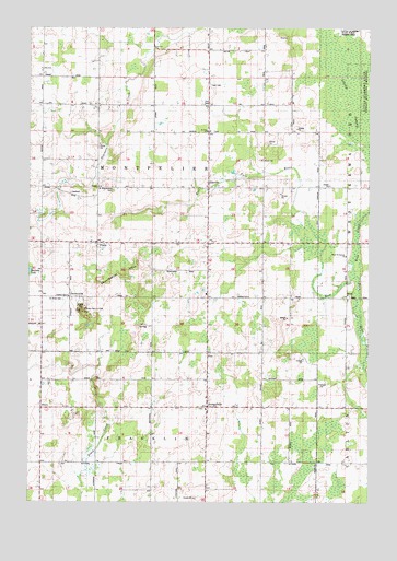
Stangelville, WI USGS Topographic Map
Click on map above to begin viewing in our Map Viewer.

This topographic map contains these locations and features:
Feature Name Type Latitude Longitude GNIS ID View Map
Beech Grove School (historical)SchoolN44.3931°W87.6645°1840624View Map
Chernesville School (historical)SchoolN44.4292°W87.7348°1840628View Map
CherneyvillePopulated PlaceN44.4289°W87.7348°1577543View Map
Cherneyville HillSummitN44.4258°W87.7306°1562980View Map
Chervenka FarmsLocaleN44.3875°W87.7364°2704982View Map
EllisvillePopulated PlaceN44.4578°W87.6843°1564548View Map
Fairview FarmsLocaleN44.4597°W87.7228°2710608View Map
Hallada LakeLakeN44.4357°W87.7498°1565989View Map
High Bluff School (historical)SchoolN44.4286°W87.6745°1840640View Map
Jefferson School (historical)SchoolN44.4872°W87.7348°1840651View Map
KrokPopulated PlaceN44.4289°W87.6331°1577686View Map
Krok CreekStreamN44.4347°W87.6301°1567651View Map
Lipsky SwampSwampN44.4822°W87.6326°1568164View Map
Montpelier HillsSummitN44.4358°W87.7148°1569682View Map
Montpelier Township CemeteryCemeteryN44.4850°W87.6840°1840663View Map
Phillip School (historical)SchoolN44.4800°W87.6834°1840666View Map
PilsenPopulated PlaceN44.4436°W87.7251°1571412View Map
Pilsen School (historical)SchoolN44.4564°W87.7348°1840667View Map
Rolling Hills Dairy FarmLocaleN44.4417°W87.6867°2710612View Map
Saint Anna CemeteryCemeteryN44.4283°W87.7376°1572833View Map
Saint John Catholic ChurchChurchN44.4297°W87.6331°1840677View Map
Saint John Nepomuceue Catholic CemeteryCemeteryN44.4297°W87.6326°1840678View Map
Saint Joseph Catholic ChurchChurchN44.4436°W87.7276°1840681View Map
Saint Josephs Catholic CemeteryCemeteryN44.4444°W87.7273°1840683View Map
Saint Lawrence Catholic CemeteryCemeteryN44.3994°W87.6865°1840685View Map
Saint Lawrence Catholic ChurchChurchN44.3994°W87.6848°1840686View Map
Saint Paul Lutheran CemeteryCemeteryN44.4728°W87.6834°1840696View Map
Saint Paul Lutheran SchoolSchoolN44.4728°W87.6848°1573459View Map
Saint Pauls Lutheran ChurchChurchN44.4728°W87.6843°1840698View Map
Saint Wenceslaus CemeteryCemeteryN44.4578°W87.7193°1573595View Map
Salzsieder FarmsLocaleN44.4783°W87.6972°2710616View Map
School Lane DairyLocaleN44.4544°W87.7325°2710613View Map
StangelvillePopulated PlaceN44.4003°W87.6845°1574789View Map
Town of MontpelierCivilN44.4581°W87.7045°1583748View Map
Valley View DairyLocaleN44.4008°W87.7378°2704983View Map
West Kewaunee United Methodist ChurchChurchN44.4403°W87.6331°1576519View Map
White Ledge DairyLocaleN44.4781°W87.6789°2710611View Map
Whittier School (historical)SchoolN44.3922°W87.7448°1840707View Map
Woodland School (historical)SchoolN44.3925°W87.7043°1840708View Map
Zion CemeteryCemeteryN44.4800°W87.6840°1577142View Map

Note: Coordinates in the location and feature list above are referenced to NAD83 datum.


Copyright (C) 2008-2024 Ryan Niemi / Sunset Dynamics ... All Rights Reserved