TopoQuest Logo
Do you find TopoQuest useful?
Help keep TopoQuest running and adding new maps/features by donating!
Bitcoin:  19c7KJd3qBynnjoSw5npx9KScwjBe4ifkT
Litecoin:  LXs6TkuXGGXo1vDsWCkWVdjQX94eUKd6ui
Home View Maps Find Maps Find Places Resources & Links


Statesville East, North Carolina Topographic Map

USGS Map Title: Statesville East, NC
USGS Map MRC: 35080G7
DRG (GeoTIFF) Download: o35080g7.tif


Neighboring USGS Topographic Map Quads:


  Central, NC  
35080H8
 

  Harmony, NC  
35080H7
 

  Calahaln, NC  
35080H6
 

  Statesville West, NC  
35080G8
 

  Statesville East, NC  
35080G7
 

  Cool Springs, NC  
35080G6
 

  Troutman, NC  
35080F8
 

  Shepherds, NC  
35080F7
 

  Cleveland, NC  
35080F6


Map MRC Location:

N36°
W81°
N36°
W80°
H8 H7 H6 H5 H4 H3 H2 H1
G8 G7 G6 G5 G4 G3 G2 G1
F8 F7 F6 F5 F4 F3 F2 F1
E8 E7 E6 E5 E4 E3 E2 E1
D8 D7 D6 D5 D4 D3 D2 D1
C8 C7 C6 C5 C4 C3 C2 C1
B8 B7 B6 B5 B4 B3 B2 B1
A8 A7 A6 A5 A4 A3 A2 A1
N35°
W81°
N35°
W80°

Statesville East, NC USGS 1:24K Topographic Map Preview:
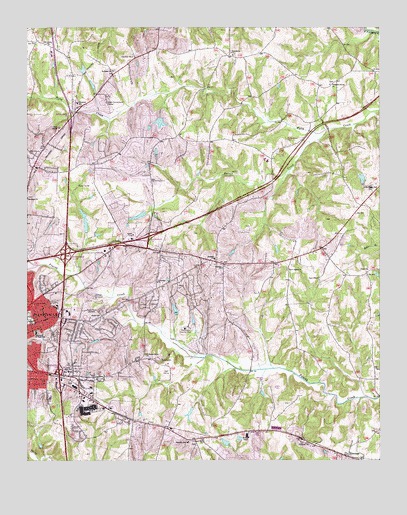
Statesville East, NC USGS Topographic Map
Click on map above to begin viewing in our Map Viewer.

This topographic map contains these locations and features:
Feature Name Type Latitude Longitude GNIS ID View Map
Abilene ChurchChurchN35.8057°W80.8056°980023View Map
Baymount MeadowsPopulated PlaceN35.8451°W80.8315°1006001View Map
Beaver CreekStreamN35.8457°W80.7684°980788View Map
BellwoodPopulated PlaceN35.7654°W80.8062°1006005View Map
BelmontPopulated PlaceN35.7721°W80.8540°1006021View Map
Belmont CemeteryCemeteryN35.7735°W80.8490°980968View Map
Berkshire HillsPopulated PlaceN35.7812°W80.8667°1006023View Map
Bethany ChurchChurchN35.8626°W80.8445°981086View Map
BroadviewPopulated PlaceN35.7949°W80.8265°1006009View Map
Brookdale Lake DamDamN35.8001°W80.8748°999463View Map
BrookgreenPopulated PlaceN35.8007°W80.8690°1006025View Map
BrookmeadePopulated PlaceN35.8026°W80.8126°1006007View Map
Brookwood SchoolSchoolN35.7837°W80.8642°1001701View Map
Camelot AcresPopulated PlaceN35.8068°W80.8192°1006006View Map
Cameron ChurchChurchN35.7543°W80.7748°982480View Map
Cedar HillsPopulated PlaceN35.8057°W80.8037°1006004View Map
Chapel Hill ChurchChurchN35.7562°W80.8126°983018View Map
Chestnut Grove ChurchChurchN35.8587°W80.7673°983102View Map
Christ ChurchChurchN35.7921°W80.8492°983164View Map
City of StatesvilleCivilN35.7840°W80.8712°2405526View Map
Clark PlantBuildingN35.8118°W80.8656°1007796View Map
CloaningerPopulated PlaceN35.7757°W80.8512°1006020View Map
Cool Springs Volunteer Fire Department Station 1BuildingN35.8072°W80.8050°2639092View Map
Covenant ChurchChurchN35.8015°W80.8287°983626View Map
Crawford DamDamN35.8485°W80.8281°999574View Map
Dal-Wan HeightsPopulated PlaceN35.7924°W80.8415°1006013View Map
Danbury ForestPopulated PlaceN35.8374°W80.8565°1006028View Map
Davidson ChurchChurchN35.8260°W80.8745°983975View Map
Davis Regional Medical CenterHospitalN35.8185°W80.8289°1023939View Map
East BrookPopulated PlaceN35.7987°W80.8351°1006011View Map
East Iredell SchoolSchoolN35.8085°W80.8351°1001713View Map
Eastfield EstatesPopulated PlaceN35.7940°W80.8509°1006014View Map
Eastover AcresPopulated PlaceN35.8107°W80.8698°1006024View Map
EastsidePopulated PlaceN35.7890°W80.8601°1006016View Map
Ebenezer SchoolSchoolN35.8535°W80.8570°984615View Map
Ebenezer Volunteer Fire DepartmentBuildingN35.8530°W80.8530°2639090View Map
ElmwoodPopulated PlaceN35.7513°W80.7609°984751View Map
Elmwood QuarryMineN35.7647°W80.7558°2648492View Map
Faith ChurchChurchN35.8049°W80.7540°984953View Map
Fifth Creek ChurchChurchN35.8287°W80.7509°985068View Map
Forest Park ChurchChurchN35.7951°W80.8720°985289View Map
Fourth Creek Sewage Treatment PlantLocaleN35.7754°W80.7953°1007802View Map
Foxcroft ApartmentsPopulated PlaceN35.7796°W80.8659°1006022View Map
Freedom ChurchChurchN35.8665°W80.8376°985383View Map
Gays ChapelChurchN35.8026°W80.7712°985617View Map
Glenn EchoPopulated PlaceN35.7571°W80.8573°1018749View Map
Green AcresPopulated PlaceN35.7860°W80.8562°1006018View Map
Hatfield Association LakeReservoirN35.8285°W80.8431°999536View Map
Hatfield Association Lake DamDamN35.8285°W80.8431°999537View Map
Hawthorne Dam LowerDamN35.8151°W80.8548°999499View Map
Hawthorne Dam UpperDamN35.8201°W80.8548°999517View Map
Hawthorne LakeReservoirN35.8181°W80.8540°999498View Map
Ian Joy AcresPopulated PlaceN35.7868°W80.8487°1006017View Map
Iredell CountyCivilN35.8067°W80.8735°1008565View Map
Iredell HeightsPopulated PlaceN35.8379°W80.8731°1006027View Map
Martin DamDamN35.8618°W80.8548°999600View Map
Matthew (historical)Populated PlaceN35.7510°W80.8651°1001727View Map
Meadow ViewPopulated PlaceN35.8404°W80.8381°1006002View Map
Mitchell AirePopulated PlaceN35.7946°W80.8331°1006012View Map
Nelly Green EstatesPopulated PlaceN35.8024°W80.8315°1006010View Map
New Salem ChurchChurchN35.8051°W80.7820°991094View Map
Newtowne MallLocaleN35.7918°W80.8601°1001736View Map
NonameReservoirN35.7535°W80.8698°999352View Map
Oak Grove ChurchChurchN35.8701°W80.8673°991385View Map
Oakdale ChurchChurchN35.8085°W80.8084°991462View Map
Oakwood Junior High SchoolSchoolN35.7871°W80.8717°991497View Map
Old FarmPopulated PlaceN35.8007°W80.8403°1018748View Map
OurdellPopulated PlaceN35.7835°W80.8498°1006019View Map
Pressly SchoolSchoolN35.7949°W80.8642°992789View Map
Providence ChurchChurchN35.8671°W80.8023°992879View Map
Rose ChapelChurchN35.8460°W80.8634°993693View Map
Shannon AcresPopulated PlaceN35.7929°W80.8159°1006008View Map
Sherwood ForestPopulated PlaceN35.8349°W80.8673°1006026View Map
Signal Hill ApartmentsPopulated PlaceN35.7932°W80.8548°1006015View Map
Signal Hill Shopping CenterLocaleN35.7912°W80.8567°1001742View Map
Statesville Country ClubLocaleN35.7879°W80.8190°995440View Map
Statesville Fire Department Station 3BuildingN35.7796°W80.8585°2639107View Map
Statesville Flour Mill DamDamN35.8318°W80.7565°999548View Map
Township of BethanyCivilN35.8556°W80.8742°1026813View Map
Township of ChambersburgCivilN35.7566°W80.7959°1026814View Map
Township of Cool SpringsCivilN35.8464°W80.7721°1026817View Map
Twin Oaks Golf CourseLocaleN35.7751°W80.8256°1018747View Map
Unity High SchoolSchoolN35.7757°W80.8598°996532View Map
Valley StreamPopulated PlaceN35.7837°W80.8729°1001753View Map
VanceLocaleN35.8074°W80.8006°1001754View Map
Wayside SchoolSchoolN35.7554°W80.8176°996901View Map
Wayside Volunteer Fire DepartmentBuildingN35.7572°W80.8146°2638777View Map
WDRV-AM (Statesville)TowerN35.7954°W80.8545°1018500View Map
Wildwood ParkPopulated PlaceN35.8382°W80.8456°1006003View Map
William L Walker DamDamN35.7535°W80.8698°999353View Map
Williams Grove ChurchChurchN35.7807°W80.8326°997382View Map
Wilson Brothers Dam Number OneDamN35.8251°W80.8331°999525View Map
Wilson Brothers Dam Number TwoDamN35.8218°W80.8331°999520View Map
Wilson Brothers Lake Number OneReservoirN35.8251°W80.8331°999526View Map
Wilson Brothers Lake Number TwoReservoirN35.8208°W80.8349°999521View Map
Zion ChurchChurchN35.7560°W80.7776°997777View Map

Note: Coordinates in the location and feature list above are referenced to NAD83 datum.


Copyright (C) 2008-2024 Ryan Niemi / Sunset Dynamics ... All Rights Reserved