TopoQuest Logo
Do you find TopoQuest useful?
Help keep TopoQuest running and adding new maps/features by donating!
Bitcoin:  19c7KJd3qBynnjoSw5npx9KScwjBe4ifkT
Litecoin:  LXs6TkuXGGXo1vDsWCkWVdjQX94eUKd6ui
Home View Maps Find Maps Find Places Resources & Links


Central, North Carolina Topographic Map

USGS Map Title: Central, NC
USGS Map MRC: 35080H8
DRG (GeoTIFF) Download: o35080h8.tif


Neighboring USGS Topographic Map Quads:


  Gilreath, NC  
36081A1
 

  Osbornville, NC  
36080A8
 

  Brooks Crossroads, NC  
36080A7
 

  Hiddenite, NC  
35081H1
 

  Central, NC  
35080H8
 

  Harmony, NC  
35080H7
 

  Stony Point, NC  
35081G1
 

  Statesville West, NC  
35080G8
 

  Statesville East, NC  
35080G7


Map MRC Location:

N36°
W81°
N36°
W80°
H8 H7 H6 H5 H4 H3 H2 H1
G8 G7 G6 G5 G4 G3 G2 G1
F8 F7 F6 F5 F4 F3 F2 F1
E8 E7 E6 E5 E4 E3 E2 E1
D8 D7 D6 D5 D4 D3 D2 D1
C8 C7 C6 C5 C4 C3 C2 C1
B8 B7 B6 B5 B4 B3 B2 B1
A8 A7 A6 A5 A4 A3 A2 A1
N35°
W81°
N35°
W80°

Central, NC USGS 1:24K Topographic Map Preview:
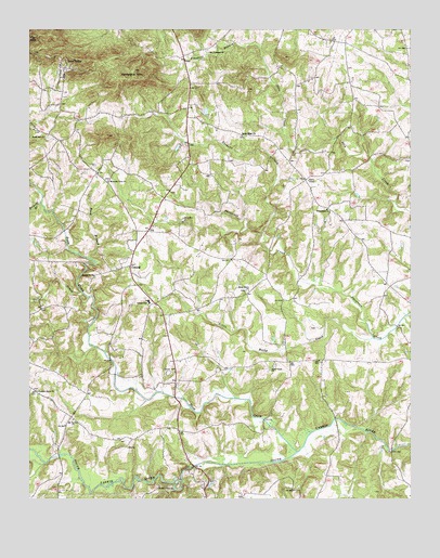
Central, NC USGS Topographic Map
Click on map above to begin viewing in our Map Viewer.

This topographic map contains these locations and features:
Feature Name Type Latitude Longitude GNIS ID View Map
Bailey BridgeBridgeN35.8963°W80.9229°2725533View Map
Bailey HillsPopulated PlaceN35.8949°W80.9381°2704660View Map
Buck BranchStreamN35.9396°W80.9804°982095View Map
CentralPopulated PlaceN35.9371°W80.9665°982948View Map
Central Elementary SchoolSchoolN35.9279°W80.9606°1024814View Map
Central Volunteer Fire DepartmentBuildingN35.9559°W80.9544°2639670View Map
Clio ChurchChurchN35.8887°W80.9673°983294View Map
Damascus ChurchChurchN35.9346°W80.9784°983924View Map
Dobson Dairy FarmLocaleN35.9406°W80.9397°2680747View Map
Dripoff BranchStreamN35.9535°W80.9959°984333View Map
Fox MountainSummitN35.9979°W80.9998°1020345View Map
Friendship ChurchChurchN35.9524°W80.9023°985451View Map
Hams Grove ChurchChurchN35.9307°W80.9281°986347View Map
Keaton Grove ChurchChurchN35.8782°W80.9570°987881View Map
Little Rocky CreekStreamN35.9179°W80.8867°988763View Map
Love ValleyPopulated PlaceN35.9899°W80.9881°1021294View Map
McHargue MountainSummitN35.9893°W80.9656°989586View Map
Mount Vernon ChurchChurchN35.8962°W80.9854°990604View Map
Mountain View ChurchChurchN35.9599°W80.9740°990723View Map
New Prospect ChurchChurchN35.9940°W80.9417°991080View Map
Outz CreekStreamN35.9287°W80.9804°991735View Map
Pleasant Grove ChurchChurchN35.9037°W80.9973°992491View Map
Prospect BranchStreamN35.9899°W80.9220°992840View Map
Raeford Rhyne AirparkAirportN35.9592°W80.9757°998009View Map
Rocky Hill ChurchChurchN35.9715°W80.9945°993595View Map
Sandy Ridge ChurchChurchN35.9721°W80.9304°994318View Map
Sharp (historical)Populated PlaceN35.9429°W80.9109°1001741View Map
Snow CreekStreamN35.8879°W80.9117°995062View Map
Snow Creek (historical)Populated PlaceN35.8887°W80.8809°1001743View Map
Snow Creek Methodist ChurchChurchN35.9099°W80.9198°995065View Map
Town of Love ValleyCivilN35.9873°W80.9834°2406050View Map
Township of SharpesburgCivilN35.9265°W80.9642°1026823View Map
Tuckers CreekStreamN35.9462°W80.9237°996299View Map
Wilson Godfrey DamDamN35.9701°W80.9498°999828View Map
Windy Hill Acres Lake DamDamN35.8801°W80.9398°999652View Map
Windy Hills Acres LakeReservoirN35.8795°W80.9401°999653View Map

Note: Coordinates in the location and feature list above are referenced to NAD83 datum.


Copyright (C) 2008-2025 Ryan Niemi / Sunset Dynamics ... All Rights Reserved