TopoQuest Logo
Do you find TopoQuest useful?
Help keep TopoQuest running and adding new maps/features by donating!
Bitcoin:  19c7KJd3qBynnjoSw5npx9KScwjBe4ifkT
Litecoin:  LXs6TkuXGGXo1vDsWCkWVdjQX94eUKd6ui
Home View Maps Find Maps Find Places Resources & Links


Nadeau, Michigan Topographic Map

USGS Map Title: Nadeau, MI
USGS Map MRC: 45087E5
DRG (GeoTIFF) Download: o45087e5.tif


Neighboring USGS Topographic Map Quads:


  Cunard, MI  
45087F6
 

  Hermansville, MI  
45087F5
 

  Wilson, MI  
45087F4
 

  Banat, MI  
45087E6
 

  Nadeau, MI  
45087E5
 

  Gourley, MI  
45087E4
 

  Swanson, MI  
45087D6
 

  Stephenson, MI  
45087D5
 

  North Lake, MI  
45087D4


Map MRC Location:

N46°
W88°
N46°
W87°
H8 H7 H6 H5 H4 H3 H2 H1
G8 G7 G6 G5 G4 G3 G2 G1
F8 F7 F6 F5 F4 F3 F2 F1
E8 E7 E6 E5 E4 E3 E2 E1
D8 D7 D6 D5 D4 D3 D2 D1
C8 C7 C6 C5 C4 C3 C2 C1
B8 B7 B6 B5 B4 B3 B2 B1
A8 A7 A6 A5 A4 A3 A2 A1
N45°
W88°
N45°
W87°

Nadeau, MI USGS 1:24K Topographic Map Preview:
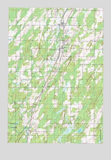
Nadeau, MI USGS Topographic Map
Click on map above to begin viewing in our Map Viewer.

This topographic map contains these locations and features:
Feature Name Type Latitude Longitude GNIS ID View Map
Adams ParkParkN45.5519°W87.5773°1616996View Map
BagleyPopulated PlaceN45.5514°W87.5757°620435View Map
Bagley Post Office (historical)Post OfficeN45.5514°W87.5756°2353187View Map
Bagley Station (historical)LocaleN45.5511°W87.5756°2353186View Map
Blount Post Office (historical)Post OfficeN45.6236°W87.5486°2353183View Map
Boyle CreekStreamN45.5108°W87.5457°621823View Map
Calvary CemeteryCemeteryN45.6083°W87.5522°2353262View Map
CarneyPopulated PlaceN45.5866°W87.5573°622743View Map
Carney Evangelical Free ChurchChurchN45.5883°W87.5542°2353250View Map
Carney Post OfficePost OfficeN45.5908°W87.5528°2353251View Map
Carney StationLocaleN45.5872°W87.5575°2353252View Map
Carney Village CemeteryCemeteryN45.5914°W87.5525°2353261View Map
DeGroote LakeLakeN45.5119°W87.5301°624393View Map
Holmes CreekStreamN45.5611°W87.5937°628451View Map
Maple Grove CemeteryCemeteryN45.5241°W87.5423°631442View Map
Menominee CountyCivilN45.5251°W87.5097°1622997View Map
NadeauPopulated PlaceN45.6089°W87.5529°633202View Map
Nadeau Post OfficePost OfficeN45.6103°W87.5533°2353246View Map
Nadeau StationLocaleN45.6086°W87.5556°2353247View Map
Nadeau Township Fire DepartmentBuildingN45.5934°W87.5547°2353249View Map
Oakwood CemeteryCemeteryN45.5066°W87.5115°633924View Map
Poterfield CreekStreamN45.5583°W87.5948°635336View Map
Saint Brunos Catholic ChurchChurchN45.6111°W87.5519°2353248View Map
Schetter CreekStreamN45.5555°W87.6137°637336View Map
Snow CreekStreamN45.5377°W87.6065°638200View Map
Swedish CemeteryCemeteryN45.5877°W87.5301°1616992View Map
TalbotPopulated PlaceN45.5105°W87.5976°1617889View Map
Talbot PondLakeN45.5136°W87.6015°1614548View Map
Talbot Post Office (historical)Post OfficeN45.5106°W87.5975°2353154View Map
Talbot StationLocaleN45.5108°W87.5975°2353153View Map
Township of NadeauCivilN45.5722°W87.5423°1626787View Map
Village of CarneyCivilN45.5935°W87.5548°2397557View Map

Note: Coordinates in the location and feature list above are referenced to NAD83 datum.


Copyright (C) 2008-2025 Ryan Niemi / Sunset Dynamics ... All Rights Reserved