TopoQuest Logo
Do you find TopoQuest useful?
Help keep TopoQuest running and adding new maps/features by donating!
Bitcoin:  19c7KJd3qBynnjoSw5npx9KScwjBe4ifkT
Litecoin:  LXs6TkuXGGXo1vDsWCkWVdjQX94eUKd6ui
Home View Maps Find Maps Find Places Resources & Links


Stockdale, Ohio Topographic Map

USGS Map Title: Stockdale, OH
USGS Map MRC: 38082H7
DRG (GeoTIFF) Download: o38082h7.tif


Neighboring USGS Topographic Map Quads:


  Waverly South, OH  
39082A8
 

  Beaver, OH  
39082A7
 

  Jackson, OH  
39082A6
 

  Lucasville, OH  
38082H8
 

  Stockdale, OH  
38082H7
 

  Petersburg, OH  
38082H6
 

  New Boston, OH  
38082G8
 

  Minford, OH  
38082G7
 

  South Webster, OH  
38082G6


Map MRC Location:

N39°
W83°
N39°
W82°
H8 H7 H6 H5 H4 H3 H2 H1
G8 G7 G6 G5 G4 G3 G2 G1
F8 F7 F6 F5 F4 F3 F2 F1
E8 E7 E6 E5 E4 E3 E2 E1
D8 D7 D6 D5 D4 D3 D2 D1
C8 C7 C6 C5 C4 C3 C2 C1
B8 B7 B6 B5 B4 B3 B2 B1
A8 A7 A6 A5 A4 A3 A2 A1
N38°
W83°
N38°
W82°

Stockdale, OH USGS 1:24K Topographic Map Preview:
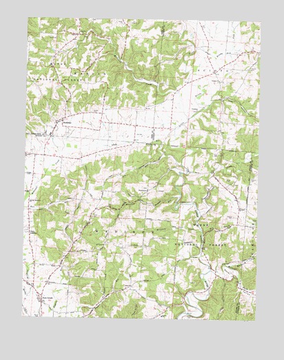
Stockdale, OH USGS Topographic Map
Click on map above to begin viewing in our Map Viewer.

This topographic map contains these locations and features:
Feature Name Type Latitude Longitude GNIS ID View Map
Bethesda CemeteryCemeteryN38.9748°W82.7707°1964016View Map
Bethesda Chapel Freewill Baptist ChurchChurchN38.9748°W82.7713°1070679View Map
Brown FarmLocaleN38.9572°W82.8236°2704741View Map
Brushy ForkStreamN38.9879°W82.7841°1066609View Map
Buckhorn CreekStreamN38.9120°W82.7799°1038481View Map
Bucklick CreekStreamN38.8973°W82.7643°1066615View Map
Cordle DairyLocaleN38.9511°W82.8122°2706144View Map
Dever ValleyValleyN38.8945°W82.7724°1075707View Map
Dewey School (historical)SchoolN38.9315°W82.8416°1049467View Map
Downey CemeteryCemeteryN38.9181°W82.8502°1039774View Map
Dry RunStreamN38.9437°W82.8010°1039809View Map
Flack CemeteryCemeteryN38.9439°W82.7716°1040491View Map
German CemeteryCemeteryN38.9798°W82.7554°1040828View Map
Glade RunStreamN38.9395°W82.7913°1040877View Map
Glade School (historical)SchoolN38.9331°W82.7710°1049464View Map
Hamilton ChurchChurchN38.9217°W82.7593°1041265View Map
Holland ForkStreamN38.8954°W82.7743°1076069View Map
Irish HollowValleyN38.9659°W82.7749°1041989View Map
Jenkins CemeteryCemeteryN38.9181°W82.7635°1042075View Map
Jenkins CemeteryCemeteryN38.9340°W82.7538°1042076View Map
Johnson Road BridgeBridgeN38.9587°W82.7877°1049587View Map
Kronk CemeteryCemeteryN38.9173°W82.8379°1042348View Map
Little Ettie Baptist ChurchChurchN38.9934°W82.8452°1042661View Map
Little Ettie CemeteryCemeteryN38.9937°W82.8454°1963411View Map
Madison Missionary ChurchChurchN38.9231°W82.8721°1042889View Map
Madison SchoolSchoolN38.8762°W82.8004°1042893View Map
Massie (historical)Populated PlaceN38.9134°W82.7941°1065724View Map
Massie Post Office (historical)Post OfficeN38.9140°W82.7943°2044045View Map
Mault CemeteryCemeteryN38.8762°W82.7843°1043063View Map
McConnel CreekStreamN38.8856°W82.8704°1066826View Map
McDowell CreekStreamN38.9587°W82.7879°1066828View Map
Mill HollowValleyN38.9109°W82.7782°1043333View Map
Millstone RunStreamN38.9262°W82.7916°1043388View Map
Mount Carmel ChurchChurchN38.9056°W82.8310°1043552View Map
Mount Carmel School (historical)SchoolN38.9031°W82.8432°1049468View Map
Perry AdditionPopulated PlaceN38.9104°W82.8718°1049077View Map
Pools CornersLocaleN38.8817°W82.8646°1044684View Map
Providence CemeteryCemeteryN38.9620°W82.7838°1964029View Map
Providence ChurchChurchN38.9617°W82.7832°1044785View Map
Salem CemeteryCemeteryN38.9922°W82.8595°1045872View Map
Salem ChurchChurchN38.8887°W82.8171°1045883View Map
Salem School (historical)SchoolN38.8890°W82.8166°1049466View Map
Scioto CemeteryCemeteryN38.9609°W82.8385°1046037View Map
StockdalePopulated PlaceN38.9565°W82.8582°1065387View Map
Stockdale CemeteryCemeteryN38.9592°W82.8535°1963428View Map
Stockdale Census Designated PlaceCensusN38.9578°W82.8573°2628973View Map
Stockdale ChurchChurchN38.9431°W82.8746°1046700View Map
Stockdale Elementary SchoolSchoolN38.9515°W82.8618°1055221View Map
Stockdale Post OfficePost OfficeN38.9570°W82.8582°2043434View Map
Stockdale Volunteer Fire DepartmentBuildingN38.9525°W82.8606°2550406View Map
Sugarcamp CreekStreamN38.9192°W82.7816°1066992View Map
Township of MadisonCivilN38.9044°W82.8350°1086928View Map
Township of MarionCivilN38.9904°W82.8406°1086811View Map
White Gravel CemeteryCemeteryN38.9292°W82.8096°1964239View Map
White Gravel ChurchChurchN38.9290°W82.8085°1047875View Map
White Gravel School (historical)SchoolN38.9256°W82.8138°1049465View Map

Note: Coordinates in the location and feature list above are referenced to NAD83 datum.


Copyright (C) 2008-2024 Ryan Niemi / Sunset Dynamics ... All Rights Reserved