TopoQuest Logo
Do you find TopoQuest useful?
Help keep TopoQuest running and adding new maps/features by donating!
Bitcoin:  19c7KJd3qBynnjoSw5npx9KScwjBe4ifkT
Litecoin:  LXs6TkuXGGXo1vDsWCkWVdjQX94eUKd6ui
Home View Maps Find Maps Find Places Resources & Links


Stratford, New York Topographic Map

USGS Map Title: Stratford, NY
USGS Map MRC: 43074B6
DRG (GeoTIFF) Download: o43074b6.tif


Neighboring USGS Topographic Map Quads:


  Salisbury, NY  
43074B7
 

  Stratford, NY  
43074B6
 

  Canada Lake, NY  
43074B5
 

  Little Falls, NY  
43074A7
 

  Oppenheim, NY  
43074A6
 

  Lassellsville, NY  
43074A5


Map MRC Location:

N44°
W75°
N44°
W74°
H8 H7 H6 H5 H4 H3 H2 H1
G8 G7 G6 G5 G4 G3 G2 G1
F8 F7 F6 F5 F4 F3 F2 F1
E8 E7 E6 E5 E4 E3 E2 E1
D8 D7 D6 D5 D4 D3 D2 D1
C8 C7 C6 C5 C4 C3 C2 C1
B8 B7 B6 B5 B4 B3 B2 B1
A8 A7 A6 A5 A4 A3 A2 A1
N43°
W75°
N43°
W74°

Stratford, NY USGS 1:24K Topographic Map Preview:
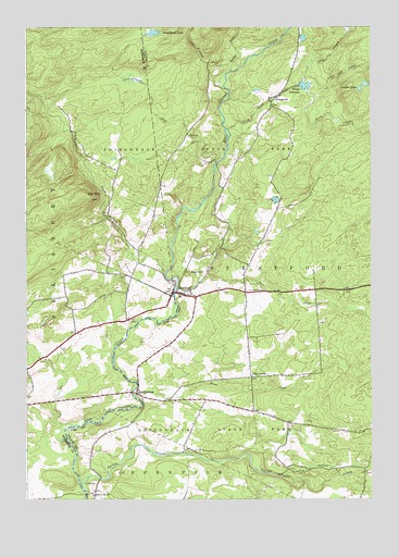
Stratford, NY USGS Topographic Map
Click on map above to begin viewing in our Map Viewer.

This topographic map contains these locations and features:
Feature Name Type Latitude Longitude GNIS ID View Map
Ayers CreekStreamN43.1803°W74.6954°942742View Map
Bear HillSummitN43.1851°W74.6915°943269View Map
Bliss CornerPopulated PlaceN43.1576°W74.6682°972243View Map
Brandy BrookStreamN43.2395°W74.6757°944637View Map
Conglin LakesLakeN43.2350°W74.6267°969285View Map
EmmonsburgPopulated PlaceN43.1531°W74.7096°949646View Map
Hart Vly StreamStreamN43.2356°W74.6496°952301View Map
Knapp ReservoirReservoirN43.2345°W74.6510°954764View Map
KnappvillePopulated PlaceN43.2301°W74.6613°954768View Map
Long Lake OutletStreamN43.2315°W74.6454°955879View Map
Moose CreekStreamN43.1520°W74.7099°957613View Map
North CreekStreamN43.2228°W74.6768°958768View Map
Oak MountainSummitN43.2059°W74.7290°959137View Map
Phipps BrookStreamN43.1251°W74.6915°960316View Map
Roundtop CemeteryCemeteryN43.1800°W74.6697°963041View Map
School Number 16 (historical)SchoolN43.1262°W74.7254°975126View Map
Smith CemeteryCemeteryN43.1294°W74.7242°965466View Map
Sprite CreekStreamN43.1281°W74.7290°966112View Map
Stony BrookStreamN43.2151°W74.6799°966529View Map
Stony Brook LakeLakeN43.2484°W74.7040°966543View Map
StratfordPopulated PlaceN43.1798°W74.6968°966621View Map
Stratford CemeteryCemeteryN43.1826°W74.6982°2556850View Map
Stratford Post OfficePost OfficeN43.1798°W74.6952°2618146View Map
Stratford Volunteer Fire DepartmentBuildingN43.1774°W74.6883°2718609View Map
Town of StratfordCivilN43.1886°W74.6296°979533View Map
Trammel CreekStreamN43.1851°W74.6999°970720View Map
Windfall CreekStreamN43.2381°W74.6763°971456View Map

Note: Coordinates in the location and feature list above are referenced to NAD83 datum.


Copyright (C) 2008-2024 Ryan Niemi / Sunset Dynamics ... All Rights Reserved